Arlesey
| V・T・E |
| latitude: 52.00, longitude: -0.26 |
| Browse map of Arlesey 52°00′00.00″ N, 0°15′36.00″ W |
| Edit map |
|
|
External links:
|
| Use this template for your locality |
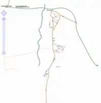
Arlesey is a village in Bedfordshire at latitude 52°00′00.00″ North, longitude 0°15′36.00″ West. Arlesey.png
Progress
- Church End (north Arlesey) is pretty much done
- Much of mid-Arlesey also done.
- Some footpaths
To do
- Side roads at south end of Arlesey
- Rest of footpaths. Would be good to map all those on Arlesey Walks, then perhaps they could use OSM maps
- Areas such as the recreation ground
Active Users
- User:Steevc - Should be able to map all roads if I can get a weekend free. Will try and map the local footpaths. Some natural features, e.g. river, traced on NPE maps