It has been proposed that this page be
deleted or replaced by a redirect. See the discussion page for further information.
The given reason is:
This was just an app that displayed an OSM map. The app is no longer available because was acquired by Outdooractive. --Nakaner (talk) 08:30, 10 October 2024 (UTC).
(Pages that link to this page.)
This page was last edited by Maro21; 22:51, 21 December 2024 (UTC) (215 days ago).
This article or section may contain
out-of-date information:
GPS-Tracks has been acquired by Outdooractive, the app is no longer available for download. If you know about the current state of affairs, please help keep everyone informed by updating this information. (Discussion)
| GPS-Tracks
|
|
|
| Author:
|
GEO-Tracks GmbH
|
| License:
|
(free of charge)
|
| Platforms:
|
iPhone, Windows Mobile, and Android
|
| Status:
|
Broken
|
| Version:
|
2.40 (iPhone); 1.52 (Windows Mobile); 2.50 (Android) (2017-11-21)
|
| Languages:
|
English, German, French, and Italian
|
| Website:
|
http://www.gps-tracks.com/
|
| Install:
|
|
|
Features
| Feature
|
Value
|
| Map Display
|
| Display map
|
yes
|
| Map data
|
raster
|
| Source
|
online; cache
|
| Rotate map
|
yes
|
| 3D view
|
no
|
| Shows website
|
?
|
| Shows phone number
|
?
|
| Shows operation hours
|
?
|
| Routing
|
| Routing
|
yes (Go-To only; hiking and cycling routing possible in selected areas)
|
| Create route manually
|
?
|
| Calculate route
|
no
|
| Create route via Waypoints
|
?
|
| Routing profiles
|
?
|
| Turn restrictions
|
?
|
| Calculate route without Internet (Offline routing)
|
?
|
| Routing providers
|
?
|
| Avoid traffic
|
?
|
| Traffic Provider
|
?
|
| Navigating
|
| Navigate
|
yes
|
| Find location
|
yes
|
| Find nearby POIs
|
yes
|
| Navigate to point
|
yes
|
| Navigation with voice / Voice guidance
|
?
|
| Keep on road
|
no
|
| Lane guidance
|
?
|
| Works without GPS
|
yes
|
| Navigate along predefined route
|
no
|
| Tracking
|
| Make track
|
yes
|
| Customizable log interval
|
no
|
| Track formats
|
?
|
| Geotagging
|
photo
|
| Fast POI buttons
|
yes
|
| Upload GPX to OSM
|
no
|
| Monitoring
|
| Monitoring
|
yes
|
| Show current track
|
yes
|
| Open existing track
|
yes
|
| Altitude diagram
|
no
|
| Show POD value
|
yes
|
| Satellite view
|
no
|
| Show live NMEA data
|
no
|
| Show speed
|
yes
|
| Send current position
|
no
|
| Editing
?
|
| Rendering
?
|
| Accessibility
?
|
|
|
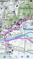
GPS-Tracks (gps-tracks.com) is a free app for iPhone, Android and Windows Mobile. It uses OSM and OCM and other map sources (free, paid and sponsored) with a focus on Switzerland, Austria and Germany. It can also be used for tracking. Tracks can be uploaded and shared to the web site. The site offers reviewed tracks for tourists.
The author notes that GPS-Tracks does not work (well) on hacked/jailbroken devices from Apple.
This article is a stub. You can help OpenStreetMap by expanding it.