Indonesia
| V・T・E |
| latitude: -2.5, longitude: 117.9 |
| Browse map of Indonesia 2°30′00.00″ S, 117°54′00.00″ E |
| Edit map |
|
External links:
|
| Use this template for your locality |
Indonesia is a country in Southeast Asia at latitude 2°30′00.00″ South, longitude 117°54′00.00″ East.
Welcome to OSM Indonesia!
Let's join forces and create a complete, accurate and useful map of Indonesia.
Main cities
Available maps
- Bandung (Browse Map)
- most streets and highways are covered
- lots of pois registered
- Bengkulu (Browse Map)
- First streets are there. Hopefully finished after Idul Fitri (Thanks Hendriex_s)
- Bogor (Browse Map)
- Many of the main streets, street names needed
- Residential streets needed
- Distinctions between canals, streams, and walking paths needed.
- Features needed
- Denpasar (Browse Map)
- already a lot of streets and the airport, most of streets without names yet
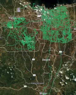
- Depok (Browse Map)
- Reza Primardiansyah is currently working on it.
- Jakarta (Browse Map)
- mostly covered
- Firman Hadi is currently working on it. Finished most of the primary and motorways. The residential streets remain to be done
- Impressive work! --Indomapper 13:50, 10 June 2009 (UTC)
- See Public transport in Jakarta for public transport lines and their relations
- Kupang (Browse Map)
- Editors can now work tile by tile with the OSM Tasking Manager
- started from scratch in June 2008 by MarkusLupp
- supported by Kristian1234567 Kristian1234567
- Hendriex_s and Daniel_NTT are working on it
- Padang (Browse Map)
- HOT(Humanitarian Open Street Map) set up application to grid Padang. Editors can now work tile by tile in the OSM Tasking Manager
- HOT also bought satellite imagery for Padang. They are available as tile services
- Purwokerto (Browse Map)
- supported by Nicho Pratama Nicho Pratama
- started from scratch in November 2012 by Nicho Pratama
- street names needed
- Semarang (Browse Map)
- started from scratch in February 2008 by Indomapper
- tracing Yahoo Aerial (highways, main streets, railways, rivers)
- most streets have names
- will continue in August as I'll be there for a month (hopefully including Karimun Jawa) --Indomapper 13:50, 10 June 2009 (UTC)
- Surabaya (Browse Map)
- tracing yahoo aerial for same items as above, working with personal knowladge and photos for street names.
- ill be buying a gps unit at some point and will map out my yearly travels to surabaya as they happen.--Jerjozwik 21:59, 6 June 2008 (UTC)
- Great! I used a GPS logger Holux M241 for my last travel, it worked great in combination with BT747 for downloading the data.--Indomapper 09:24, 24 June 2008 (UTC)
- have been back in indonesia for a week, will be here for two more. I've been gps tracking and logging points of interest. Most poi's have been added to the OSM, but gps traces will have to wait till i return home. will also be headed to prigen an bromo.--Jerjozwik 06:28, 2 June 2009 (UTC)
- Import Infrastructure Features in Surabaya
- Surakarta (Browse Map)
- Compare to [2]
- Yogyakarta (Browse Map)
- big streets and railroad to Solo
- Need some improvement here regarding junction, POI and building
![[2]](http://id.wikipedia.org/wiki/Berkas:Peta_Solo.jpg)
Need volunteers
- Bogor (Browse Map)
- Supported by Alex Rollin
- Makassar (Browse Map)
- Manado (Browse Map)
- Medan (Browse Map)
- Covered by User:Sylphar
- Plan to cover the whole North Sumatra
- Balikpapan (Browse Map)
- Tebing Tinggi (Browse Map)
- Supported by Faisal H
- Covers most parts of the city
- Malang (Browse Map)
- Tidar dan sekitarnya (Malang Barat) supported by Hardi Kris
- Purwokerto(Browse Map)
- Supported by Nicho Pratama
- Mataram (Browse Map)
- Yogyakarta (Browse Map)
- Supported by Ivan Garcia
Tagging conventions
Access and barrier tagging in Indonesia
The use of access and barrier or commonly called gates will affect access to a road. If there is a gate that is permanently closed, it will result in the road access around it being closed. If we want to enter a housing complex area and there is a portal guarded by security officers or security guards, then it will result in the road access becoming private. Below is a flowchart or flow diagram if necessary to edit the OSM map, especially if we are going to add access or portals on the road. This flowchart will help newbie or experienced editors to add access or barrier tags to the road network or highway in OSM.

- OSM Map Features
- Overview how to map the real world with OSM
- General OSM Editing Standards and Conventions
- Humanitarian OSM Tags
- Humanitarian OSM Tags Indonesia 2011
- Humanitarian OSM Tags for Indonesia
- Indonesia/Landuse
- Power infrastructure mapping in Indonesia
- Road signs in Indonesia
Kaart Groundwork & Editing
Kaart conducts ground surveys for improvements to OSM data. A list of editors can be found on the Kaart wiki page.
- Mapillary imagery from the Indonesian drives can be viewed here.
Jakarta (October, 2019)
Ground Focus
- Primary focus was on adding street names, missing geometry, and one-ways.
Post Processing
- After the ground survey was conducted, our office team reviewed the footage gathered and updated street names by checking the consistency with current data and physical road signs.
- The team added turn restrictions, barriers, pedestrian crossings, ref tags, surfaces to roads, lanes, destination tags, and additional missing geometry.
Suggested Community Edits
- There are still many names that need to be entered in Jakarta. We did our best to enter the names available to us in Jakarta and the surrounding municipalities. Where that was not feasible, government data is available to the public in the town halls.
The ground survey of Jakarta was conducted by Kaart Team members Kaarti_B, Whimsical Otter, GhostEye, and JAAS.
Tracing Aerial Imagery
This is the easiest way to quickly and effortlessly edit, fix or add map details, create new ways without having to drive around town with GPS logger and camera :-) So, what should we do? Just open www.openstreetmap.org, move the map to your hometown, click on Edit, register/login, and happy mapping!
NEWS!! Potlatch 2 (the newer standard map editor) now uses Bing aerial maps. Ebenezer from Australia hints that it has very good coverage for many cities in Indonesia. So don't wait any longer, go and map your neighborhood! If you have time, please complete the list of covered cities by Bing here.
Walking-Papers now LIVE! in Bahasa Indonesia
YES! You can check it out on Walking-Papers website ! Translated by: emirhartato and Vasanthi
Community
Mailing List: Talk-id
- Talk-id at openstreetmap.org (Bahasa Indonesia)
- Mailing list or discussion for OpenStreetMap in Bahasa Indonesia
Social Network
- Komunitas OpenStreetMap Indonesia
- Facebook group for OSM Indonesia Community
- @OSM_ID
- OSM Indonesia twitter page
Contributors
The following users have been observed to contribute in mapping Indonesia:
- indomapper : Semarang, Surabaya, Jogja, Solo, Purworejo, Salatiga, Jawa Tengah, Jawa Timur
- ogy_4
- Jerjozwik
- Adhitya
- Esambuaga : Jakarta
- Saptaananda
- Mikecc
- ianaf4you
- Scarabeaus
- tadeus
- Anton Rifco
- MarkusLupp : Kupang
- Kristian1234567 : Kupang
- Firman Hadi : Jakarta, parts of Makassar, Manado, Medan, Balikpapan and Timor Leste
- bakesale10 : Bali
- AquaCoach : Sulawesi, Ambon
- Rhuseinh : Batam Island and surrounding area
- Bennylin: Saya ikut. Saya dari Surakarta.
- Ebenezer: Some Bing mapping in Sulawesi
- Daniel_NTT: GPS and Bing mapping in Kota Kupang and Timor island
- Hendriex_s: GPS and Bing mapping in Kota Kupang and Bengkulu
- Danil Satria: Jambi
- emirhartato: part of Jakarta, Depok, Bogor.
- Reza Primardiansyah: part of Depok.
- Yustian: Palu
- Alex Rollin : Bogor
- Nicho Pratama: Purwokerto, part of Jawa Tengah
- Berobispo: Papua, Bali
- Farras: Lhokseumawe, Banda Aceh, towns in Aceh
- Ivan Garcia: Yogyakarta(multiple POI's, added Transjogja bus routes), Solo (added BST bus routes)
- Jedrzej Pelka: Sragen
- Iwan Novirion: Bengkalis island, Riau and surrounding area
- amtplskaart: Mostly editing in Bandung and major cities in Jawa, Sumatera, Kalimantan and Sulawesi
- f_husni: mostly mapped area in DKI Jakarta, and some big cities in Sumatera, Bali, Sulawesi, Kalimantan, and Papua
Links
- openstreetmap.id
- The website of the OpenStreetMap Indonesia community
- Geospatial Information Technology in Indonesia and its Legal Framework (Bahasa Inggris, April 2011)
- Learnosm.org (Bahasa Indonesia, Bahasa Inggris, Bahasa Italia)
- Website created by the HOT team providing OSM/GPS/JOSM tutorials
- Wiki Page for the OSM Tasking Manager (Bahasa Inggris)
- Website to coordinate mapping task in specific areas
- Peta-kan Indonesia (Bahasa Indonesia)
- A blog created in April 2008 to introduce OSM in Bahasa Indonesia, provide information on the mapping tools can be used, and promote OSM to potential mappers and users in Indonesia.
- Navigasi.net (Bahasa Indonesia)
- A very active and well designed community website for Indonesian gps savvy users (over 15k as of 05/2008). Has a huge collection of commented POIs spread over Indonesia, hardware reviews, and also extensive collection of gps tracks and maps of Indonesia.
- KompetisiOSM (Bahasa Indonesia)
- A website built to support a University Competition to collect building information in Padang, Jakarta, Bandung, Yogyajakarta and Surabaya
- Mapping OSM - Good practice
- A Wiki page with the most important points about "good" mapping
- Indonesia DRR Humanitarian OSM Team/Website/Indonesia DRR
- A wiki page about pre-disaster mapping using OpenStreetMap in Indonesia
- Osmosa.net
- OSM Planet and Reintegration. located in IIX (Indonesia Internet Exchange). managed by Meruvian, sponsored by Maxindo. contact: Frans Thamura, frans at meruvian dot org
- Generic terms for verifying and validating natural geographical names