JA:Key:boundary
 |
| 説明 |
|---|
| boundaryタグは主に政治的な(その他も含む)管理領域の境界線をマークするために使用します。 |
| グループ: 境界線 |
| 適用できる要素 |
| 文書化された値の数: 15 |
| よく併用されるタグ |
| 状態:事実上の標準 |
| ツール |
使用方法
- JA:境界線も参照
境界線(Boundaries)は主に政治的な(その他も含む)管理領域の境界線をマークするために使用します。詳しくはJA:境界線を参照してください。
値
boundary キーの主な値は下記を参照してください。
| キー | 値 | 要素 | 説明 | レンダリング | 写真 | |
|---|---|---|---|---|---|---|
Boundary types | ||||||
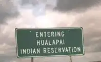
| aboriginal_lands | A boundary representing official reservation boundaries of recognized aboriginal / indigenous / native peoples. |  |
 | |||
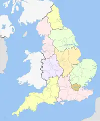
| boundary | administrative | 行政境界です。政府またはその他の管理を目的とした組織によって認識された、領域・領地・管轄区域の部分です。大きな民族国家のグループから小さい地方や郊外までの範囲を、admin_level=*タグの組み合わせで識別します。
|
 |
 | ||
| boundary | border_zone | A border zone is an area near the border where special restrictions on movement apply. Usually a permit is required for visiting. | _-_crop.jpg) | |||
| boundary | census | A census-designated boundary delineating a statistical area, not necessarily observable on the ground. | 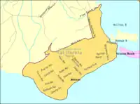 | |||
| boundary | forest | A delimited forest is a land which is predominantly wooded and which is, for this reason, given defined boundaries. It may cover different tree stands, non-wooded areas, highways… but all the area within the boundaries are considered and managed as a single forest. | 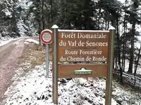 | |||
| boundary | forest_compartment | A forest compartment is a numbered sub-division within a delimited forest, physically materialized with visible, typically cleared, boundaries. | 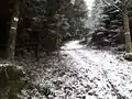 | |||
| boundary | hazard | A designated hazardous area, with a potential source of damage to health, life, property, or any other interest of value. | 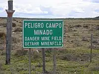 | |||
| boundary | health | Health division boundaries. Some mappers use health_level=* instead of admin_level=* to specify level in the health system hierarchy.
|
||||
| boundary | historic | 歴史上の境界線 | 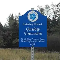 | |||
| boundary | limited_traffic_zone | Describes an officially designated area that requires authorization for the entry of certain vehicles. | .svg.png) | |||
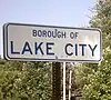
| boundary | local_authority | Describes the territory of a local authority. | ||||
| boundary | low_emission_zone | A geographically defined area which seeks to restrict or deter access by certain polluting vehicles with the aim of improving the air quality. | .png) | |||
| boundary | maritime | 海上境界線 | 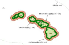 | |||
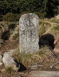
| boundary | marker | A boundary marker, border marker, boundary stone, or border stone is a robust physical marker that identifies the start of a land boundary or the change in a boundary, especially a change in direction of a boundary. See also historic=boundary_stone
|
 | |||
| boundary | national_park | 国立公園です。自然景観が飛び抜けて美しい場所に、自然保護やレクリエーションのために指定されています(他の言語)。 | 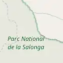 |
 | ||
| boundary | place | =place is commonly used to map the boundaries of a place=*, when these boundaries can be defined but these are not administrative boundaries.
|
||||
| boundary | political | 政治的な境界線 | ||||
| boundary | postal_code | 郵便番号の境界線 | ||||
| boundary | protected_area | 保護区域です。たとえば国立公園や水源保護や先住民保護地域など。 | 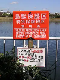 | |||
| boundary | religious_administration | 宗教の管理境界です。Talk:Key:boundary#Religious authority boundariesを参照。 | ||||
| boundary | special_economic_zone | A government-defined area in which business and trade laws are different. |  | |||
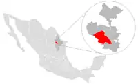
| boundary | statistical | An official boundary recognised by government for statistical purposes. |
 | |||
| boundary | disputed | An area of landed claimed by two or more parties (use with caution). See also Disputed territories. | 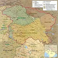 | |||
| boundary | timezone | Boundaries of time zone |  | |||
| boundary | ユーザー定義 | Taginfo でよく使われている値を確認できます。 | ||||
属性 | ||||||
| admin_level | 数値 | =administrativeに適用され、ふつうは1~10の範囲を取りますが、ドイツは例外で11になることがあります。も参照。
|
 | |||
| health_level | (number) | Used by some mappers instead of admin_level=* in conjunction with =health and is usually in the range 1 to 10.
|
||||
| postal_code_level | (number) | Used by some mappers instead of admin_level=* in conjunction with =postal_code and is usually in the range 1 to 10.
|
||||
| religious_level | (number) | Used by some mappers instead of admin_level=* in conjunction with =religious_administration and is usually in the range 1 to 10.
|
||||
| border_type | * | admin_levelで表現できない境界の種類を識別するのに使用します。様々な異なる用途(海上など)に使用されます。 | ||||
| start_date | (date) | Useful if the boundary is very recent (or if it will become effective in a near future). |  | |||
This table is a wiki template with a default description in English. Editable here. 日本語訳の編集はこちら。