Key:abandoned:railway
 |
| Description |
|---|
| Indicate the type of the abandoned railway feature. |
| Group: railways |
| Used on these elements |
| Documented values: 2 |
| Requires |
| See also |
| Status: de facto |
| Tools for this tag |
|
A key to map former railway features. It can refer either to an abandoned railway track or to another railway feature; e.g., a station.
Abandoned is within the lifecycle or railway life cycle tags. Proposed, construction, operational "rail", preserved, disused, abandoned, razed.
How to map
Draw a line ![]() representing the former railroad track and add
representing the former railroad track and add railway=abandoned.
With =see values the type of rails can be determined.
Values
Rails:
=rail=narrow_gauge=tram=light_rail=subway=funicular
Other features:
=station=switch=level_crossing=halt=platform=tram_stop=crossing=signal_box=buffer_stop=signal=turntable
and other values
Rendering
- Is not rendered on OSM Carto
- Is displayed in dashed lines on OpenRailwayMap
- Is not renderer on OpenRailwayMap-Vector in favour of OpenHistoricalMap data for former railways[1]
See also
railway=disusedhistoric:railway=rail/narrow_gauge- Demolished Railway
- Railway#Life-cycle
- Lifecycle prefix
- Open Historical Map
Photos
-
-
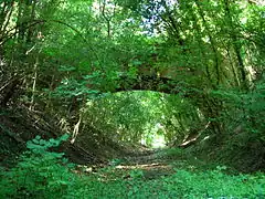
 Overgrown track - tag with railway=disused
 -
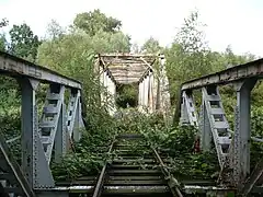
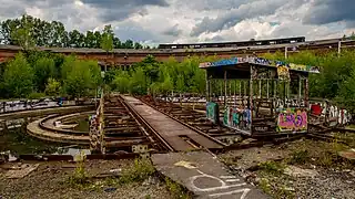
_-_abandoned_railway_turntable.JPG) Abandoned:railway=turntable - tag with - tag with disused:railway=turntable
Abandoned:railway=turntable - tag with - tag with disused:railway=turntable -
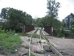
 There used to be a station here - abandoned:railway=station
 -
 disused:railway=turntable
 -
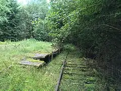
 The track has been dismantled, but remains are clearly visible - tag with railway=abandoned
 -