Key:aerialway:station
 |
| Description |
|---|
| Indicates station position (top/bottom/middle). |
| Group: aerialways |
| Used on these elements |
| Useful combination |
| Status: in use |
| Tools for this tag |
|
| Tag | Description | Picture |
|---|---|---|
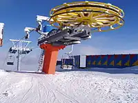
=bottom |
station at the end of the aerialway with the lower altitude | 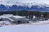 |
=top |
station at the end of the aerialway with the higher altitude | 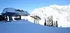 |
=mid |
any station not being at the end of and aerialway |  |