Key:fenced
 |
| Description |
|---|
| Whether the outer perimeter of something is fenced. |
| Group: properties |
| Used on these elements |
| Useful combination |
|
| See also |
| Status: in use |
| Tools for this tag |
|
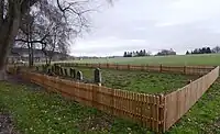
The =* tag (value yes|no) indicates whether the outer perimeter of something is fenced.
So for general information on how to map fences and associated features please see barriers.
History
Once upon a time (before 2008) there were no barrier tags, because nobody had invented them yet. In that time the only way to map a fence in Openstreetmap was with =yes. Between May 2016 and June 2023 =* was deprecated on this page under the false assumption that =yes and barrier=fence had the same meaning. Between Jan 2019 and June 2022 iD encouraged users to replace =yes with barrier=fence. Therefore almost all fences mapped since the invention of barrier=fence are (re)mapped using that newer tag.
Rendering
This tag is not rendered by OpenStreetMap Carto; according to taginfo it seems to be rendered only by OpenTopoMap. Also it is rendered in Osmand.