Key:irrigation
 |
| Description |
|---|
| Specifies the type of irrigation on farmland or whether a waterway carries water to be used for agriculture |
| Group: waterways |
| Used on these elements |
| Documented values: 2 |
| Requires |
|
| Useful combination |
| See also |
| Status: in use |
| Tools for this tag |
|
The key =* is used in 2 ways:
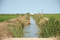
=yesis used with linear way features taggedwaterway=*to specify that an artificial waterway carries water to be used for agriculture, usually together withwaterway=canalor sometimeswaterway=ditch. The less common tag=ditchis also used in this way withwaterway=ditch.
=pivotis used with area features taggedlanduse=*to specify that a central pivot type irrigation system is used to water the area of farmland, meadow, orchard or vineyard.
See also irrigated=yes which is also used to specify that an area of landuse=* is irrigated.