LIDAR
LIDAR is a method for measuring distances by illuminating the target with laser light and measuring the reflection with a sensor. Differences in laser return times and wavelengths can then be used to make digital 3D model of the target. In OpenStreetMap context primary use is airborne scan of terrain.
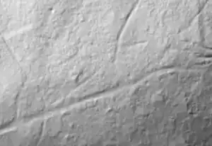
The scan results of terrain are typically presented as a shaded relief imagery, often in grayscale.
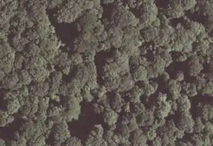
LIDAR can penetrate tree cover and be so accurate that one may map paths based on a shape of ground.
As all sources, only what is released on a compatible copyright can be used.
Some countries are fully covered by high quality LIDAR available on a compatible licenses.
External links
.svg.png) Building Heights: From Open USGS lidar to open Overture maps – Yunzhi Lin & Eric Spellman - State of the Map U.S. 2023 talk
Building Heights: From Open USGS lidar to open Overture maps – Yunzhi Lin & Eric Spellman - State of the Map U.S. 2023 talk- Improving OSM lake polygons using LiDAR data ~ Jake Low - State of the Map U.S. 2025 talk
- Beyond Street Imagery: Crowdsourcing LiDAR ~ Alex Ilisei & Philipp Kandal - State of the Map U.S. 2025 talk
- Lidar on Wikipedia