| Mapcarta
|
|
|
| Author:
|
Mapcarta
|
| License:
|
CC-BY-SA 4.0 (free of charge)
|
| Platform:
|
Web
|
| Status:
|
Active
|
| Languages:
|
English, Spanish, French, German, and Portuguese
|
| Website:
|
https://www.mapcarta.com
|
|
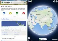
An open map with interactive POIs.
|
|
Features
| Feature
|
Value
|
| Map Display
|
| Display map
|
yes
|
| Map data
|
vector
|
| Source
|
online
|
| Rotate map
|
no
|
| 3D view
|
no
|
| Shows website
|
yes
|
| Shows phone number
|
yes
|
| Shows operation hours
|
yes
|
| Routing
|
| Routing
|
yes
|
| Create route manually
|
yes
|
| Calculate route
|
yes
|
| Create route via Waypoints
|
no
|
| Routing profiles
|
car;bike;foot
|
| Turn restrictions
|
?
|
| Calculate route without Internet (Offline routing)
|
no
|
| Routing providers
|
?
|
| Avoid traffic
|
no
|
| Traffic Provider
|
Mapbox
|
| Navigating
|
| Navigate
|
yes
|
| Find location
|
yes
|
| Find nearby POIs
|
yes
|
| Navigate to point
|
yes
|
| Navigation with voice / Voice guidance
|
no
|
| Keep on road
|
no
|
| Lane guidance
|
no
|
| Works without GPS
|
yes
|
| Navigate along predefined route
|
no
|
| Tracking
|
| Make track
|
no
|
| Customizable log interval
|
no
|
| Track formats
|
?
|
| Geotagging
|
?
|
| Fast POI buttons
|
no
|
| Upload GPX to OSM
|
no
|
| Monitoring
|
| Monitoring
|
no
|
| Show current track
|
yes
|
| Open existing track
|
yes
|
| Altitude diagram
|
no
|
| Show POD value
|
no
|
| Satellite view
|
yes
|
| Show live NMEA data
|
no
|
| Show speed
|
no
|
| Send current position
|
no
|
| Editing
?
|
| Rendering
|
| Renderer output formats
|
png
|
| Accessibility
?
|
|
|
Mapcarta is a map which shows clickable POIs.
See also