It has been proposed that this page be
deleted or replaced by a redirect. See the discussion page for further information.
The given reason is:
The app was removed from Google Play and Apple App Store. --Nakaner (talk) 13:20, 5 February 2025 (UTC).
(Pages that link to this page.)
This page was last edited by Nakaner; 13:20, 5 February 2025 (UTC) (169 days ago).
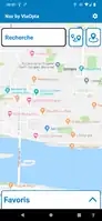
| Nav by Viaopta
|
|
|
| Author:
|
Novatis Pharla AG
|
| License:
|
(gratuit)
|
| Platforms:
|
Android and iOS
|
| Status:
|
Broken
|
| Install:
|
|
|
Online navigation, display of maps from OSM, POI and search for addresses, favourites, information on points of interest.
|
|
Features
| Feature
|
Value
|
| Map Display
|
| Display map
|
yes
|
| Map data
|
raster;vector
|
| Source
|
online
|
| Rotate map
|
yes
|
| 3D view
|
no
|
| Shows website
|
?
|
| Shows phone number
|
?
|
| Shows operation hours
|
?
|
| Routing
|
| Routing
|
?
|
| Create route manually
|
?
|
| Calculate route
|
?
|
| Create route via Waypoints
|
?
|
| Routing profiles
|
foot
|
| Turn restrictions
|
?
|
| Calculate route without Internet (Offline routing)
|
?
|
| Routing providers
|
?
|
| Avoid traffic
|
?
|
| Traffic Provider
|
?
|
| Navigating
|
| Navigate
|
yes
|
| Find location
|
yes
|
| Find nearby POIs
|
yes
|
| Navigate to point
|
yes
|
| Navigation with voice / Voice guidance
|
yes
|
| Keep on road
|
?
|
| Lane guidance
|
?
|
| Works without GPS
|
no
|
| Navigate along predefined route
|
yes
|
| Tracking
|
| Make track
|
no
|
| Customizable log interval
|
?
|
| Track formats
|
?
|
| Geotagging
|
?
|
| Fast POI buttons
|
?
|
| Upload GPX to OSM
|
?
|
| Monitoring
|
| Monitoring
|
yes
|
| Show current track
|
yes
|
| Open existing track
|
?
|
| Altitude diagram
|
no
|
| Show POD value
|
no
|
| Satellite view
|
no
|
| Show live NMEA data
|
no
|
| Show speed
|
?
|
| Send current position
|
?
|
| Editing
|
| Add POIs
|
yes
|
| Edit / Delete POIs
|
?
|
| Add way
|
?
|
| Edit geometries
|
?
|
| Edit arbitrary tags of existing OSM objects
|
?
|
| Edit relations
|
?
|
| View notes
|
?
|
| Create notes
|
?
|
| Edit notes
|
?
|
| Work offline
|
?
|
| Support imagery offset DB
|
?
|
| Upload to OSM
|
?
|
| Rendering
?
|
| Accessibility
|
| Accessibility support
|
blind
|
| Complete non graphics text output
|
?
|
| Braille interface
|
no
|
| Exploration modus
|
?
|
| Public Transport mode
|
yes
|
| Danger Warnings
|
?
|
| Screenreader
|
?
|
| Screenreader languages
|
?
|
|
|
NAV by ViaOpta is a navigation app that helps visually impaired people get around and works on most Android and IOS smartphones and tablets. The app uses clear, easy-to-read screens, large buttons and input areas for user choices and responses, and a hearing aid while navigating. Maps and points of interest are from the OpenStreetMap database and the company Here ( https://www.here.com/company/about-us )