It has been proposed that this page be
deleted or replaced by a redirect. See the discussion page for further information.
The given reason is:
Despite being open source, I do not see any significant contribution on the history of OSM that suggests to keep this page as an historic artifact. --Nakaner (talk) 15:50, 8 October 2024 (UTC).
(Pages that link to this page.)
This page was last edited by Maro21; 18:00, 24 December 2024 (UTC) (212 days ago).
| OSM Gpx Uploader
|
|
|
| Authors:
|
Elek, Márton
|
| License:
|
(free of charge)
|
| Platform:
|
Android
|
| Status:
|
Broken
|
| Version:
|
1.5.3 (2013-06-01)
|
| Language:
|
English
|
| Website:
|
https://github.com/elek/osmgpxuploader
|
| Install:
|
|
| Source code:
|
https://github.com/elek/osmgpxuploader
|
| Programming language:
|
Java
|
|
Generic GPX file uploader
|
|
Features
| Feature
|
Value
|
| Map Display
|
| Display map
|
no
|
| Map data
|
?
|
| Source
|
?
|
| Rotate map
|
no
|
| 3D view
|
no
|
| Shows website
|
?
|
| Shows phone number
|
?
|
| Shows operation hours
|
?
|
| Routing
|
| Routing
|
no
|
| Create route manually
|
?
|
| Calculate route
|
no
|
| Create route via Waypoints
|
?
|
| Routing profiles
|
?
|
| Turn restrictions
|
?
|
| Calculate route without Internet (Offline routing)
|
no
|
| Routing providers
|
?
|
| Avoid traffic
|
?
|
| Traffic Provider
|
?
|
| Navigating
|
| Navigate
|
no
|
| Find location
|
no
|
| Find nearby POIs
|
no
|
| Navigate to point
|
no
|
| Navigation with voice / Voice guidance
|
?
|
| Keep on road
|
?
|
| Lane guidance
|
?
|
| Works without GPS
|
?
|
| Navigate along predefined route
|
no
|
| Tracking
|
| Make track
|
no
|
| Customizable log interval
|
no
|
| Track formats
|
gpx
|
| Geotagging
|
no
|
| Fast POI buttons
|
no
|
| Upload GPX to OSM
|
yes
|
| Monitoring
|
| Monitoring
|
no
|
| Show current track
|
no
|
| Open existing track
|
no
|
| Altitude diagram
|
no
|
| Show POD value
|
no
|
| Satellite view
|
no
|
| Show live NMEA data
|
no
|
| Show speed
|
?
|
| Send current position
|
no
|
| Editing
|
| Add POIs
|
no
|
| Edit / Delete POIs
|
no
|
| Add way
|
no
|
| Edit geometries
|
no
|
| Edit arbitrary tags of existing OSM objects
|
no
|
| Edit relations
|
no
|
| View notes
|
?
|
| Create notes
|
?
|
| Edit notes
|
?
|
| Work offline
|
no
|
| Support imagery offset DB
|
?
|
| Upload to OSM
|
no
|
| Rendering
?
|
| Accessibility
|
| Accessibility support
|
blind;wheelchair
|
| Complete non graphics text output
|
yes
|
| Braille interface
|
no
|
| Exploration modus
|
no
|
| Public Transport mode
|
no
|
| Danger Warnings
|
no
|
| Screenreader
|
?
|
| Screenreader languages
|
?
|
|
|
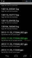
OSMGpxUploader is an Android application to upload any GPX files from the sdcard to the OSM server.
Features
- Use any android application with share functionality. Share a track and choose the uploader application to upload tracks to the OSM servers.
- Upload single GPX file
- Define location of the gpx files, show the gpx file list and upload the selected traks.
Links