| OSM Contributor
|
|
|
| Author:
|
jawg maps
|
| License:
|
GNU GPL v3 (free of charge)
|
| Platform:
|
Android 4.1+
|
| Status:
|
Unmaintained
|
| Version:
|
3.0.23 releases (2018-06-10)
|
| Languages:
|
French, English, Spanish, Portuguese, and ...
|
| Website:
|
https://github.com/jawg/osm-contributor
|
| Install:
|
|
| Source code:
|
https://github.com/jawg/osm-contributor
|
| Programming language:
|
Java
|
|
OSM Contributor mapping tool. Latest material design by the jawg team, add/edit/delete features for Nodes/Ways/Comments. Can also be used with pre-entered types for mapping parties (https://www.jawg.io)
|
|
Features
| Feature
|
Value
|
| Map Display
|
| Display map
|
yes
|
| Map data
|
raster;vector
|
| Source
|
online;cache;offline
|
| Rotate map
|
yes;no
|
| 3D view
|
yes;no
|
| Shows website
|
?
|
| Shows phone number
|
?
|
| Shows operation hours
|
?
|
| Routing
|
| Routing
|
no
|
| Create route manually
|
?
|
| Calculate route
|
no
|
| Create route via Waypoints
|
?
|
| Routing profiles
|
car;bike;foot;wheelchair
|
| Turn restrictions
|
yes
|
| Calculate route without Internet (Offline routing)
|
no
|
| Routing providers
|
none
|
| Avoid traffic
|
?
|
| Traffic Provider
|
?
|
| Navigating
|
| Navigate
|
yes
|
| Find location
|
yes
|
| Find nearby POIs
|
yes
|
| Navigate to point
|
no
|
| Navigation with voice / Voice guidance
|
no
|
| Keep on road
|
no
|
| Lane guidance
|
?
|
| Works without GPS
|
no
|
| Navigate along predefined route
|
no
|
| Tracking
|
| Make track
|
no
|
| Customizable log interval
|
no
|
| Track formats
|
?
|
| Geotagging
|
note
|
| Fast POI buttons
|
yes
|
| Upload GPX to OSM
|
no
|
| Monitoring
|
| Monitoring
|
no
|
| Show current track
|
no
|
| Open existing track
|
no
|
| Altitude diagram
|
no
|
| Show POD value
|
no
|
| Satellite view
|
no
|
| Show live NMEA data
|
no
|
| Show speed
|
no
|
| Send current position
|
yes
|
| Editing
|
| Add POIs
|
yes
|
| Edit / Delete POIs
|
yes
|
| Add way
|
yes
|
| Edit geometries
|
yes
|
| Edit arbitrary tags of existing OSM objects
|
yes
|
| Edit relations
|
yes
|
| View notes
|
yes
|
| Create notes
|
?
|
| Edit notes
|
yes
|
| Work offline
|
online;cache;offline
|
| Support imagery offset DB
|
no
|
| Upload to OSM
|
yes
|
| Rendering
?
|
| Accessibility
|
| Accessibility support
|
none
|
| Complete non graphics text output
|
yes
|
| Braille interface
|
no
|
| Exploration modus
|
yes;no
|
| Public Transport mode
|
no
|
| Danger Warnings
|
no
|
| Screenreader
|
none
|
| Screenreader languages
|
none
|
|
|
OSM Contributor ([1]) was an OpenSource Android Application to use anywhere by contributors, and during Mapping parties.
The application was either configurable for a dedicated region, and specific Data Types (useful for Mapping Parties), or globally.
It used a fork of the legacy Mapbox Android SDK and many other OpenSource libraries.
Issues, Feedbacks and contributions are welcome on the github repository.
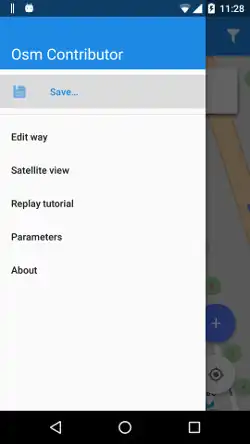
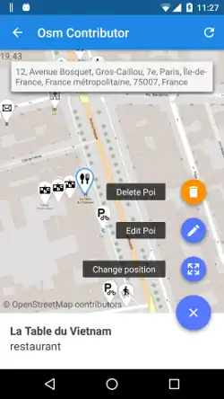
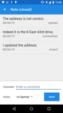
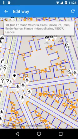
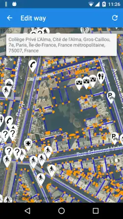
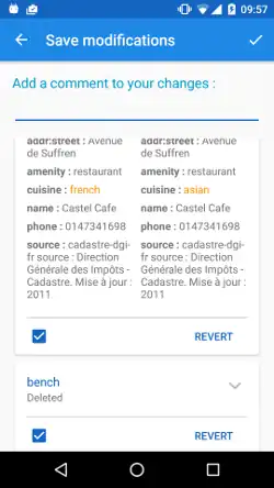
Screenshots
Development
The project is open source (GPLv3) and code is located on GitHub.
Forked app: Jungle Bus
OSM Contributor has been forked in 2017 to create a Bus stops collection dedicated app : Jungle Bus mobile app.
External links