Oklahoma
| V・T・E |
| latitude: 35.50, longitude: -98.5 |
| Browse map of Oklahoma 35°30′00.00″ N, 98°30′00.00″ W |
| Edit map |
|
|
External links:
|
| Use this template for your locality |
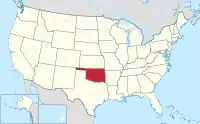
Oklahoma is a state in the United States at latitude 35°30′00.00″ North, longitude 98°30′00.00″ West.
Community
Get in touch with other Oklahoma mappers:
- Invite yourself to OSMUS Slack and join the #local-oklahoma channel.
- Subscribe to the nationwide talk-us mailing list.
Projects
- Reviewing road classification based on 2021 Highway Classification Guidance.
- Discussion ongoing at User:Dulahey/Oklahoma_Highway_Classification_Proposal
- Import Murray County roads - most of which were renamed for E911 purposes.
GIS/Road Data
Routes in Oklahoma
Interstate Highways
| Number | Relation | Status and notes |
|---|---|---|
| 35 Southbound | 2335784 |
|
| 35 Northbound | 2335783 |
State Turnpikes
State turnpikes are not numbered, only named and use network=US:OK:Turnpike
| Name | Relation | Status and notes |
|---|---|---|
| Cherokee | 2255331 |
Complete |
| Chickasaw | 2261344 |
Complete |
State Highways
Currently, Oklahoma has 214 state highways. Routes with super relations have alternate routes or are non-contiguous. State highways in Oklahoma use network=US:OK
| Number | Relation | Status and notes |
|---|---|---|
| 1 | 2253246 |
|
| 2 (Antlers - Warner) | 2253836 |
|
| 2 (Vinita - Welch) | 2253879 |
|
| 3 (Ada - Arkansas state line) | 2254167 |
|
| 3 (Colorado state line - Shawnee) | 1671845 |
|
| 3E | 2254081 |
|
| 3W | 2254050 |
|
| 4 (Central Oklahoma) | 2838398 |
|
| 4 (Eastern Oklahoma) | 2840762 |
|
| 5 (Western) | 2840802 |
|
| 5A | 2845256 |
|
| 5B | 2845257 |
|
| 5C | 2845258 |
|
| 6 | 2855448 |
|
| 7 | 2860867 |
|
| 7B | 2863164 |
|
| 7D | 2863165 |
|
| 7 Spur | 3234405 |
|
| 8 | 2887865 |
|
| 8A | 2887867 |
|
| 8B | 2887866 |
|
| 9 | 2888844 |
|
| 9A (Earlsboro-Konawa) | 3234405 |
|
| 9A (Canadian-Eufaula) | 3286535 |
|
| 9A (Arkoma) | 3647625 |
|
| 9 Business (Gotebo) | 2890912 |
|
| 9 Business (Hobart) | 2889070 |
|
| 10 | 3445472 |
|
| 10A | 3647620 |
|
| 10C | 3647722 |
|
| 11 | 1535171 |
|
| 11A | 1535171 |
|
| 12 | 3647930 |
Future state highway. |
| 14 | 3647991 |
|
| 15 (Western) | 3222042 |
|
| 15 (Eastern) | 3537459 |
|
| 16 | 3149627 |
|
| 17 | 3650855 |
|
| 17A | 3193556 |
|
| 18 | 3305337 |
|
| 18A | 3652359 |
|
| 18B | 3651350 |
|
| 19 | 3221763 |
|
| 19C | 3669802 |
|
| 19D | 3669969 |
|
| 20 | 3013705 |
|
| 22 | 3221764 |
|
| 23 | 3222044 |
|
| 24 | 3670085 |
|
| 25 (Eastern) | 3653449 |
|
| 25 (Western) | 3653438 |
|
| 26 | 3653381 |
|
| 27 | 3653334 | |
| 28 | 3445473 |
|
| 28A | 3652687 |
|
| 29 | 3652386 |
|
| 29A | 3652438 |
|
| 30 | 3649890 |
|
| 31 | 3221765 |
|
| 31A | 3221766 |
|
| 31B | 3649879 |
|
| 32 | 3639051 |
|
| 33 | 3193559 |
|
| 33 Truck | 3672484 |
|
| 34 | 3140334 |
|
| 34A | 3632354 |
|
| 34B | 3632355 |
|
| 34C | 3632353 |
|
| 48 | 3006413 |
WIP, fixing known continuity problems. |
| 48A | 3006577 |
State Cycleways
Currently, Oklahoma has 1 state cycleway. Relations for state cycleways use network=rcn
| Number | Relation | Status and notes |
|---|---|---|
| 66 | 1421823 |
Needs surveying in and around OKC and Tulsa to see how this route bypasses freeways, incomplete west of OKC. Route still subject to change. |
Local Routes
Localities with local routes should be listed here, routes in those localities should be listed on their respective pages.