Organised Editing/Activities/Nigeria Mokwa Flood Recovery 2025
Background
Event
On May 28, 2025, flooding caused by heavy rainfall submerged the market town of Mokwa in Niger State, Nigeria, causing severe damage. Officials said that the floods killed more than 200 people and confirmed that 1,000 were missing. At least 121 others were injured, and the flooding destroyed 2,000 homes (source: Mokwa flood Wiki).
OSM Perspective
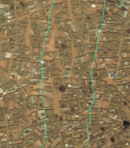
On June 3, 2025 the Open Mapping Hub Western and Northern Africa conducted a size-up (OSM needs assessment) of the disaster focusing in on a GDACS polygon. This found that Mokwa town was already very well mapped on OSM due to a successful Tasking Manager project from Médecins Sans Frontières (MSF) that completely intersects Mokwa Town. The project had used Maxar imagery captured in November 2020 - which was the latest available open imagery for improving OSM in that region (via Bing/Esri). Thus, no immediate needs to improve OSM base map data in response to the disaster were identified.
On June 4, Humanitarian OpenStreetMap Team (HOT) created a custom Humanitarian Data Exchange (HDX) export to allow data users to easily download OSM data clipped to Mokwa Town. This will be available from HDX for at least six months.
On June 5, Maxar released a post-flood scene captured on 2 June under a Creative Commons Attribution Non Commercial 4.0 International following a request from HOT the day before. This scene was then added to OpenAerialMap.
On June 9, the Open Mapping Hub Western and Northern Africa / HOT spoke to a representative of Geohazards Risk Mapping Initiative, who shared that for their longer term flood recovery efforts it would be valuable for damage tags to be added to building footprints using the post-flood Maxar imagery. See image comparison on right for visual clarity of flood damage (Maxar November 2020 scene vs June 2025 scene).
On June 12, the Western and Northern Africa Hub published a Tasking Manager project to kick start the coordinated mapping of damage in the most affected area of Mokwa and posted in the OSM Community Forum to notify wider public. On June 18 this project was completed on Tasking Manager (fully mapped and validated).
The resulting data from this completed project was added to a public uMap(data can be downloaded directly) as well as via the Disasters Charter.
Open Mapping Hub Western and Northern Africa
The Open Mapping Hub - West and Northern Africa engages open mapping organizations and communities in the region to facilitate the exchange of ideas and expertise and provide financial and technical support to scale local edits on OpenStreetMap. It is one of four regional hubs that make up HOT.
Geohazards Risk Mapping Initiative
Geohazards Risk Mapping Initiative (GRMI) is a Nigeria based organization that engages skilled GIS volunteers to create flood susceptibility and post-disaster maps in Nigeria.
Contacts
- Omowonuola 'Ola' Akintola - omowonuola.akintola@hotosm.org
- Sam Colchester - sam.colchester@hotosm.org
Tracking contributions
All OSM edits associated with this activity will have #MokwaFloods2025 automatically added to the changesets.
Data
- Outputs from Tasking Manager project focused on mapping damage added to a public uMap, the data can be downloaded directly from that uMap
- OSM data in custom Humanitarian Data Exchange (HDX) export focused on Mokwa Town
- Detailed flood extent from UNOSAT (used Maxar post-flood scene)
- Maxar post-flood scene (2 June 2025) on OpenAerialMap (OAM)
- Maxar pre-flood scene (9 October 2023) on OAM
- Maxar's scenes were downloaded from here and then merged and re-projected ready for OAM using these Python scripts: First merge_geotiffs.py and then raster_reprojectTo4326.py
Timeframe
Starting: 3 June 2025
Ended: 18 June 2025
Remote Mapping Coordination
The associated HOT Tasking Manager project and its progress can be seen here.
Due to the complexity of the project, mapping and validation permissions are restricted to the following groups of manually vetted OSM users:
Mapping:
Mapping and validation:
Mapping Instructions
Imagery
Please use:
- The custom imagery that loads by default to detect damage and destruction, it is Maxar post-flood imagery captured on 2 June 2025
- Esri World imagery for comparison to get the pre-flood 'picture', this area was last mapped using this imagery (which is actually Maxar captured in November 2020)
Damage mapping (IMPORTANT)
The boundary of this project is focused on UNOSATs flood extent data, derived from the post-flood Maxar scene, ensuring that mapping efforts are targeted to areas affected by the disaster.
The area has been well mapped already on OSM, so the goal here is to add relevant tags to existing OSM building footprints based on the latest damage.
On comparing the custom (post flood) imagery with mapped footprints and Esri World Imagery, if you spot damage or destruction please tag the relevant building footprint with:
damage=minimalORdamage=significantORdamage=complete(based on this interpretation of the BAR methodology)source:damage:date=2025-05source:damage=Maxar Imagery
Leave the building=yes or building=house etc. tags as they are for the footprints.
Please pay special attention to any buildings that existed in OpenStreetMap (OSM) prior to the flood but that are no longer visible in the Maxar Imagery provided, they have a high likelihood of being destroyed or heavily damaged (i.e. damage=complete).
Do not delete any building footprints, even if they seem completely destroyed, the resuting data will be used for recovery and it is important to know what existed before the flood event (baseline data).
Buildings
Almost all buildings are already mapped in this region, however if you do spot any that seem to have been built since 2020 please do map them. Buildings are generally rectangular, so make buildings rectangular even if a shadow, tree or roof pitch makes it appear otherwise. Please do improve any building footprints if you spot any inaccurate geometries.
Roads and other features
You are not requested to map anything other than building damage in this project.
See instructions directly in Tasking Manager project.