Tag:amenity=fuel
| Description |
|---|
| A retail facility for refueling motor vehicles |
| Rendering in OSM Carto |
| Group: amenities |
| Used on these elements |
| Useful combination |
| See also |
| Status: de facto |
| Tools for this tag |
|
The fuel tag is used to map a fuel station, also known as a filling station, petrol station, gas station and petrol garage. It is the retail-type facility where motor vehicles can be refueled. Fuel stations for watercraft, aircraft and rail vehicles are using different tags (see below).
How to map
Add a node ![]() at the centre of the fuel station or create a way around the fueling area
at the centre of the fuel station or create a way around the fueling area ![]() and add
and add amenity= and name=* to it. The brand is usefully used for the name. If it can be used by large vehicles add hgv=yes.
Names
Often the station is operated operator=* by one of the major brands brand=*. If the station has a name of its own, that can be tagged too using name=*.
Contact details
Tags such as addr:*=* (Addresses), phone=* / contact:phone=* and website=* / contact:website=* are spread widely.
Fuel types
Different fuel types are tagged as mentioned at fuel:*=*
Payment and Discounts
Use payment:*=* to tag payment options. Tag discounts as fuel:discount=<discount programme> in combination with amenity= if the fuel station accepts discount vouchers, e.g. shopper dockets or other loyalty programmes.
Service
Add the opening hours using the key opening_hours=*. For data about wheelchair access, see wheelchair=*. There are not agreed upon tags for different levels of service, but both self_service=yes/no and full_service=yes/no and automated=yes/no have been used. Note that a gas station can be both self serve and full serve. The expectation for the default values of self_service and full_service will probably vary greatly from location to location, so it’s probably best to always explicitly specify both to take the guessing out of it. When conditions vary along the day you could apply the conditional restrictions scheme. Here are some examples of use:
- Only serviced by attendant:
self_service=nofull_service=yes
- Self service always available, attended only during the day:
self_service=yesfull_service=nofull_service:conditional=yes @ 06:00-18:00
- Self service only available at night when no attendant is present:
self_service=yesself_service:conditional=no @ 06:00-18:00full_service=nofull_service:conditional=yes @ 06:00-18:00
Capacity
Indicate the size of the station using the key capacity=*, this should be the total number of pumps available, that is the number of vehicles which could be refuelling at any one time. Optionally include more detail with capacity for specific vehicle types such as capacity:hgv=*.
Surroundings
- The roof of petrol stations can be tagged with
building=roofandlayer=1. - It is also a good idea to tag the ways leading to, through and away from the fuel station with
highway=serviceand if applicableoneway=yes. Use themaxheight=*tag to indicate the maximum height for a vehicle that can access the fuel pumps under the roof. Alternatively the area around the fuel pumps may be tagged asarea:highway=serviceandsurface=*. advertising=totemfor advertising totems with pricesman_made=fuel_pump+amenity=vending_machine+vending=fuelfor micromapping the individual fuel pumps
The entire area of the gas station
Use landuse=retail for the entire area of the gas station.
Additional services
Note the rule One feature, one OSM element!
- Shop: Add a node with
shop=convenienceorshop=kioskor tag the building related to the fuel station if there is a convenience shop or kiosk as part of the fueling area. - Fast-food: If you can buy fast food (eg. hot-dogs) at a petrol station use
fast_food=*in combination with main tag. - Car Wash:
car_wash=yes
- Toilets:
toilets=yes/no
- Compressed air:
compressed_air=yes/no
- Or add an additional node with
amenity=compressed_air.
- Vacuum cleaner: Add a node for
amenity=vacuum_cleaner - Refill drinking water tank (caravans, buses etc): Add
water_point=yesor add node foramenity=water_pointto mark the location of this facility. - Empty septic tank (caravans, buses etc): Add
sanitary_dump_station=yesor add node foramenity=sanitary_dump_stationto mark the exact place of facility.
Example
| Picture/Description | Tags | Openstreetmap Carto |
|---|---|---|
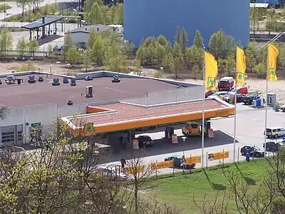
|
amenity=
|
Goto this place(52.98770 N, 8.87101 E) |
Possible tagging mistakes
See also
amenity=charging_station- Charging station, a station that supplies energy to electrical vehicles.- Proposal:Fuel - approved proposal for second level tags.
man_made=fuel_pump- a fuel pump also known as petrol pump or gas pump located within a fuel station (for micromapping the individual fuel pumps).man_made=fuel_column- there exists more popularman_made=fuel_pumptag with the same meaning, please use that instead.
Fuel stations for other vehicle classes are should be tagged as:
waterway=fuel- Fuel station for watercraftaeroway=fuel- Fuel station for aircraftrailway=fuel- Fuel station for rail vehicle
Fuel for non-automotive use (heating, cooking, etc.) should be tagged as:
shop=fuel- a shop selling coal, charcoal, coke, firewood, wood briquettes, wood pellets etc. for small to medium purposes.
External links
- https://community.openstreetmap.org/t/differing-approaches-to-tagging-vending-machines-for-motor-fuel-dispensing-have-caused-confusion/103421 - how to tag motorcycle fuel stations?