Tag:hazard=loose_gravel
 |
| Description |
|---|
| An area along the road where rocks and stones may be present, presenting a hazard to motorists. |
| Group: hazards |
| Used on these elements |
| Useful combination |
| Status: approved |
| Tools for this tag |
|
A loose gravel hazard is an area along the road where rocks and stones may be present, presenting a hazard to motorists.
How to map
Loose gravel hazards may be mapped in the following ways:
- Place a node
 at the location of the loose gravel hazard traffic sign, tagged
 traffic_sign=hazard+hazard=. - Tag a node along a
highway=*way at the location of the sign
 - Tag the section of
highway=*where the loose gravel hazard is present.
Signage examples
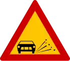
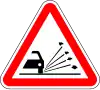
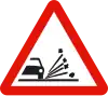
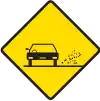
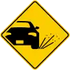
The tables below show what loose gravel hazard signage looks like in various countries.
European-style signage
| Belgium | Czechia | Denmark | Estonia | Finland | France | Germany | Greece |
|---|---|---|---|---|---|---|---|

|

|

|

|

|

|

|
|
| Hungary | Iceland | Italy | Luxembourg | Netherlands | Norway | Poland | Portugal |
|---|---|---|---|---|---|---|---|

|

|

|

|
|

|

|
|
| Romania | Russia Belarus |
Slovakia | Slovenia | Spain | Sweden | Switzerland Liechtenstein |
Turkey |
|---|---|---|---|---|---|---|---|

|

|

|

|
|

|

|

|
| Ukraine | UK |
|---|---|

|

|
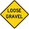
MUTCD-style signage
| Argentina | Australia | Brazil | Canada | Canada (Ontario) |
Canada (Quebec) |
Chile | Colombia |
|---|---|---|---|---|---|---|---|
|

|

|
|
|

|
|
| Indonesia | Ireland | Jamaica | Liberia | Mexico | New Zealand | Panama | Peru |
|---|---|---|---|---|---|---|---|

|

|

|

|

|

|

|

|
| Thailand | USA | Uruguay |
|---|---|---|

|
|

|