Tag:highway=traffic_sign
 |
| Description |
|---|
| Traffic sign object at its actual location. |
| Group: highways |
| Used on these elements |
| Useful combination |
|
| See also |
| Status: in use |
| Tools for this tag |
|
How to map
The tag highway= can be used to map a traffic sign as an object at its actual location to clarify that a node represents the object of the traffic sign itself. Add traffic_sign=* to specify which traffic sign(s) is/are shown on the sign.
The implications of a traffic sign should always be tagged on the concerned section of the road itself as well. When mapping a speed limit sign for example: always add a maxspeed=* and a source:maxspeed=sign tag to the road itself (see traffic_sign=*).
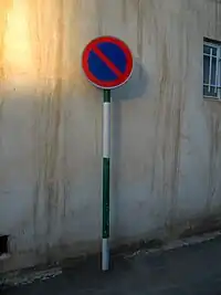
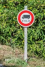
Examples
|
|
Remark: The implication of the traffic sign should also be mapped on the highway line ( |

|
|
Remark: The implications of the traffic signs should also be mapped on the highway line ( |