Tag:landuse=military
 |
| Description |
|---|
| Area used for military purposes. |
| Rendering in OSM Carto |

|
| Group: military |
| Used on these elements |
| Useful combination |
| Status: de facto |
| Tools for this tag |
|
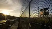
An area used for any military purpose, with additional tags used to describe what that purpose is.
How to map
Map the outline of the military area ![]() and add
and add
In cases where it is applicable also add military=* and military_service=*.
Note that in many cases military=* objects are mapped separately, for example military=bunker that may be within landuse= or outside it (common for historic bunkers).
For military bases add military=base for the base area.
Additional tags
name=*military_service=*military=*
Note that following military=* values are rather tagged on separate objects. In many cases such object will not be within landuse=. For example historic bunkers are commonly outside areas used by military.