Th:Tag:highway=tertiary
 |
| คำอธิบาย |
|---|
| ถนนที่เชื่อมโยงชุมชนเล็กๆ หรือศูนย์กลางท้องถิ่นของเมืองหรือเมืองใหญ่ |
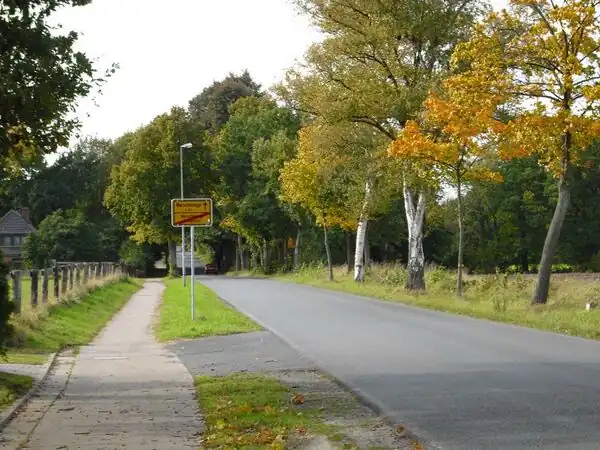
| การเรนเดอร์บน OSM Carto |
|
| กลุ่ม: ทางหลวง |
| ใช้บนส่วนประกอบเหล่านี้ |
| หมายความว่า |
|
|
| คู่ผสมที่เป็นประโยชน์ |
| สถานะ: อนุมัติแล้ว |
| เครื่องมือสำหรับแท็กนี้ |
highway= ใช้ในการแท็กถนน หรือทางหลวงที่เชื่อมโยงชุมชนขนาดเล็ก กับชุมชนขนาดใหญ่ และถนนภายในศูนย์กลางตัวเมืองขนาดใหญ่ หรือเขตเทศบาล ในแง่ของเครือข่ายการขนส่ง 'ถนนสายย่อย' ของ OpenStreetMap มักจะเชื่อมต่อทางหลวงแผ่นดินสายรองและสายหลักด้วย
วิธีการทำแผนที่ในประเทศไทย
- บทความหลัก: ทางหลวงในประเทศไทย
โปรดทราบไว้ว่านี่เป็นหลักการสำหรับการทำแผนที่ในเขตประเทศไทยเท่านั้น
สำหรับถนนระหว่างเมือง
จะใช้แท็กนี้กับถนนระหว่างเมืองใน 2 กรณี ได้แก่:

 ทางหลวงชนบททั้งหมด (อักษรย่อจังหวัดและเลข 4 หลัก) ยกเว้นมีการระบุไว้เป็นกรณีพิเศษ
- ถนนท้องถิ่นที่มีความสำคัญเท่ากับหรือมากกว่า(ในแง่ของประสิทธิภาพ/ความกว้าง/ปริมาณของไฟจราจร/ความยาวรวม) เทียบกับถนนสายย่อย (มักเป็นถนนท้องถิ่นหลักที่มีเลขอ้างอิง)
ตัวอย่างถนน
| รหัสถนน | แท็กที่ใช้ | ตัวอย่างบนแผนที่ |
|
|
highway=
|
|

|
highway=
|
สำหรับถนนภายในเมือง/เทศบาล
จะใช้แท็กนี้กับถนนที่มีความสำคัญมากกว่าถนนพื้นฐาน หรือถนนชุมชน หรือถนนที่เชื่อมกับถนนพื้นฐานหรือถนนชุมชนอยู่หลายเส้น
ตัวอย่างถนน
| แท็กที่ใช้ | ตัวอย่างบนแผนที่ |
highway=
|
|
highway=
|
การใช้งานแท็ก
วิธีการทำแผนที่ทั่วไป
Map a tertiary road as you would any other highway=*: draw a simple ![]() way along your GPS trace or the centreline of the road if tracing satellite imagery, and tag it with
way along your GPS trace or the centreline of the road if tracing satellite imagery, and tag it with highway=.
แท็กที่ใช้ร่วมกัน
name=nameThe name of the highway, for example "Skipton Road"ref=reference codeThe reference number of the road, for example "R 372" or "C452"loc_name=local nameThe unofficial or local name for a roadold_name=*– Historical/old name, still in some use.oneway=yesmaxspeed=numberMaximum legal speed limit, e.g. "45" (in metric countries), or "30 mph"maxweight=numberThe weight limit in tonnes, for example "5.5"cycleway=*– Cycle lanes or tracks provided within the carriageway or nextsidewalk=*– Indicates the presence or absence of a sidewalk (pavement/footway).surface=*– A description of the road's surface, e.g. "unpaved"lit=yes– when the highway is litwidth=numberorest_width=numberWidth of the road in metres, e.g. "4.5"lanes=numberThe total number of car-sized lanes available on the road, regardless of direction.lane_markings=*– Specifies if a highway has painted markings to indicate the position of the laneswinter_service=*– if winter service is providedembedded_rails=tram– tram traffic on the roadway
อ้างอิง
| ||||||||||||||||||||||||||||||