It has been proposed that this page be
deleted or replaced by a redirect. See the discussion page for further information.
The given reason is:
Website is gone, app was proprietary, no significant impact for the OSM project. --Nakaner (talk) 13:30, 7 October 2024 (UTC).
(Pages that link to this page.)
This page was last edited by Nakaner; 13:30, 7 October 2024 (UTC) (291 days ago).
| TravelDroyd
|
|
|
| Author:
|
OneStepAhead AG
|
| License:
|
Proprietary (5€+books)
|
| Status:
|
Broken
|
| Language:
|
20
|
| Website:
|
http://www.traveldroyd.com
|
|
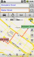
Abandoned. Combining offline OSM+wikipedia articles for travelguides that you have to buy
|
|
Features
| Feature
|
Value
|
| Map Display
|
| Display map
|
yes
|
| Map data
|
vector
|
| Source
|
offline
|
| Rotate map
|
yes
|
| 3D view
|
no
|
| Shows website
|
?
|
| Shows phone number
|
?
|
| Shows operation hours
|
?
|
| Routing
|
| Routing
|
yes
|
| Create route manually
|
?
|
| Calculate route
|
?
|
| Create route via Waypoints
|
?
|
| Routing profiles
|
?
|
| Turn restrictions
|
?
|
| Calculate route without Internet (Offline routing)
|
?
|
| Routing providers
|
?
|
| Avoid traffic
|
?
|
| Traffic Provider
|
?
|
| Navigating
|
| Navigate
|
no
|
| Find location
|
yes
|
| Find nearby POIs
|
?
|
| Navigate to point
|
?
|
| Navigation with voice / Voice guidance
|
?
|
| Keep on road
|
?
|
| Lane guidance
|
?
|
| Works without GPS
|
?
|
| Navigate along predefined route
|
?
|
| Tracking
|
| Make track
|
no
|
| Customizable log interval
|
?
|
| Track formats
|
?
|
| Geotagging
|
?
|
| Fast POI buttons
|
?
|
| Upload GPX to OSM
|
?
|
| Monitoring
|
| Monitoring
|
no
|
| Show current track
|
yes
|
| Open existing track
|
?
|
| Altitude diagram
|
?
|
| Show POD value
|
?
|
| Satellite view
|
?
|
| Show live NMEA data
|
no
|
| Show speed
|
?
|
| Send current position
|
?
|
| Editing
?
|
| Rendering
?
|
| Accessibility
?
|
|
|
TravelDroyd (traveldroyd.com) is an Android app combining offline OSM and wikipedia articles for travelguides that you have to buy