It has been proposed that this page be
deleted or replaced by a redirect. See the discussion page for further information.
The given reason is:
This app is not related to OpenStreetMap. In addition, this page is a stub and the application supports no Windows version newer than Windows 7. --Nakaner (talk) 10:26, 4 February 2025 (UTC).
(Pages that link to this page.)
This page was last edited by Nakaner; 10:26, 4 February 2025 (UTC) (171 days ago).
| VisualGPS
|
|
|
| License:
|
(free of charge)
|
| Platform:
|
Windows
|
| Version:
|
4.2 (2009-03-29)
|
| Language:
|
English
|
| Website:
|
http://www.visualgps.net/VisualGPS/
|
|
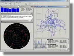
GPS signal analyses
|
|
Features
| Feature
|
Value
|
| Map Display
|
| Display map
|
yes
|
| Map data
|
?
|
| Source
|
?
|
| Rotate map
|
no
|
| 3D view
|
no
|
| Shows website
|
?
|
| Shows phone number
|
?
|
| Shows operation hours
|
?
|
| Routing
|
| Routing
|
no
|
| Create route manually
|
?
|
| Calculate route
|
?
|
| Create route via Waypoints
|
?
|
| Routing profiles
|
?
|
| Turn restrictions
|
?
|
| Calculate route without Internet (Offline routing)
|
?
|
| Routing providers
|
?
|
| Avoid traffic
|
?
|
| Traffic Provider
|
?
|
| Navigating
|
| Navigate
|
no
|
| Find location
|
?
|
| Find nearby POIs
|
?
|
| Navigate to point
|
?
|
| Navigation with voice / Voice guidance
|
?
|
| Keep on road
|
?
|
| Lane guidance
|
?
|
| Works without GPS
|
yes
|
| Navigate along predefined route
|
?
|
| Tracking
|
| Make track
|
no
|
| Customizable log interval
|
yes
|
| Track formats
|
?
|
| Geotagging
|
?
|
| Fast POI buttons
|
?
|
| Upload GPX to OSM
|
?
|
| Monitoring
|
| Monitoring
|
no
|
| Show current track
|
?
|
| Open existing track
|
?
|
| Altitude diagram
|
yes
|
| Show POD value
|
yes
|
| Satellite view
|
yes
|
| Show live NMEA data
|
yes
|
| Show speed
|
?
|
| Send current position
|
?
|
| Editing
?
|
| Rendering
?
|
| Accessibility
?
|
|
|
Has a mobile spinoff: VisualGPSce