Key:map_type
| Description |
|---|
| Specifies the type of a map. |
| Group: tourism |
| Used on these elements |
| Requires |
| Status: de facto |
| Tools for this tag |
|
=*What type of map is it?
| key=value | Description | Example/photo |
|---|---|---|
=topo
|
A map with topographical background for e.g. a historical or hiking map. The map contains contour lines. |  |
=street
|
A map with all streets or ways of an area. The streets are mostly named. The angles, distances etc. are accurate. Used e.g. at tourist offices for the accommodation overview. | 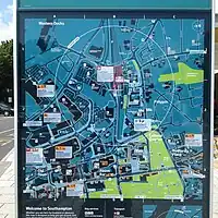 |
=scheme
|
A sketched map with only important ways and POIs. The angles, distances etc. are merely illustrative, not accurate. Used e.g. by travel agencies to explain their tours. | 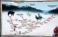 |
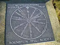
=toposcope
|
A marker erected on high places which indicates the direction to notable landscape features which can be seen from that point (associated with tourism=viewpoint).
|
 |
=*
|
All commonly used values according to Taginfo |