Key:monitoring:groundwater
 |
| Description |
|---|
| Monitoring station for groundwater parameters |
| Group: man made |
| Used on these elements |
| Requires |
| See also |
| Status: in use |
| Tools for this tag |
|
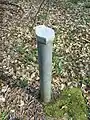
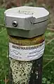
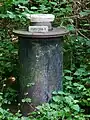
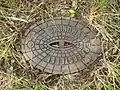
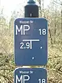
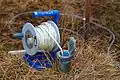
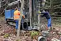
A ![]() Water_well#Classification to measure groundwater parameters like level, pore pressure and quality. Also used for measuring of groundwater contamination.
Water_well#Classification to measure groundwater parameters like level, pore pressure and quality. Also used for measuring of groundwater contamination.
How to map
There are two main base types of groundwater monitoring facilities:
=level- for water level monitoring=quality- for water quality monitoring
If no information is available or the facility is used for both measurements, use (=yes).
Combination tags
display=analog/digitalrecording=manually/automated/remoteref=*- to annotate the reference code, if existing