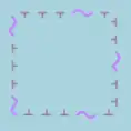
Tag:seamark:type=cable_area
| Description |
|---|
| An area which contains one or more submarine cables. |
| Group: marine navigation |
| Used on these elements |
| Status: in use |
| Tools for this tag |
|
An area which contains one or more submarine cables.
How to map
Draw the outline of the area ![]() and add
and add
seamark:type=seamark:name=*- nameseamark:cable_area:restriction=no_anchoring;no_fishing
Symbol in OpenSeaMap

See also
For the cable itself use: