Key:urban
 |
| Description |
|---|
| Indicates whether the road is inside the built-up area. |
| Group: restrictions |
| Used on these elements |
| Requires |
|
| See also |
| Status: in use |
| Tools for this tag |
|
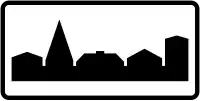
This tag indicates whether, for the purposes of road traffic rules, a highway is located inside of city limits.
Values

=yes: the road is inside the built-up area (within city limits of some place)
=no: the road is outside the built-up area (not within city limits of any place)
How to map
In most cases, you need to tag zone:traffic=* and you do not need to tag =*, because the correct value of =* can be derived from the value of zone:traffic=*. For example, zone:traffic=*:urban automatically means =yes and zone:traffic=*:rural automatically means =no.
However, for some values of zone:traffic=* (e.g. zone:traffic=DE:motorway), the value of =* is not obvious, and in this case you can tag =* explicitly.