Key:water_source
 |
| Description |
|---|
| Indicates the source of the water for features that provide or use water. |
| Group: water management |
| Used on these elements |
| Documented values: 8 |
| Useful combination |
| Status: approved |
| Tools for this tag |
|
=* can be used to indicate the source of the water for features that provide or use water.
This tag was initially approved for use in combination with emergency=fire_hydrant, but it has been used for other features as well, such as shelters and campsites.
Values
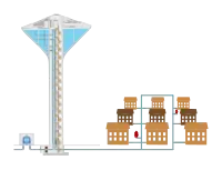
- "main" describes a connection to a pressurized water main
Common values
LOADING TAG LIST...
Further values
LOADING TAG LIST...
landuse=farmland
Values used in combination with landuse=farmland
Note: So far it has been used almost exclusively in Afghanistan.
LOADING TAG LIST...
There are also the following keys for irrigation:
irrigated=*irrigation=*
Shelters and huts
Sometimes water is hard to find at a site and you have to plan accordingly.
In 2020, a user made the following suggestion: Proposed value water_source=no means that there is no water found nearby. No lakes, streams within 2 km. Consider making sure that all streams, river and lakes in the area is mapped before adding this tag.