Ko:Key:crossing
 |
| 설명 |
|---|
highway=crossing 또는 railway=crossing 태그가 이미 붙은 노드를 좀 더 개선합니다. |
| 그룹: 속성 |
| 해당 요소의 사용 |
| 문서화된 값: 1 |
| 의존하는 태그 |
| 유용한 조합 |
|
| 상태:승인 |
| 이 태그를 위한 도구 |
이 태그는 좀 더 정확하게 도로를 가로지르는 보행자 횡단보도와 도로 혹은 철로 위를 지나는 다른 유형의 횡단보도의 구체적인 유형을 묘사하기 위해 사용합니다. 보행자, 자전거 등의 편의를 위한 횡단보도 시설은 가장 먼저 highway=crossing 또는 railway=crossing 태그가 적절하게 붙어 있어야 합니다. 횡단보도의 유형을 =* 태그와 아래에 설명된 다른 속성으로 더 구체적으로 만들 수 있습니다.
이 태그는 두 도로(인도와 도로, 도로와 철로 등)가 교차하는 곳에 있는 노드에 사용합니다. 더 자세하게 지도에 표기하기 위해서 인도에서 횡단보도 노드로 이어지는 길에 footway=crossing 또는 cycleway=crossing 태그를 적절하게 붙이는 것이 유용할 수 있습니다.
횡단보도 태그
=traffic_signals- 횡단보도 이용자(보행자, 자전거)가 별도의 신호등을 이용하는 경우에 이 태그를 붙이세요.
highway=traffic_signals와 가장 비슷합니다.traffic_signals:sound=yes/no- 시각 장애가 있는 보행자를 위한 버튼을 눌러서 신호를 바꾸는 횡단보도에 소리까지 나오는 경우에 사용합니다.
traffic_signals:vibration=yes/no- 시각 장애가 있는 보행자를 위한 버튼을 눌러서 신호를 바꾸는 횡단보도에 진동까지 나오는 경우에 사용합니다.
=uncontrolled- 어떤 유형의 신호등도 없고 도로에 표시만 있는 일반적인 횡단보도. 예를 들어 zebra-crossing이 있으며, 미국에서는 "crosswalk"라 부릅니다.
highway=crossing과 가장 많이 조합되어 쓰입니다.
=no- Where definitely no crossing is possible/legal. This tag must be used without a
highway=crossing, so data consumers only evaluating the high-level highway tag are not mislead into assuming a crossing here.
As=noexcludes the existence of a crossing, the combination ofhighway=crossingand=nois invalid.
Thus, if there is a place where one would expect a crossing but where is definitely no crossing, you may tag this with=nobut withouthighway=crossing.
=unmarked- A crossing without road markings or traffic lights
=island- A crossing with a small traffic-island for pedestrians in the middle of the road. Note that this tag is highly confusing, as it is orthogonal to traffic_signals/uncontrolled/unmarked classification. Tagging
highway=crossingwith=islandmakes impossible to distinguish between=traffic_signalsand=uncontrolled. For this reason many editors do not use this tag and some consider it as a broken tagging scheme[1]. Alternatively,crossing:island=yescan be used in addition to=traffic_signals/uncontrolled/unmarked. - Mostly in combination with
highway=crossing, it would be very unusual for this feature to appear onrailway=crossing.
Additional tags
bicycle=*- A value of
yesmeans that pedal cyclists are permitted to ride across the crossing.
horse=*- A value of
yesmeans that horse riders are permitted to ride across the crossing.
button_operated=yes/no- Green light on a traffic signal can be requested by a bicycle rider or pedestrian by button press.
segregated=yes/no- Like many others, this parameter is Boolean , i. e. it can take the values "yes" or "no". Different from several other Boolean parameters, in this case no default is assumed. A value of
yesindicates that crossing traffic of differing types is segregated from each other (there is a separate crossing area for each mode of transport). At many traffic lights, crossing foot and bicycle traffic are segregated. A more regional example is the segregation of horse and foot traffic within some UK Pegasus Crossings.
supervised=yes/no- This is a Boolean parameter, too. But there is the default
no. A value ofyesindicates that the crossing may be managed by a crossing guard at busy times.
crossing_ref=*- The traditional, region-specific reference, such as
zebraorpelican.
sloped_curb=yes/no/one/both- To indicate whether a wheelchair can pass the crossing.
- Tag on the node representing the kerb (en_US: curb) on the highway=footway for each side of the crossing. Add the footway as single way where needed. (Consider using
kerb=*instead as it is a more general purpose method. Add your input to the relevant talk pages.)
tactile_paving=yes/(no)/incorrect- To indicate whether there is a pattern in the ground to aid the blind.
- Tag on the node representing the kerb (en_US: curb) on the highway=footway. Add the footway as single way where needed.
flashing_lights=yes/no- (default is
no) A value ofyesindicates that flashing lights warn drivers when a pedestrian is crossing. For more detail, consider using a value ofbutton,sensor(if the lights turn on automatically), oralways(if the lights are constantly flashing).
Examples
The following table shows how the crossing might be tagged:
| Name and description | Tags | UK shortcuts | Image |
|---|---|---|---|
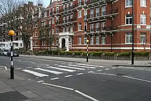
Zebra crossing
|
highway=crossing
|
=zebra
|

|
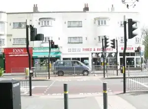
Pelican crossing (traditional British name)
|
highway=crossing
|
=pelican
|
|
Tiger crossing
|
highway=crossing
|
=tiger
|
|
Toucan crossing (traditional British name, like "two-can")
|
highway=crossing
|
=toucan
|
|
Pegasus crossing (traditional British name)
|
highway=crossing
|
=pegasus
|
|
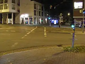
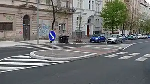
| An unmarked crossing with sloped curbs. | highway=crossing
|

| |
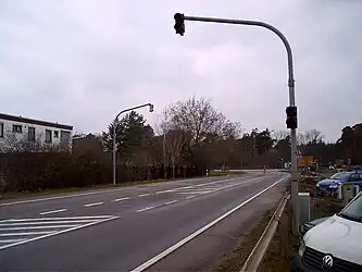
| A crossing with a traffic island (implicit mapping with a property or explicitly to mark a footway or similar on a traffic island crossing). | highway=crossing
|
| |
A supervised crossing (additional property)
|
highway=crossing
|
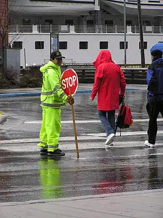
| |
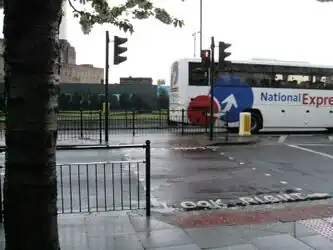
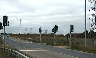
Traffic signals without a pedestrian crossing.
|
highway=traffic_signals
|
 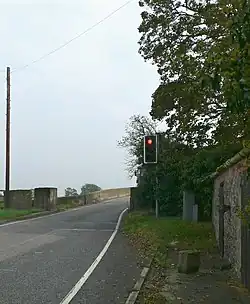
|
Tagging crossings as ways
Some mappers tag a way ![]() segment of a
segment of a highway=footway or highway=cycleway that crosses multiple roads and/or railways with =traffic_signals to indicate that there is only one traffic light controlling the cyclist or pedestrian, to avoid multiple nodes ![]() being tagged as crossings.
being tagged as crossings.
Similarly, a way segment of a highway=footway is being tagged =uncontrolled + crossing_ref=zebra to indicate its full length.
Disadvantage: Please note that this mapping style makes it difficult for routers and navigation systems to recognise that there is a crossing for pedestrians or cyclists along the road, since there is no special crossing node ![]() on the route being evaluated.
on the route being evaluated.
See Also
- Approved features/Road crossings - the original proposal for this tag
- Cycle routes - closely linked with many toucan crossings
- Proposed features/Traffic_island
External Links
- Pedestrian_crossing (wikipedia) - international differences and terminology