Ko:Tag:tourism=information
 |
| 설명 |
|---|
| 관광객 및 방문객을 위한 정보 |
| 그룹: 관광 |
| 해당 요소의 사용 |
| 의존하는 태그 |
| 유용한 조합 |
|
| 상태:사실상 표준 |
| 이 태그를 위한 도구 |
관광객과 여행자를 위한 정보의 출처입니다. 다음을 포함할 수 있습니다:
- 관광 안내소 및 사무소
- 마을 지도, 현장 지도, 하이킹 및 기타 스포츠 트레일 지도와 같은 지도 안내판
- 관광객을 위한 안내판
- 지역 역사, 야생동물 등에 대한 세부 정보를 보여주는 안내판
- 이정표 및 웨이마커
매핑하는 방법
시설의 유형에 따라 마디 ![]() 을 추가하거나 영역
을 추가하거나 영역 ![]() 을 그리세요. 마디 또는 영역에
을 그리세요. 마디 또는 영역에 tourism=와 information=* 태그를 지정하세요 (아래 참조). 그 외 유용한 태그:
name=*description=*
값
| 키 | 값 | 요소 | 설명 | 렌더링 | 이미지 |
|---|---|---|---|---|---|
| information | office | An office where you can get information about a town or region. |  |
 | |
| information | visitor_centre | A place where you can get information about a specific attraction or place of interest. |  | ||
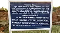
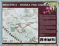
| information | board | A board with information. To describe it closer, have a look at board_type=*.
|
 |
 | |
| information | stele | A stele for information. | 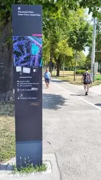 | ||
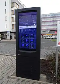
| information | terminal | A information terminal provides information access via electronic methods. Mostly it is combined with access to the internet. (See internet_access=*.)
|
 |
 | |
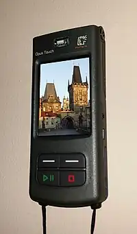
| information | audioguide | A place where you can get information using headphones or a mobile phone. |  |
 | |
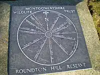
| information | map | A board with a map. To specify the type or shown details, have a look at map_type=* and map_size=* in information=map. To describe the access to the shown routes or the kind of route use the keys e.g hiking=yes, bicycle=yes, mtb=yes, horse=yes or ski=yes.
|
 |
  | |
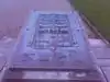
| information | tactile_map | Tactile maps are maps for the blind, also known as haptic maps. | |
 | |
| information | tactile_model | Tactile models are models for the blind representing buildings and surroundings. |  | ||
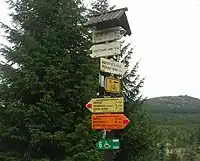
| information | guidepost | Signposts/Guideposts are often found along official hiking/cycling routes to indicate the directions to different destinations. To describe the access to the shown routes or the kind of route use the keys e.g hiking=yes, bicycle=yes, mtb=yes, horse=yes or ski=yes.
|
 |
 | |
| information | post | A small pole, erected vertically, with information on the top or sides that may be inscribed, or on a small plaque. Somewhat similar to an information=stele, but smaller. | .jpg) | ||
| information |
A marker that shows the position of the way of a route. Could be a symbol, a short pole or a painted marking. Note that two partially equivalent tag values are used: a more popular |
.jpg) 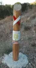 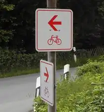 | |||
| information | user defined | All commonly used values according to Taginfo |
This table is a wiki template with a default description in English. Editable here. 한국어 번역은 여기에 있습니다.
자주하는 실수
함께 보기
- Proposal:Top-level information tag - proposal to separate
tourism=frominformation=*