These are featured images, which have been identified as the best examples of OpenStreetMap mapping, or as useful illustrations of the OpenStreetMap project.
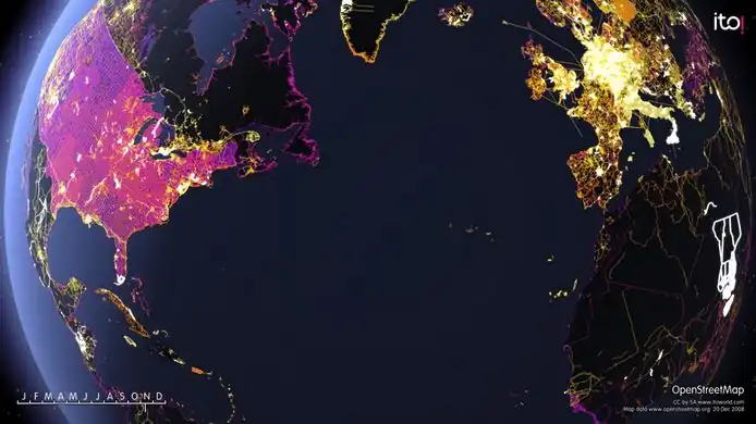
A frame from 'OSM 2008 - A year of edits'. Other stills available on Flickr. Animation on the ITO Vimeo site from midnight (Australia time) on Dec 31st.
The Naga City GIS released their data to public domain and is now imported to OSM. All roads, railways, rivers and buildings.
Week 5 (26 Jan – 1 Feb2025-01-26–Error: Invalid time.)
English
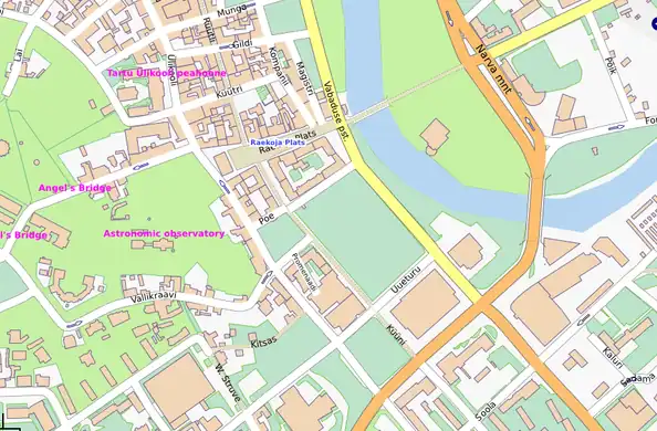
Map of Tartu, the green University town in Estonia were contributed by the City Government
Week 6 (2–8 Feb2025-02-02–Error: Invalid time.)
English
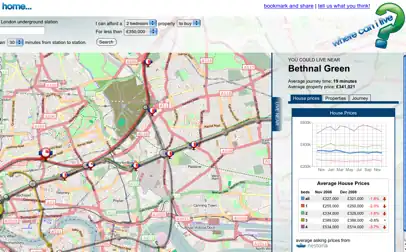
Where-can-i-live uses OSM maps to display houses within a certain commute time of work
Week 7 (9–15 Feb2025-02-09–Error: Invalid time.)
English
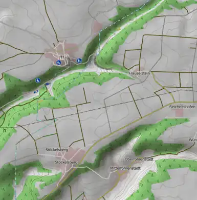
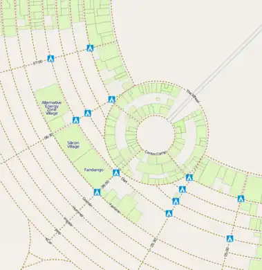
A hiking map is available, showing the relief and contours of the landscape, and highlighting paths and trails (Note: Now seems to be described at DE:OSMC Reitkarte)
Week 8 (16–22 Feb2025-02-16–Error: Invalid time.)
English
osmdiff is a program to visualize and report changes in an area (e.g. see osmdiff reports)
Week 9 (23 Feb – 1 Mar2025-02-23–Error: Invalid time.)
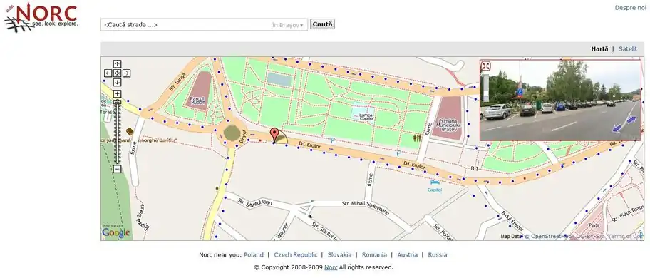
http://www.norc.ro is a service similar to Google StreetView, offered by a Romanian company. They are using OpenStreetMap as an overlay to display the panoramas (only for Romania at higher zoom levels for now). They also donated 16 GB of GPS logs and gave us permission to derive data from their images.
Week 11 (9–15 Mar2025-03-09–Error: Invalid time.)
English
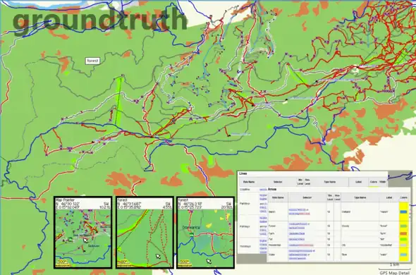
GroundTruth is a new mapmaking tool for converting OSM data into Garmin maps. This featured image is a collage of various screenshots taken from MapSource, a Garmin unit and from Wiki pages containing rendering rules.
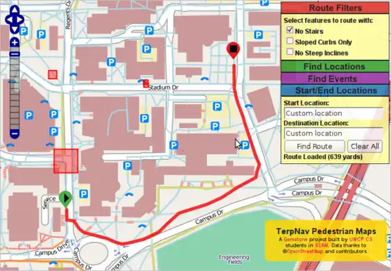
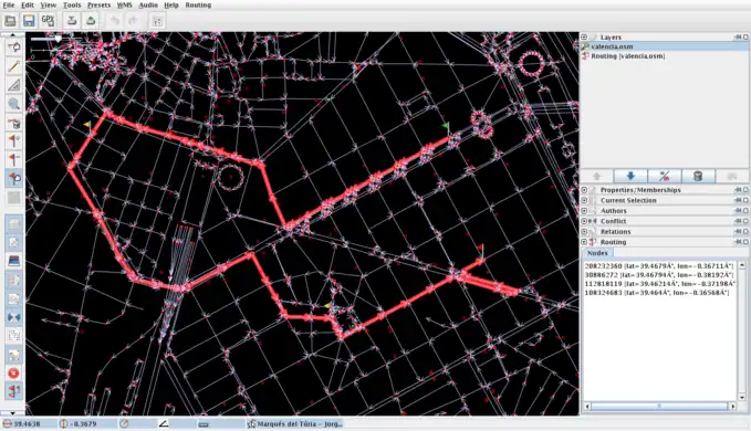
Computer Science students at the University of Maryland have created a pedestrian routing map based on OpenStreetMap data. Support is even included for wheel friendly routing, and avoiding certain areas.
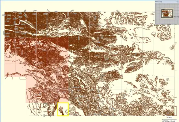
GroundTruth-generated relief contours map for Garmin GPS units. The elevation data source is SRTM. This is a MapSource screenshot of map tiles. See here for more info.
The building and open space layers from MassGIS for large swathes of Massachusetts have been imported thanks to effort by User:crschmidt and others in the region. [1]
Week 19 (4–10 May2025-05-04–Error: Invalid time.)
English
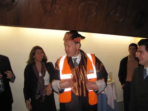
Sir Tim Berners-Lee recently received both a doctor honoris causa award (for his outstanding contributions to the WWW [2][3]) and a hi-viz vest (for his outstanding mentions of OSM [4])
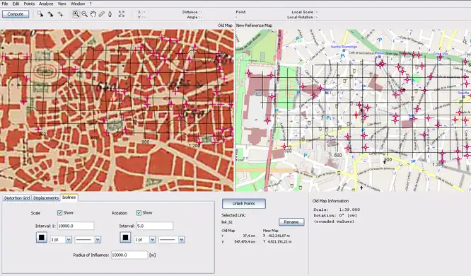
MapAnalyst is an open source tool for distortion analysis in old maps, that uses OSM as a the default reference cartography. (Shown here: 1:50k map of Madrid dated from 1875)
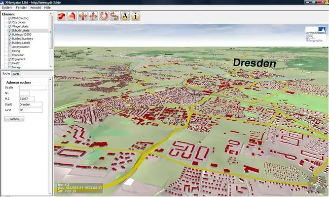
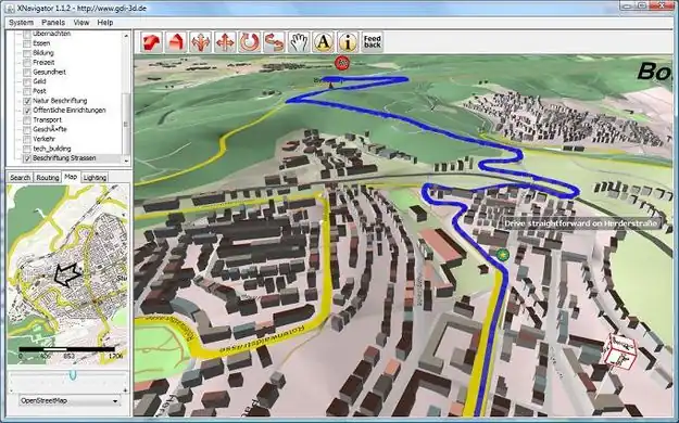
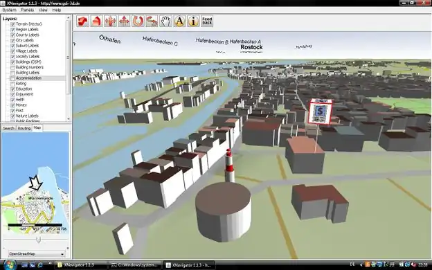
Rostock-3D – 3D city model in OSM, with all buildings and correct building heights.
Week 44 (26 Oct – 1 Nov2025-10-26–Error: Invalid time.)
English
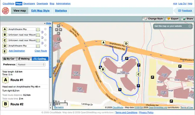
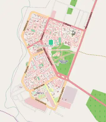
Kuznetsovsk is a small city in Western Ukraine, with population of 40100 citizens. It is known for two reasons: there is a nuclear power station nearby and most of the CloudMade test team members are from there.