Pt:Key:cycleway
 |
| Descrição |
|---|
| A marca ciclovia usada para descrever as características de uma ciclovia. |
| Grupo: ciclovia |
| Usado nos elementos |
| Sugere |
| Ver também |
| Situação: de facto |
| Ferramentas |
Ciclovia
| Tag | Element | Comentario | Foto | |||
|---|---|---|---|---|---|---|
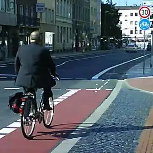
Dedicated bicycle lanes | ||||||
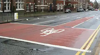
| lane | A lane é uma rota que se encontra dentro da pista | _-_geograph.org.uk_-_4129897.jpg) | ||||
|
| ||||||
| shared_lane | Cyclists share a lane with motor vehicles, and there are markings (like The road markings are usually there to highlight a cycle route or to remind drivers that you can cycle there. |
 | ||||
| share_busway | A special lane reserved for public transport on which cyclists are also allowed to bike. | 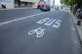 | ||||
Bicycle tracks | ||||||
| track | A trilha é uma rota que é separado da estrada.+oneway=yes, se necessário | 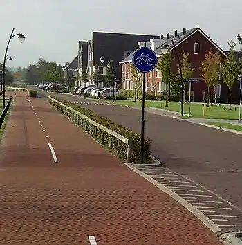 | ||||
| separate | Should be used to indicate that a cycle track associated with a highway has been mapped as a separate OSM element (i.e., is tagged with highway=cycleway). Meaning is similar to the use of sidewalk=separate for footways, and can potentially be used when simplifying geometries for rendering. It also acts as a hint to avoid duplicating an existing cycleway by adding =track to a highway. Don't confuse with segregated=yes.
|
|||||
No bicycle infrastructure | ||||||
| no | Explicitly marks that a street has no bicycle infrastructure. This allows to explicitly note that the road was surveyed for bicycle infrastructure. | 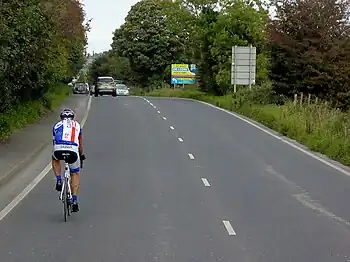 | ||||
Other bicycle infrastructure | ||||||
| crossing | Used on separately mapped paths to indicate that it's a bicycle crossing. | 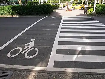 | ||||
| shoulder | Used to indicate that a road has no designated infrastructure for cyclists, but shoulders (a.k.a. breakdown lanes) are navigable and legal to cycle on. Especially on rural roads with high speed limits, the existence of a shoulder usable by cyclists can make the difference whether the road is usable at all (semi-)safely for cyclists. Not every shoulder=* is automatically usable for cyclists: Some shoulders are used for parking (parking=shoulder) instead, not all shoulders are paved (with asphalt, e.g. grass pavers). Additionally, shoulder=yes is typically only mapped for shoulders that are broad enough to accommodate a car. For cyclists however, a less wide shoulder is fine, too.
|
 | ||||
| link | A connector between OSM segments for cycle traffic, for example to connect a separately mapped cycle path to a junction on the opposite side. Serves primarily as a routing aid and does not necessarily have to be identifiable as built infrastructure. | 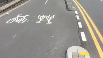 | ||||
| traffic_island | Used on the parts of refugee islands of a =crossing.
|
 | ||||
| asl | Indicates an advanced stop line or bike box at junctions. Use =asl on a direction=forward or direction=backward for an explicitly reference to the closest junction that a ASL relates to and thus the direction of traffic that it applies to.
|
 | ||||
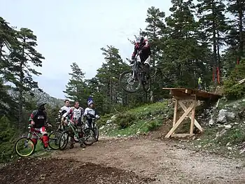
| gap_jump | A gap jump segment of MTB downhill route. Generally would consist of two or three parts: a take-off ramp; a physically non-existent mid-air segment; and optionally a landing ramp (if not present, a regular bike track serves as a landing zone). The mid-air segment may cross other roads or features, in which case it should be tagged with layer=1 without a node at the intersection; surface=none has occasionally been added as well. Consider explicitly providing foot=no or access=no + bicycle=designated in order to prevent routing for any other activity.
|
 | ||||
Deprecated or discouraged tags | ||||||
| Utilizadas em formas com oneway=yes, onde é permitido ciclo em ambos os sentidos.
Nota - tais ruas são comuns na Bélgica, Holanda e Dinamarca, por exemplo, mas são raros no Reino Unido (embora elas existam): muitas vezes, em vez disso, na verdade, a rua é de mão dupla normal para toda a sua extensão, exceto para o troço muito curto após a nenhum sinal de entrada, no final, onde os ciclos são isentos das não-entrada por meio de uma pista curta separados por uma ilha. Isso é chamado de "plug ciclo". Em alguns lugares isto tem sido representado como Caminho oneway muito curto no final com uma ciclovia adjacente, formando um pequeno triângulo com a estrada, eles se juntam, ou às vezes com um curto caminho de mão única com cycleway=opposite_lane ou opposite_track | ||||||
Formerly used on cycleways which were mapped as separate ways tagged as highway=cycleway before the segregated=* tag was formalized. Its use with highway=cycleway is now considered obsolete.
| ||||||
This table is a wiki template with a default description in English. Editable here.
| ||||||||||||||||||||||||||||||