Tag:historic=citywalls
 |
| Description |
|---|
| A citywall is a fortification used to defend a city. |
| Rendering in OSM Carto |

|
| Group: historic |
| Used on these elements |
| Useful combination |
| See also |
| Status: de facto |
| Tools for this tag |
|
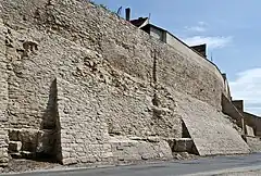
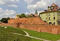
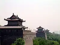
A citywall is a fortification used to defend a city or settlement from potential aggressors. In ancient to modern times, they were used to enclose settlements. Note that barrier=city_wall also exists.
Walls that are still standing and in good shape probably qualify for both barrier=city_wall and historic=, in that case historic=* is obvious as all city walls are nowadays historic.
Note that existing city walls that are ruined, maybe with only foundations remaining may no longer qualify as barrier=city_wall but are still historic=.
How to map
Draw a way ![]() along the citywall.
along the citywall.
Example
- Citywall Prenzlau
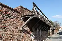
| Photo | Tags | OSM Carto | Historical map |
|---|---|---|---|

|
historic=
|
 (c) OpenStreetMap-contributors Historic.Place |
Images
Possible tagging mistakes
External links
Defensive_wall on Wikipedia