Tag:place=state
 |
| Description |
|---|
| A large sub-national political/administrative area. |
| Group: places |
| Used on these elements |
| Useful combination |
|
| See also |
| Status: in use |
| Tools for this tag |
|
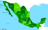
place= - a high-level sub-national political entity (![]() Federated state) in several large countries such as USA ("State"), Australia ("State"), Mexico ("State"), Canada ("Province").
Federated state) in several large countries such as USA ("State"), Australia ("State"), Mexico ("State"), Canada ("Province").
May also be applicable in other countries and languages (e.g. "Provincia", "Estado", "Land"). place=province is an alternative option and is currently in use in a few countries - the choice of which to use is at your discretion and that of mappers in your respective country.
How to map
Add the place= to the appropriate the area or node and name it using name=<Name of State>. Place the node on a neutral spot (preferably public land), to prevent drawing attention to private properties or their owners.
If mapping as a node, you might also want to add other useful information such as name in other languages, abbreviation, if any, and what the approximate population is population=*.
If a place node is a ![]() label
labelboundary=administrative relation, tag the relation with border_type=state, province, etc. depending on the administrative area's official designation.
Example
place=
name=Ontario
name:en=Province of Ontario
name:fr=Province de Ontario
ref=ON
state_code=ON
population=13425124