Key:manhole
 |
| Description |
|---|
| Hole with a cover that allows access to an underground service location, just large enough for a human to climb through. |
| Group: man made |
| Used on these elements |
| Documented values: 2 |
| Requires |
| Useful combination |
| See also |
|
| Status: de facto |
| Tools for this tag |
|
Hole with a cover that allows access to an underground service location, just large enough for a human to climb through.
This tag indicates the type or use of a man_made=manhole.
Where the pipeline it connects to has not yet been discovered, it can be beneficial to future mappers to mark the locations of manholes for later use.
Values
=* can take any values, but the following are the first set in use
- plain:
 manhole covers with no markings at all available
 - unknown: manhole cover with unknown markings, or of unknown use. Combine with
label=*when possible for later identification. - water: maintenance access to clean water pipelines (see also
utility=water) - rainwater: maintenance access to rainwater pipelines (consider using drain)
- sewer: maintenance access to pipelines carrying wastewater (sewage, see also
utility=sewerage) - drain: surface water drain for removing rainwater
- heat: district heating maintenance holes (see also
utility=heating) - cold: district cooling maintenance holes
- gas: maintenance access to gas transport pipelines (see also
utility=gas) - telecom: maintenance access to pipelines containing telecommunication cables (see also
utility=telecom) - power: access to underground electricity wires (see also
utility=power) - other: all you can think of
How to Map
It may be useful to document the shape of the cover with shape=*, and additionally the dimensions with width=*, length=* or diameter=*. material=* and colour=* can also be used.
If the cover is not made of a single material, but instead is covered in the same way as the surrounding surface, the values from the surface=* tag can be used inside of the material=* key (e.g. material=paving_stones). The additional details that follow that tagging scheme can also be used (e.g. paving_stones:pattern=*), however colour=* should be used instead of surface:colour=* (see above).
Manholes occasionally act as an inlet to some piece of liquids infrastructure (e.g. =drain), in these cases, it is recommended to also tag the object with the corresponding inlet=* value, where appropriate.
Tips on surveying
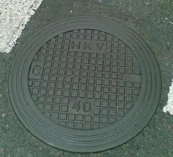
Often the manhole covers themselves don't feature a description of what's below, but you'll find a marker on a nearby wall, or on a dedicated stick or ventilation shaft. On such markers you might be able to read the distance to the manhole along with a diameter of the pipeline and/or an indicator of pipeline contents; some markers feature a number suitable for the tag ref=*.
When the cast iron covers themselves read "40" or "25", it's usually just a maximum weight restriction (in tonnes).
Incorrect use on a covered gutter
Although it may seem tempting, this tag is not to be used on long covered gutters that also act as a drain. It should only be used on manhole cover ![]() nodes. No consensus has been made on how to tag this feature but there has been some discussion on the Key:inlet talk page.
nodes. No consensus has been made on how to tag this feature but there has been some discussion on the Key:inlet talk page.