Week 1
(30 Dec. – 5 Jan.)
|

|
|
Week 2
(6–12 Jan2025-01-06–Error: Invalid time.)
|

|
| English
|
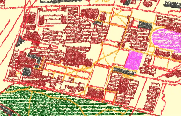
In the last few weeks the German postal code areas were consolidated and checked: Before (left map) some postalcodes were tagged on admin boundary relations and duplicates existed. After (right map) all 8201 postalcode areas in Germany have their own postal_code relation. See the project page (in German).
|

|
|
Week 3
(13–19 Jan2025-01-13–Error: Invalid time.)
|

|
| English
|
A car dashboard kitted out with gadgets. This is just one of a wide variety of mapping techniques. Visible here (left to right): A smartphone running OsmAnd (information and map display) and a tablet computer set up with OSMtracker (POI recording).
|
|
|
Week 4
(20–26 Jan2025-01-20–Error: Invalid time.)
|
|
| English
|
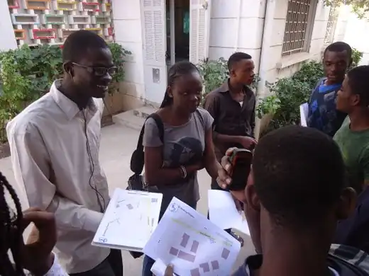
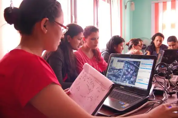
The OpenSteetMap community in Senegal is growingǃ A lot of activities, training and presentations are happening these days. This photo shows architecture students during a surveying training session with Walking Papers printouts and GPS devices in Dakar.
|
|
|
Week 5
(27 Jan – 2 Feb2025-01-27–Error: Invalid time.)
|
|
| English
|
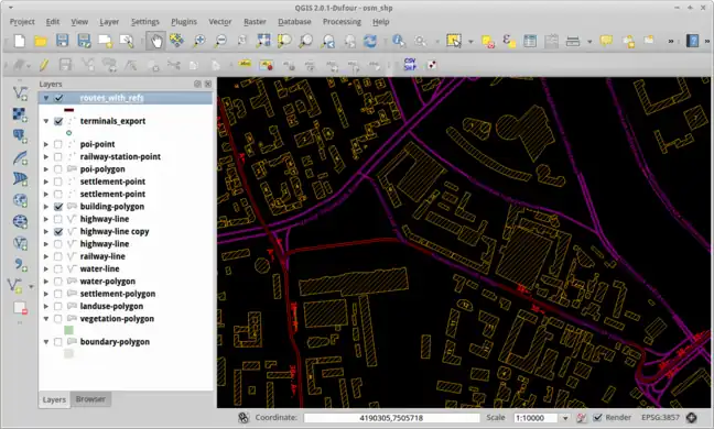
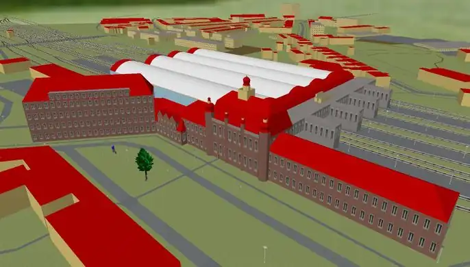
Viewing OpenStreetMap buildings and tram data within the open source QGIS software.
|
|
|
Week 6
(3–9 Feb2025-02-03–Error: Invalid time.)
|
|
|
Week 7
(10–16 Feb2025-02-10–Error: Invalid time.)
|
|
| English
|
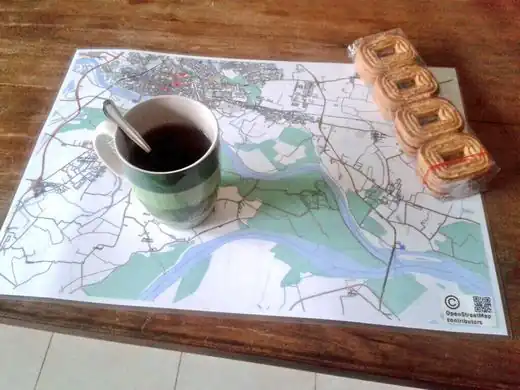
A map of Pavia in Italy, rendered in high resolution using Maperitive, printed, laminated and used as a personal breakfast mat
|
|
|
Week 8
(17–23 Feb2025-02-17–Error: Invalid time.)
|
|
|
Week 9
(24 Feb – 2 Mar2025-02-24–Error: Invalid time.)
|
|
| English
|
Forty people gathered for an event in Managua, Nicaragua, working on improving the OSM data including public transportation, neighbourhoods and important POIs
|
|
|
Week 10
(3–9 Mar2025-03-03–Error: Invalid time.)
|

|
| English
|
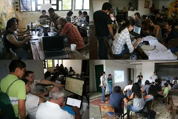
1st “OpenStreetMap Workshop from scratch” – a free and open event that brought together artists, cartographers, marketing companies and territorial planning/computer science students as part of the activities of the HackLabCocha in Cochabamba, Bolivia. View the full set of photos.
|
|
|
Week 11
(10–16 Mar2025-03-10–Error: Invalid time.)
|
|
| English
|
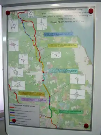
A map of the “Sortavala” highway in Russia, on display at the road construction company offices. This poster has an OSM base map, and also inset details of road junctions based on the OpenStreetMap contributors data.
|
|
|
Week 12
(17–23 Mar2025-03-17–Error: Invalid time.)
|
|
|
Week 13
(24–30 Mar2025-03-24–Error: Invalid time.)
|
|
| English
|
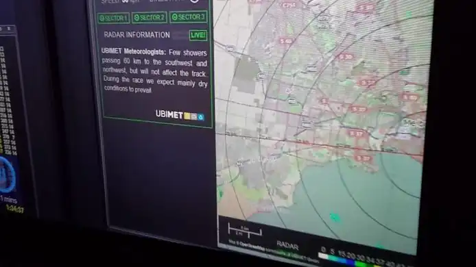
OSM used as a backdrop on the weather radar for the Formula One Grand Prix at Melbourne. (TV photo)
|
|
|
Week 14
(31 Mar – 6 Apr2025-03-31–Error: Invalid time.)
|

|
|
Week 15
(7–13 Apr2025-04-07–Error: Invalid time.)
|
|
| English
|
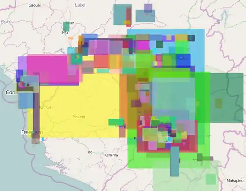
HOT is coordinating mapping efforts for the Ebola outbreak in West Africa.
The map shows all changesets with #HOT in and around Guinea. The tool visualises changesets of the last seven days with a certain comment.
|
|
|
Week 16
(14–20 Apr2025-04-14–Error: Invalid time.)
|

|
|
Week 17
(21–27 Apr2025-04-21–Error: Invalid time.)
|
|
|
Week 18
(28 Apr – 4 May2025-04-28–Error: Invalid time.)
|
|
|
Week 19
(5–11 May2025-05-05–Error: Invalid time.)
|
|
|
Week 20
(12–18 May2025-05-12–Error: Invalid time.)
|
|
|
Week 21
(19–25 May2025-05-19–Error: Invalid time.)
|
|
| English
|
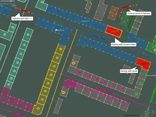
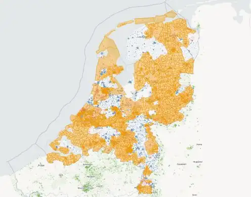
For the past few months the community in the Netherlands have been carrying out a manual merging BAGimport of open address and buildings data, using a special JOSM import plugin (dutch), and this site to monitor the progress uploading areas of data
|
|
|
Week 22
(26 May – 1 Jun2025-05-26–Error: Invalid time.)
|
|
| English
|
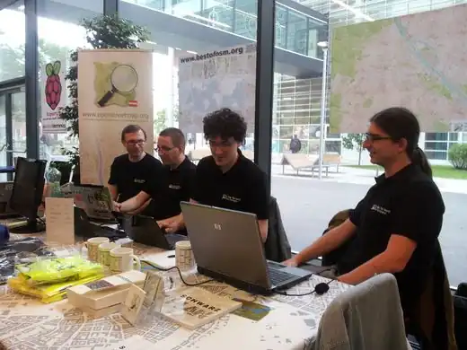
Austrian OpenStreetMappers at Linuxwochen 2014 in Vienna, offering T-shirts, tablecloths, posters, books, cups, and notebooks!
|
|
|
Week 23
(2–8 Jun2025-06-02–Error: Invalid time.)
|

|
| English
|
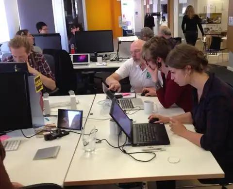
Trying out the iD editor for the first time. Sixteen test subjects went through the process and gave their feedback as part of a "Civic User Testing Group" event in Chicago
|
|
|
Week 24
(9–15 Jun2025-06-09–Error: Invalid time.)
|
|
| English
|
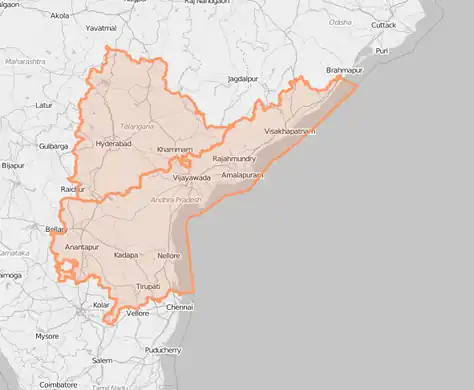
The new Indian state of Telangana which was created by an order of the Indian government, has been incorporated into the map by OpenStreetMap volunteers. Telangana was created by partitioning the state of Andhra Pradesh into two. Read more on dalek2point3's diary
|
|
|
Week 25
(16–22 Jun2025-06-16–Error: Invalid time.)
|

|
|
Week 26
(23–29 Jun2025-06-23–Error: Invalid time.)
|

|
| English
|
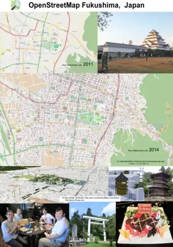
This event in Natori, Japan, was an OpenStreetMap mapping party as part of a LocalWiki initiative to describe city neighbourhoods, and promote community building in an area struck by the 2011 tsunami. Read more on the localwiki blog
|
|
|
Week 27
(30 Jun – 6 Jul2025-06-30–Error: Invalid time.)
|
|
|
Week 28
(7–13 Jul2025-07-07–Error: Invalid time.)
|

|
|
Week 29
(14–20 Jul2025-07-14–Error: Invalid time.)
|
|
| English
|
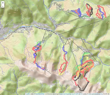
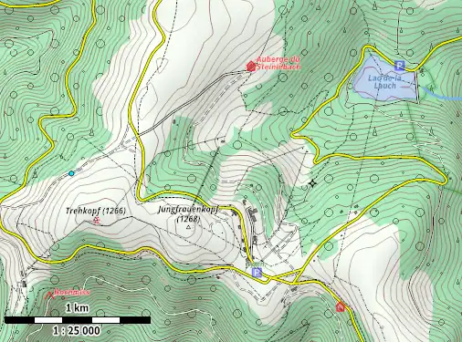
A sample area rendered in the R25 Maperitive style, which was designed by User:JBacc. It works best rendering hi resolution paper maps at approximately 1:25000 map scale, as he demonstrated with his entry coming 2nd place in the SOTMEU poster competition
|
|
|
Week 30
(21–27 Jul2025-07-21–Error: Invalid time.)
|

|
| English
|
3D printed model of the Gorbals, Glasgow, location of the Commonwealth games 2014. Created using osm2world to convert from .osm to 3D and SRTM elevation data. Printed using a Ultimaker 2.
|
|
|
Week 31
(28 Jul – 3 Aug2025-07-28–Error: Invalid time.)
|
|
|
Week 32
(4–10 Aug2025-08-04–Error: Invalid time.)
|

|
| English
|
Mapping for fun, and to help with humanitarian aid at the Missing Maps Party in London last week
|
|
|
Week 33
(11–17 Aug2025-08-11–Error: Invalid time.)
|

|
| English
|
Last weekend we celebrated OpenStreetMap's 10th Birthday in cities all around the world, and (as is now traditional) we had birthday cakes at many of the party locations, such as this one in Passau, Germany
|
|
|
Week 34
(18–24 Aug2025-08-18–Error: Invalid time.)
|
|
| English
|
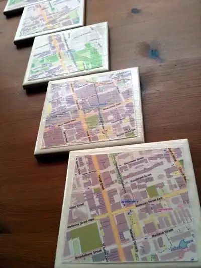
Cake is good. And so are map tiles. Toronto mappers made coasters from maps and ceramic tiles. The coasters safely supported the beverages consumed at the Toronto 10th OSM Birthday celebration, and then attendees were each able to take home the commemorative coasters in addition to the ones that they made.
|
|
|
Week 35
(25–31 Aug2025-08-25–Error: Invalid time.)
|
|
| English
|
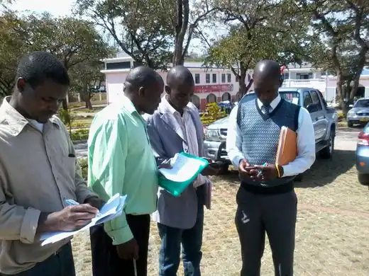
Malawi government officials learning how to create maps with OpenStreetMap. The Humanitarian OpenStreetMap Team have sent a field team to Malawi to run training courses in mapping techniques and also integrating OpenStreetMap into their open GIS data portal. Read more on the HOT blog
|
|
|
Week 36
(1–7 Sep2025-09-01–Error: Invalid time.)
|
|
| English
|
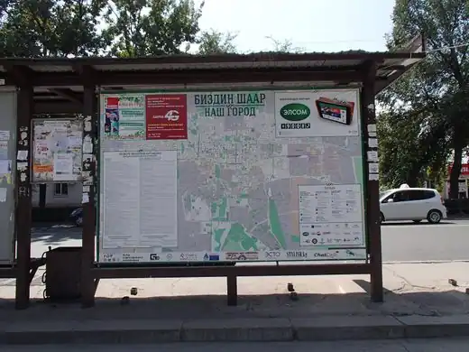
Printed street maps from OpenStreetMap seen in several bus stops around Bishkek, the capital of Kyrgyzstan
|
|
|
Week 37
(8–14 Sep2025-09-08–Error: Invalid time.)
|
|
|
Week 38
(15–21 Sep2025-09-15–Error: Invalid time.)
|
|
| English
|
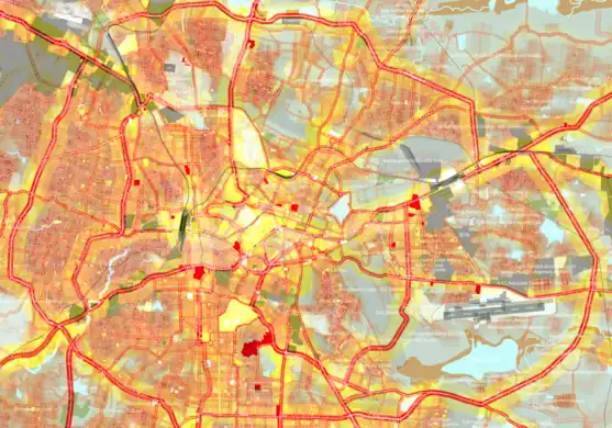
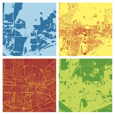
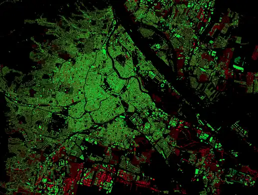
A striking dark-background rendering of OpenStreetMap building coverage (green) and those which are missing (red) as compared to basemap.at data in Austria. Blog post and slippy map
|
|
|
Week 39
(22–28 Sep2025-09-22–Error: Invalid time.)
|
|
|
Week 40
(29 Sep – 5 Oct2025-09-29–Error: Invalid time.)
|

|
| English
|
This advertisement on the side of a tram in Toronto features a large map from OpenStreetMap! Commercial use of OpenStreetMap is allowed and encouraged (when people follow the copyright instructions correctly like this) and we love to see our maps appearing in interesting places.
|
|
|
Week 41
(6–12 Oct2025-10-06–Error: Invalid time.)
|

|
|
Week 42
(13–19 Oct2025-10-13–Error: Invalid time.)
|
|
| English
|
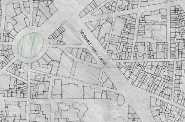
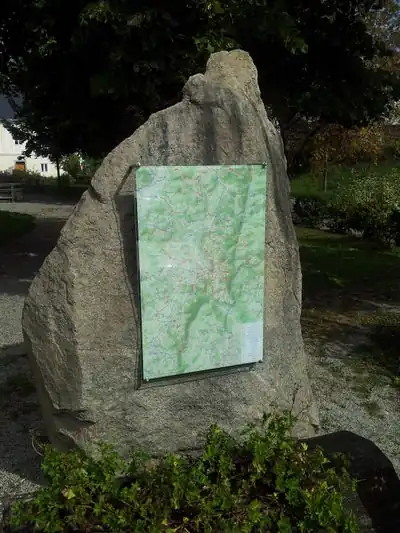
A walking map display board mounted on a rock. Holger Schöner has produced hiking and cycling maps in various forms around the area of Gutau (a small village in Upper Austria) Read more (in German)
|
|
|
Week 43
(20–26 Oct2025-10-20–Error: Invalid time.)
|
|
| English
|
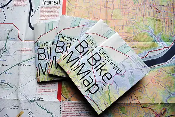
This month, Nate Wessel published a full-color cycle map of Cincinnati, Ohio, United States, based on OpenStreetMap data. A print run of 9,000 is being distributed locally. Unlike many urban cycle maps, which highlight a curated selection of "preferred" routes for cyclists, the Cincinnati Bike Map indicates road conditions for all roads.
|
|
|
Week 44
(27 Oct – 2 Nov2025-10-27–Error: Invalid time.)
|

|
| English
|
OpenStreetMap mappers from Togo, Senegal, Burkina Faso, Niger, Côte d'Ivoire and Benin, meeting in Lomé. International Organisation internationale de la Francophonie (OIF) is promoting OpenStreetMap in Africa, particularly in the french speaking countries
|
|
|
Week 45
(3–9 Nov2025-11-03–Error: Invalid time.)
|

|
| English
|
A first meeting in Quito, Ecuador to strengthen the Ecuadorian OpenStreetMap Community and to promote and disseminate the use of free geographic data in the country. The meeting was organized by the Community of Free Software and Computer Security Hackem in the "Escuela Politécnica Nacional".
|
|
|
Week 46
(10–16 Nov2025-11-10–Error: Invalid time.)
|

|
|
Week 47
(17–23 Nov2025-11-17–Error: Invalid time.)
|

|
| English
|
Thanks to the more than 2,000 mappers who made more than 10,000,000 map-changes in the ebola area since March! The changes are visualized on a map from Pascal Neis. In a blog post he presents more information about the involved contributors.
See the current HOT tasks.
|
|
|
Week 48
(24–30 Nov2025-11-24–Error: Invalid time.)
|

|
| English
|
mapisart.com allows users to create lamps, coasters, clocks, trays, prints and wall canvases with OpenStreetMap data.
|
|
|
Week 49
(1–7 Dec2025-12-01–Error: Invalid time.)
|
|
| English
|
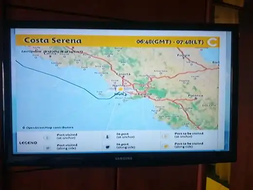
On Costa cruises, passengers can visualise the progress of the ships on many screens (inside the cabin, on interactive screens) featuring maps from OpenStreetMap
|
|
|
Week 50
(8–14 Dec2025-12-08–Error: Invalid time.)
|

|
| English
|
Mapping curiosities: This butterfly, or perhaps an angel, emerged on the map while mapping water wells in Niger.(see it here on the map)
|
|
|
Week 51
(15–21 Dec2025-12-15–Error: Invalid time.)
|
|
|
Week 52
(22–28 Dec.)
|

|
|
