MUTCD/California/G
< MUTCD | California
Series G of the CA MUTCD is for guide signs. The following tables display only the signs specific to the CA MUTCD in California; consult MUTCD/D for destination and distance signs in the national standard.
G1: Destination
| Sign or plaque | Designation | Name | Tags | Notes |
|---|---|---|---|---|
| File:MUTCD-CA G1-1.svg | G1-1 | Destination | destination=Redlands aheaddestination=Redlands distance=30 mi on the traffic sign node
| |
| File:MUTCD-CA G1-4.svg | G1-4 | Destination | destination=Redlands;Stockton aheaddestination=Redlands;Stockton distance=2 mi;5 mi on the traffic sign node
| |
| File:MUTCD-CA G1-7.svg | G1-7 | Destination | destination=Salinas aheaddestination=Redlands on the cross street to the rightdestination=Salinas;Redlands distance=50 mi;30 mi on the traffic sign node
| |
| File:MUTCD-CA G1-10.svg | G1-10 | Destination | destination=Salinas aheaddestination=Roseville;Sacramento on the cross street to the rightdestination=Salinas;Roseville;Sacramento distance=50 mi;5 mi;23 mi on the traffic sign node
| |
| File:MUTCD-CA G1-13.svg | G1-13 | Destination | destination=Redlands;Stockton aheaddestination=Orange on the cross street to the rightdestination=Redlands;Stockton;Orange distance=2 mi;5 mi;13 mi on the traffic sign node
| |
| File:MUTCD-CA G1-16.svg | G1-16 | Destination | destination=Mariposa aheaddestination=Fresno on the cross street to the leftdestination=Stockton on the cross street or ramp to the rightdestination=Mariposa;Fresno;Stockton distance=20 mi;25 mi;35 mi on the traffic sign node
| |
| File:MUTCD-CA G1-19.svg | G1-19 | Destination | destination=Mariposa;Fresno;Stockton on the cross street or ramp to the rightdestination=Mariposa;Fresno;Stockton distance=20 mi;25 mi;35 mi on the traffic sign node
|
G5: Distance
| Sign or plaque | Designation | Name | Tags | Notes |
|---|---|---|---|---|
| File:MUTCD-CA G5.svg | G5 | Distance | destination=Roseville;Sacramento;Oakland distance=5 mi;23 mi;110 mi on the traffic sign node
|
G7: Street Name
| Sign or plaque | Designation | Name | Tags | Notes |
|---|---|---|---|---|
| G7-1 | Street Name | name=Main Street on the cross street
| ||
| G7-2 | Advance Street Name | name=Main Street on the cross street
|
G8: Destination & Street Name with Arrow
| Sign or plaque | Designation | Name | Tags | Notes |
|---|---|---|---|---|
| File:MUTCD-CA G8-1.svg | G8-1 | Destination & Street Name with Arrow | destination=Redlands on the cross street to the right
| |
| File:MUTCD-CA G8-4.svg | G8-4 | Destination & Street Name with Arrow | destination=Chico;Oroville on the cross street to the right
| |
| File:MUTCD-CA G8-7.svg | G8-7 | Destination & Street Name with Arrow | destination=Oroville aheaddestination=Chico on the cross street to the right
| |
| File:MUTCD-CA G8-10.svg | G8-10 | Destination & Street Name with Arrow | destination=Salinas aheaddestination=Roseville;Sacramento on the cross street to the right
| |
| File:MUTCD-CA G8-13.svg | G8-13 | Destination & Street Name with Arrow | destination=Redlands;Stockton aheaddestination=Orange on the cross street to the right
| |
| G8-16 | Destination & Street Name with Arrow | destination=Mariposa aheaddestination=Fresno on the cross street to the leftdestination=Stockton on the cross street to the right
| ||
| File:MUTCD-CA G8-19.svg | G8-19 | Destination & Street Name with Arrow | destination=Mariposa;Fresno;Stockton on the cross street to the right
| |
| File:MUTCD-CA G8-22.svg | G8-22 | Destination & Street Name with Arrow | name=Fairview Road on the cross street to the right or destination=Fairview Road on the ramp to the right
|
G9: City Limit
| Sign or plaque | Designation | Name | Tags | Notes |
|---|---|---|---|---|
| File:MUTCD-CA G9-1.svg | G9-1 | Population/Elevation Overlay plate | population=*
| |
| File:MUTCD-CA G9-2.svg | G9-2 | Unincorporated Community | place=village name=Soda Springs population=487 ele=2386'
| |
| File:MUTCD-CA G9-5.svg | G9-5 | City Limit | type=boundary boundary=administrative admin_level=8 border_type=city name=Cloverdale population=874 ele=40'place=village name=Cloverdale population=874 ele=40'
|
G10: County Line
| Sign or plaque | Designation | Name | Tags | Notes |
|---|---|---|---|---|
| File:MUTCD-CA G10.svg | G10 | County Line | type=boundary boundary=administrative admin_level=6 border_type=county name=Kern County
| |
| G10-3 | County Line Sign | type=boundary boundary=administrative admin_level=6 border_type=county name=Kern Countyname=Kern County strapline=Where We Honor Veterans on the traffic sign node
| ||
| File:MUTCD-CA G10-4.svg | G10-4 | Where We Honor Veterans | strapline=Where We Honor Veterans on the traffic sign node
| |
| G10B | Welcome To California | type=boundary boundary=administrative admin_level=4 border_type=state name=California
|
G11: Inventory Marker
| Sign or plaque | Designation | Name | Tags | Notes |
|---|---|---|---|---|
| File:MUTCD-CA G11-1.svg | G11-1 | Inventory Marker | waterway=river name=Cuyama River belowman_made=bridge name=Cuyama River ref=53-52highway=* bridge=yes ref=US 101 bridge:name=Cuyama River bridge:ref=53-52highway=milestone marker=* route_ref=US 101 is_in:county=Orange distance=144.44 mi distance:postmile=R144.44 |
Speculative |
| File:MUTCD-CA G11-2.svg | G11-2 | Inventory Marker | waterway=river name=Cuyama River belowman_made=bridge name=Cuyama River Overcrossing ref=22-04highway=* bridge=yes bridge:name=Cuyama River Overcrossing bridge:ref=22-04
| |
| G11-4.1 | Inventory Marker | name=Ventura Boulevard on the street belowman_made=bridge name=Ventura Boulevard Overhead ref=00 0000highway=* bridge=yes ref=I 405 bridge:name=Ventura Boulevard Overhead bridge:ref=00 0000highway=milestone marker=* route_ref=I 405 is_in:county=Los Angeles distance=32.46 mi distance:postmile=R32.46 |
Speculative | |
| File:MUTCD-CA G11-4A.svg | G11-4A | Memorial Bridge | man_made=bridge name=George F. Butler Memorial Bridge name:etymology=George F. Butlerhighway=* bridge=yes bridge:name=George F. Butler Memorial Bridge
| |
| File:MUTCD-CA G11-4B.svg | G11-4B | Memorial Bridge | man_made=bridge name=Armed Forces of Mendocino County Memorial Bridgehighway=* bridge=yes bridge:name=Armed Forces of Mendocino County Memorial Bridge
| |
| File:MUTCD-CA G11-5.svg | G11-5 | Inventory Marker | waterway=river name=North Fork Kings River belowman_made=bridge name=North Fork Kings River ref=6-152highway=* bridge=yes ref=US 101 bridge:name=North Fork Kings River bridge:ref=6-152highway=milestone marker=* route_ref=US 101 is_in:county=Humboldt distance=144.44 mi distance:postmile=R144.44 |
Speculative |
| G11-6 | Inventory Marker | highway=milestone marker=* route_ref=US 101 is_in:county=Humboldt distance=144.44 mi distance:postmile=R144.44 |
Speculative | |
| File:MUTCD-CA G11-7.svg | G11-7 | Inventory Marker | highway=milestone marker=* route_ref=US 101 is_in:county=Humboldt distance=144.44 mi distance:postmile=R144.44/XX |
Speculative |
| File:MUTCD-CA G11-8.svg | G11-8 | Memorial Bridge | waterway=river name=Napa River belowman_made=bridge name=George F. Butler Memorial Bridge name:etymology=George F. Butler alt_name=Napa River ref=21-49highway=* bridge=yes ref=CA 29 bridge:name=George F. Butler Memorial Bridge bridge:ref=21-49highway=milestone marker=* route_ref=CA 29 is_in:county=Napa distance=6.99 mi distance:postmile=R6.99 |
Speculative |
| File:MUTCD-CA G11-9.svg | G11-9 | Memorial Bridge | waterway=river name=Navarro River belowman_made=bridge name=Armed Forces of Mendocino County Memorial Bridge alt_name=Navarro River ref=10-130highway=* bridge=yes ref=CA 1 bridge:name=Armed Forces of Mendocino County Memorial Bridge bridge:ref=10-130highway=milestone marker=* route_ref=CA 1 is_in:county=Mendocino distance=40.27 mi distance:postmile=R40.27 |
Speculative |
| File:MUTCD-CA G11-10.svg | G11-10 | Inventory Marker | highway=milestone marker=* route_ref=US 101 is_in:county=Humboldt distance=144.44 mi distance:postmile=R144.44type=boundary boundary=protected_area protect_class=* |
Speculative |
G12: Memorial Sign
| Sign or plaque | Designation | Name | Tags | Notes |
|---|---|---|---|---|
| File:MUTCD-CA G12-1.svg | G12-1 | Memorial Sign (1-Line) | man_made=tunnel name=Joe Smith Tunnel name:etymology=Joe Smithhighway=* tunnel=yes tunnel:name=Joe Smith Tunnel
| |
| File:MUTCD-CA G12-2.svg | G12-2 | Memorial Sign (2-Line) | highway=* official_name=CHP Officer Joe Smith Memorial Highway official_name:etymology=Joe Smith
| |
| G12-3 | Memorial Bikeway | highway=cycleway official_name=Joe Smith Memorial Highway official_name:etymology=Joe Smith
|
G13: Historical Landmark
| Sign or plaque | Designation | Name | Tags | Notes |
|---|---|---|---|---|

|
G13-1 | Historical Landmark | historic=heritage heritage=2 name=Mission Santa Cruz heritage:operator=chisl heritage:operator:wikidata=Q2933979 heritage:ref=342 ref:chisl=342 2 miles to the right
| |
| File:MUTCD-CA G13-2.svg | G13-2 | Historical Landmark | historic=heritage heritage=2 name=Mission Santa Cruz heritage:operator=chisl heritage:operator:wikidata=Q2933979 heritage:ref=342 ref:chisl=342 down the road from the next right
|
G14: Advance Historical Landmark
| Sign or plaque | Designation | Name | Tags | Notes |
|---|---|---|---|---|

|
G14 | Advance Historical Landmark | historic=memorial memorial=plaque or tourism=information information=board board_type=history with name=Lang subject=* ref:chisl=342 500 feet ahead
|
G15: Point of Historical Interest
| Sign or plaque | Designation | Name | Tags | Notes |
|---|---|---|---|---|
| G15 | Point of Historical Interest | historic=heritage heritage=4 heritage:operator=cphi heritage:operator:wikidata=Q16152996
|
G16: Mountain Pass Elevation
| Sign or plaque | Designation | Name | Tags | Notes |
|---|---|---|---|---|
| G16 | Mountain Pass Elevation | mountain_pass=yes name=Donner Pass ele=7135'natural=saddle name=Donner Pass
|
G17: Elevation
| Sign or plaque | Designation | Name | Tags | Notes |
|---|---|---|---|---|
| File:MUTCD-CA G17.svg | G17 | Elevation | ele=3000'
|
G20: Advance Lane Assignment
| Sign or plaque | Designation | Name | Tags | Notes |
|---|---|---|---|---|
| File:MUTCD-CA G20-1.svg | G20-1 | Advance Lane Assignment | destination:lanes=|Sacramentodestination=Sacramento on the ramp to the right
| |
| G20-3 | Advance Lane Assignment | destination:lanes=|Marysville;Yuba Citydestination=Marysville;Yuba City on the ramp to the right
| ||
| File:MUTCD-CA G20-5.svg | G20-5 | Advance Lane Assignment | destination:lanes=|Fair View destination:ref:lanes=CA 12 Northdestination=Fair View destination:ref=CA 12 North on the ramp to the right
| |
| File:MUTCD-CA G20-7.svg | G20-7 | Advance Lane Assignment | destination:lanes=|Oakland;San Jose destination:ref:lanes=US 50destination=Oakland;San Jose destination:ref=US 50 on the ramp to the right
| |
| File:MUTCD-CA G20-9.svg | G20-9 | HOV Advance Lane Assignment | destination:ref:lanes=I 5 North hov=lane hov:lanes=|designateddestination:ref=I 5 North hov=designated on the ramp to the right
|
G21: Advance Lane Assignment
| Sign or plaque | Designation | Name | Tags | Notes |
|---|---|---|---|---|
| File:MUTCD-CA G21-1.svg | G21-1 | Advance Lane Assignment | destination:ref:lanes=CA 99 South|CA 99 Northdestination:ref=I 5 South on the ramp to the leftdestination:ref=I 5 North on the ramp to the right
| |

|
G21-3 | Advance Lane Assignment | destination:ref:lanes=CA 99 South|CA 99 Northdestination:ref=I 5 South on the ramp to the leftdestination:ref=I 5 North on the ramp to the right
|
G22: Advance Turn
| Sign or plaque | Designation | Name | Tags | Notes |
|---|---|---|---|---|
| File:MUTCD-CA G22.svg | G22 | Advance Turn | destination=Salinas on the cross street ¼ mile ahead
|
G23: Interchange Sequence
| Sign or plaque | Designation | Name | Tags | Notes |
|---|---|---|---|---|
| G23-1 | Interchange Sequence | destination=Santa Barbara Avenue;Vernon Avenue;51st Street distance=0.75 mi;1.5 mi;2.25 mi on the traffic sign node
| ||
| File:MUTCD-CA G23-2.svg | G23-2 | Interchange Sequence | destination=Santa Barbara Avenue;Vernon Avenue;51st Street destination:ref=CA 12 distance=0.75 mi;1.5 mi;2.25 mi on the traffic sign node |
How to indicate that SR 12 follows Santa Barbara Avenue? |
| G23-3 | Interchange Sequence | destination=Santa Barbara Avenue;Vernon Avenue;51st Street destination:ref=CA 12 distance=0.75 mi;1.5 mi;2.25 mi on the traffic sign node |
How to indicate that SR 12 follows Vernon Avenue? | |
| File:Caltrans G23-4.svg | G23-4 | Interchange Sequence | destination=Santa Barbara Avenue;Vernon Avenue;51st Street destination:ref=CA 12 distance=0.75 mi;1.5 mi;2.25 mi on the traffic sign node |
How to indicate that SR 12 follows 51st Street? |
| File:MUTCD-CA G23-5.svg | G23-5 | Interchange Sequence | destination=Santa Barbara Avenue;Vernon Avenue;51st Street;San Bernardino Avenue destination:ref=CA 12 distance=0.75 mi;1.5 mi;2.25 mi;2.25 mi on the traffic sign node |
How to indicate that SR 12 follows 51st Street? |
| File:MUTCD-CA G23-6.svg | G23-6 | Interchange Sequence | destination=Spring Street;Iowa Avenue;Maple Avenue distance=1 mi;2.25 mi;2.25 mi on the traffic sign node
|
G24: Pull-Through
| Sign or plaque | Designation | Name | Tags | Notes |
|---|---|---|---|---|
| File:MUTCD-CA G24-1.svg | G24-1 | Pull-Through | destination:lanes=San Bernardino| destination:ref:lanes=I 15|
| |
| File:MUTCD-CA G24-3.svg | G24-3 | Pull-Through | destination:lanes=Los Angeles;San Bernardino| destination:ref:lanes=I 10 East|
| |
| File:MUTCD-CA G24-4.svg | G24-4 | Pull-Through | destination:lanes=Riverside;Los Angeles| destination:ref:lanes=I 15;US 395|
| |
| File:MUTCD-CA G24-5.svg | G24-5 | Pull-Through | destination:lanes=|Riverside| destination:ref:lanes=|CA 60 East|
| |
| G24-6 | Pull-Through | destination:lanes=|Monterey;San Diego|Monterey;San Diego| destination:ref:lanes=|CA 1 South|CA 1 South|
|
G26: U.S. Route
| Sign or plaque | Designation | Name | Tags | Notes |
|---|---|---|---|---|
| G26-1 | U.S. Route Shield | destination:ref=US 395
| ||
.svg.png)
|
G26-2 | U.S. Route Marker | ref=US 395type=route route=road network=US:US ref=395 is_in:state=CA
|
G27: Interstate Route
| Sign or plaque | Designation | Name | Tags | Notes |
|---|---|---|---|---|
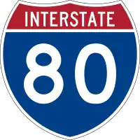
|
G27-1 | Interstate Route Shield | destination:ref=I 80
| |
.svg.png)
|
G27-2 | Interstate Route Marker | ref=I 80type=route route=road network=US:I ref=80 is_in:state=CA
|
G28: State Route
| Sign or plaque | Designation | Name | Tags | Notes |
|---|---|---|---|---|
| File:MUTCD-CA G28-1.svg | G28-1 | State Route Shield | destination:ref=CA *
| |

|
G28-2 | State Route Marker | ref=CA 1type=route route=road network=US:CA ref=1
|
G30: Scenic Route
| Sign or plaque | Designation | Name | Tags | Notes |
|---|---|---|---|---|
| G30 | Scenic Route | ref=CA * scenic=yes on the highway way
| ||
| G30A | Scenic Route | ref=CA * scenic=yes on the highway way
| ||

|
G30B | Scenic Route | ref=* scenic=yes on the highway way
| |
| G30C | Begin Plate | scenic=yes on the highway way
| ||
| G30D | End Plate | scenic=no on the highway way
|
G32: Directional Arrow Auxiliary
| Sign or plaque | Designation | Name | Tags | Notes |
|---|---|---|---|---|
| File:MUTCD-CA G32.svg | G32 | Directional Arrow Auxiliary | N/A |
G33: Directional Arrow Auxiliary
| Sign or plaque | Designation | Name | Tags | Notes |
|---|---|---|---|---|
| File:MUTCD-CA G33.svg | G33 | Directional Arrow Auxiliary | N/A | |
| File:MUTCD-CA G33-1.svg | G33-1 | Directional Arrow Auxiliary | N/A |
G34: Directional Arrow Auxiliary
| Sign or plaque | Designation | Name | Tags | Notes |
|---|---|---|---|---|
| G34 | Directional Arrow Auxiliary | N/A |
G35: Directional Arrow Auxiliary
| Sign or plaque | Designation | Name | Tags | Notes |
|---|---|---|---|---|
| G35 | Directional Arrow Auxiliary | N/A |
G36: Directional Arrow Auxiliary
| Sign or plaque | Designation | Name | Tags | Notes |
|---|---|---|---|---|
| G36 | Directional Arrow Auxiliary | N/A |
G37: Directional Arrow Auxiliary
| Sign or plaque | Designation | Name | Tags | Notes |
|---|---|---|---|---|
| G37 | Directional Arrow Auxiliary | N/A |
G38: Directional Arrow Auxiliary
| Sign or plaque | Designation | Name | Tags | Notes |
|---|---|---|---|---|
| G38 | Directional Arrow Auxiliary | N/A |
G43: Directional Arrow Auxiliary
| Sign or plaque | Designation | Name | Tags | Notes |
|---|---|---|---|---|
| G43 | Directional Arrow Auxiliary | N/A |
G44: Directional Arrow Auxiliary
| Sign or plaque | Designation | Name | Tags | Notes |
|---|---|---|---|---|
| G44 | Directional Arrow Auxiliary | N/A |
G45: Advance Turn Arrow Auxiliary
| Sign or plaque | Designation | Name | Tags | Notes |
|---|---|---|---|---|
| G45 | Directional Arrow Auxiliary | N/A |
G46: Advance Turn Arrow Auxiliary
| Sign or plaque | Designation | Name | Tags | Notes |
|---|---|---|---|---|
| G46 | Directional Arrow Auxiliary | N/A |
G47: North
| Sign or plaque | Designation | Name | Tags | Notes |
|---|---|---|---|---|
| G47 | North | Roadway has role destination:ref=* North on a ramp
|
G48: South
| Sign or plaque | Designation | Name | Tags | Notes |
|---|---|---|---|---|
| G48 | South | Roadway has role destination:ref=* South on a ramp
|
G49: East
| Sign or plaque | Designation | Name | Tags | Notes |
|---|---|---|---|---|
| G49 | East | Roadway has role destination:ref=* East on a ramp
|
G50: West
| Sign or plaque | Designation | Name | Tags | Notes |
|---|---|---|---|---|
| G50 | West | Roadway has role destination:ref=* West on a ramp
|
G51: Temporary
| Sign or plaque | Designation | Name | Tags | Notes |
|---|---|---|---|---|
| G51 | Temporary | ref=* Temporary or * Tempnetwork=*:Temporary modifier=Temporarydestination:ref=* Temporary or destination:ref=* Temp on a ramp |
Only tag if long-term |
G53: Alternate
| Sign or plaque | Designation | Name | Tags | Notes |
|---|---|---|---|---|
| G53 | Alternate | ref=* Alternate or * Altnetwork=*:Alternate modifier=Alternatedestination:ref=* Alternate or * Alt on a ramp
|
G55: Business
| Sign or plaque | Designation | Name | Tags | Notes |
|---|---|---|---|---|
| G55 | Business | ref=* Business or * Busnetwork=*:Business modifier=Businessdestination:ref=* Business or * Bus on a ramp
|
G56: Jct
| Sign or plaque | Designation | Name | Tags | Notes |
|---|---|---|---|---|
| G56 | Jct | ref=* on the cross street
|
G57: End
| Sign or plaque | Designation | Name | Tags | Notes |
|---|---|---|---|---|
| G57 | End | N/A |
G58: Next Right/Left
| Sign or plaque | Designation | Name | Tags | Notes |
|---|---|---|---|---|
| File:MUTCD-CA G58.svg | G58 | Next Right/Left | N/A |
G59: To
| Sign or plaque | Designation | Name | Tags | Notes |
|---|---|---|---|---|
| G59 | To | destination:ref:to=*
|
G66: General Service
| Sign or plaque | Designation | Name | Tags | Notes |
|---|---|---|---|---|

|
G66-11 | Methanol Fuel | amenity=fuel fuel:methanol=yesdestination:symbol=fuel_methanol on a freeway off-ramp
| |
| G66-11A | Methanol | amenity=fuel fuel:methanol=yesdestination:symbol=fuel_methanol on a freeway off-ramp
| ||
| G66-12A | Diesel | amenity=fuel fuel:diesel=yesdestination:symbol=fuel_diesel on a freeway off-ramp
| ||

|
G66-21 | Electric Vehicle Charging Station | amenity=charging_station motorcar=yesdestination:symbol=charging on a freeway off-ramp
| |
| File:MUTCD-CA G66-21A.svg | G66-21A | Distance with Arrow | amenity=charging_station motorcar=yes ½ mile off to the right
| |
.svg.png)
|
G66-21B | Electric Vehicle Charging Station Symbol | amenity=charging_station motorcar=yesdestination:symbol=charging on a freeway off-ramp
| |
| G66-21C | Fast Electric Vehicle Charging Station (header plaque) | charging_station:output=*
| ||

|
G66-22A | Compressed Natural Gas | amenity=fuel fuel:cng=yesdestination:symbol=fuel_cng on a freeway off-ramp
| |

|
G66-22B | Liquefied Natural Gas | amenity=fuel fuel:lng=yesdestination:symbol=fuel_lng on a freeway off-ramp
| |

|
G66-22C | Biodiesel | amenity=fuel fuel:biodiesel=yesdestination:symbol=fuel_biodiesel on a freeway off-ramp
| |
| G66-22D | Biodiesel | amenity=fuel fuel:biodiesel=yesdestination:symbol=fuel_biodiesel on a freeway off-ramp
| ||

|
G66-22E | Ethanol E85 | amenity=fuel fuel:e85=yesdestination:symbol=fuel_e85 on a freeway off-ramp
| |
| G66-22F | Ethanol | amenity=fuel fuel:e85=yesdestination:symbol=fuel_e85 on a freeway off-ramp
| ||

|
G66-22G | Hydrogen | amenity=fuel fuel:LH2=yesdestination:symbol=fuel_LH2 on a freeway off-ramp |
Speculative |
| G66-22H | Hydrogen | amenity=fuel fuel:LH2=yesdestination:symbol=fuel_LH2 on a freeway off-ramp |
Speculative | |

|
G66-22J | Alternative Alt | amenity=fuel fuel:unleaded=no fuel:diesel=nodestination:symbol=fuel_alternative on a freeway off-ramp |
Speculative |

|
G66-22K | Alternative Fuels | amenity=fuel fuel:LH2=yes fuel:lng=yes fuel:e85=yesdestination:symbol=fuel_HL2;fuel_lng;fuel_e85 on a freeway off-ramp |
Speculative |

|
G66-55 | STAA Truck Service | hgv=destination hgv:national_network=service_access |
Speculative |
|
G66-56 | STAA Truck Terminal Access | hgv=destination hgv:national_network=terminal_access
| |

|
G66-56A | Next Exit OK | N/A | |

|
G66-57 | Highway Patrol | amenity=police operator=California Highway Patrol operator:wikidata=Q2249117 nearbydestination:symbol=police on a freeway off-ramp
| |
| File:MUTCD-CA G66-58.svg | G66-58 | Brake Check Area | ?
| |
| File:MUTCD-CA G66-59.svg | G66-59 | Brake Check Area with Arrow | ?
| |
| File:MUTCD-CA G66-60.svg | G66-60 | Brake Check Area (X Mile) | ?
| |

|
G66-61 | Sheriff | amenity=police operator=* County Sheriff's Office operator:wikidata=* nearbydestination:symbol=police on a freeway off-ramp
| |

|
G66-62 | Police | amenity=police operator=* Police Department operator:wikidata=* nearbydestination:symbol=police on a freeway off-ramp
|
G68: Divided Road
| Sign or plaque | Designation | Name | Tags | Notes |
|---|---|---|---|---|
| File:MUTCD-CA G68.svg | G68 | Divided Road (X Miles Ahead) | dual_carriageway=yes 2 miles ahead
|
G69: Passing Lane
| Sign or plaque | Designation | Name | Tags | Notes |
|---|---|---|---|---|
| File:MUTCD-CA G69.svg | G69 | Passing Lane (X Miles) or Ahead | lanes:forward=2 2 miles ahead
|
G72: National/State Park
| Sign or plaque | Designation | Name | Tags | Notes |
|---|---|---|---|---|
| File:MUTCD-CA G72.svg | G72 | National/State Park | destination=D. L. Bliss State Park on the cross street to the right
|
G76: Business Route
| Sign or plaque | Designation | Name | Tags | Notes |
|---|---|---|---|---|
| File:MUTCD-CA G76.svg | G76 | Route ____ Business | ref=* Business on the cross streettype=route route=road network=*:Business modifier=Business
|
G77: Interchange Guide
| Sign or plaque | Designation | Name | Tags | Notes |
|---|---|---|---|---|
| File:MUTCD-CA G77-1.svg | G77-1 | Interchange Guide | destination=Stockton Boulevard South aheaddestination=Stockton Boulevard North to the right
| |
| File:MUTCD-CA G77-4.svg | G77-4 | Interchange Guide | destination:ref=CA 99 West aheaddestination:ref=CA 99 East to the right
| |
| File:MUTCD-CA G77-7.svg | G77-7 | Interchange Guide | destination=Harbor Freeway South destination:ref=CA 11 South aheaddestination=Harbor Freeway North destination:ref=CA 11 North to the right
| |
| G77A | Interchange Guide | destination:ref=US 101 North to the rightdestination:ref:lanes=US 101 South| aheaddestination:ref=US 101 South ahead and to the right
|
G78: Interchange Guide
| Sign or plaque | Designation | Name | Tags | Notes |
|---|---|---|---|---|
| File:MUTCD-CA G78-1.svg | G78-1 | Interchange Guide | destination:ref=US 101 South to the right
| |
| File:MUTCD-CA G78-4.svg | G78-4 | Interchange Guide | destination=Harbor Freeway destination:ref=CA 11 North to the left
|
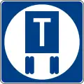
G79: Rest Area
| Sign or plaque | Designation | Name | Tags | Notes |
|---|---|---|---|---|
| G79 | Rest Area (X Mile) | highway=rest_area 1 mile aheaddestination=Rest Area distance=1 mi on the traffic sign node
| ||
| File:MUTCD-CA G79A.svg | G79A | Next Rest (X Mile) | highway=rest_area that many miles ahead
|
G80: Rest Area
| Sign or plaque | Designation | Name | Tags | Notes |
|---|---|---|---|---|

|
G80A | Rest Area | highway=rest_area aheaddestination=Rest Area on the off-ramp
| |
| File:MUTCD-CA G80B.svg | G80B | Patrolled by Highway Patrol | patrolled=yes patroller=California Highway Patrol patroller:wikidata=Q2249117 |
Speculative |
G81: Information
| Sign or plaque | Designation | Name | Tags | Notes |
|---|---|---|---|---|
| File:MUTCD-CA G81-21.svg | G81-21 | Tourist Information | tourism=information information=office within ½ miledestination=Tourist Information
| |
| File:MUTCD-CA G81-24.svg | G81-24 | Tourist Information | tourism=information information=office within ½ miledestination=Tourist Information
| |
| File:MUTCD-CA G81-52.svg | G81-52 | LP Gas | amenity=fuel fuel:lpg=yesdestination:symbol=fuel_lpg on a freeway off-ramp
| |
| File:MUTCD-CA G81-61.svg | G81-61 | Emergency Call 9-1-1 | emergency_telephone_code=911 on a containing boundary relation
| |
| File:MUTCD-CA G81-62.svg | G81-62 | Emergency Call 9-1-1 | emergency_telephone_code=911 on a containing boundary relation
| |
| File:MUTCD-CA G81-63.svg | G81-63 | Vending Machines | amenity=vending_machine vending=drinks;sweets opening_hours=24/7 at the rest areadestination:symbol=vending_machines on the on-ramp and traffic sign node
| |
| File:MUTCD-CA G81-64A.svg | G81-64A | When Flashing | ?
| |
| File:MUTCD-CA G81-65.svg | G81-65 | Radio-Recreation Information | ?
| |
| File:MUTCD-CA G81-66.svg | G81-66 | Report Drunk Drivers Call 911 | N/A | |
| G81-67 | PEDESTRIANS PROHIBITED CALL 911 | foot=no
|
G82: Freeway with Arrow
| Sign or plaque | Designation | Name | Tags | Notes |
|---|---|---|---|---|
| File:MUTCD-CA G82.svg | G82 | Freeway with Arrow | destination=Freeway on the cross street to the righthighway=motorway_link off to the right
|
G83: Advance Guide
| Sign or plaque | Designation | Name | Tags | Notes |
|---|---|---|---|---|
| G83-1 | Advance Guide | destination=Modesto Street on the off-ramp 1 mile aheaddestination=Modesto Street distance=1 mi on the traffic sign node
| ||
| G83-2 | Advance Guide | destination=Los Angeles destination:ref=I 5 on the ramp 1 mile aheaddestination=Los Angeles destination:ref=I 5 distance=1 mi on the traffic sign node
| ||
| File:MUTCD-CA G83-5.svg | E1-5P,G83-5 | Exit Numbered Advance Guide | destination=Modesto Street junction:ref=444A on the ramp 1 mile aheaddestination=Modesto Street distance=1 mi junction:ref=444A on the traffic sign node
| |
| File:MUTCD-CA G83-6.svg | G83-6 | HOV Advance Guide | destination=Barranca Parkway hov=designated on the off-ramp
|
G84: Exit with Arrow
| Sign or plaque | Designation | Name | Tags | Notes |
|---|---|---|---|---|
| File:MUTCD-CA G84.svg | G84 | Exit with Arrow | highway=motorway_junction noref=yeshighway=*_link
| |
| File:MUTCD-CA G84-2.svg | G84-2 | Exit (XX) with Arrow | highway=motorway_junction ref=44highway=*_link junction:ref=44
| |
| File:MUTCD-CA G84-3.svg | G84-3 | Exit (XXXX) with Arrow | highway=motorway_junction ref=444Ahighway=*_link junction:ref=444A
|
G85: Exit Direction
| Sign or plaque | Designation | Name | Tags | Notes |
|---|---|---|---|---|
| File:MUTCD-CA G85-1.svg | G85-1 | Exit Direction | highway=*_link destination=Main Street
| |
| File:MUTCD-CA G85-2.svg | G85-2 | Exit Direction | highway=*_link destination=Main Street
| |
| File:MUTCD-CA G85-3.svg | G85-3 | Exit Direction | highway=*_link destination:ref=CA 299 destination=Redding
| |
| File:MUTCD-CA G85-4.svg | G85-4 | Exit Direction | highway=*_link destination:ref=I 80 destination=Sacramento;San Francisco
| |
| File:MUTCD-CA G85-5.svg | G85-5 | Exit Direction | highway=*_link destination=Oakland Road East
| |
File:MUTCD-CA G85-6.svg |
E1-5P,G85-6 | Exit Numbered Direction | highway=motorway_junction ref=444Ahighway=*_link junction:ref=444A destination=Modesto Street
| |
| File:MUTCD-CA G85-12.svg | G85-12 | HOV Exit Direction | highway=motorway_junctionhighway=motorway_link destination=Barranca Parkway hov=designated
|
G86: Supplemental Destination
| Sign or plaque | Designation | Name | Tags | Notes |
|---|---|---|---|---|
| File:MUTCD-CA G86-1.svg | G86-1 | Supplemental Destination | destination=Lodi on the traffic sign node |
Only tag the ramp if this is the most prominent destination sign |
| File:MUTCD-CA G86-3.svg | G86-3 | Supplemental Destination | destination:ref=I 5 South destination=Los Angeles on the traffic sign node |
Only tag the ramp if this is the most prominent destination sign |
| File:MUTCD-CA G86-5.svg | G86-5 | Supplemental Destination | destination=San Diego;Los Angeles on the traffic sign node |
Only tag the ramp if this is the most prominent destination sign |
| File:MUTCD-CA G86-7.svg | G86-7 | Supplemental Destination | destination:ref=I 5 North destination=Fresno;Stockton on the traffic sign node |
Only tag the ramp if this is the most prominent destination sign |
| File:MUTCD-CA G86-11.svg | G86-11 | Historic District Supplemental Destination | destination=Old Towne Orange Historic District on the traffic sign node |
Do not tag the ramp |
| E1-5P,G86-13 | Exit Numbered Supplemental Destination | junction:ref=444A destination=Modesto Street on the traffic sign nodehighway=motorway_junction ref=444A aheadhighway=*_link junction:ref=444A |
Only tag this destination=* on the ramp if this is the most prominent destination sign
| |
| File:MUTCD-CA G86-14.svg | E1-5P,G86-14 | Murrieta Veterans Memorial Sign | junction:ref=444 destination=Murrieta Veterans Memorial on the traffic sign nodehighway=motorway_junction ref=444 aheadhighway=*_link junction:ref=444 |
Do not tag this destination=* on the ramp
|
| File:MUTCD-CA G86-15.svg | G86-15 | HOV Supplemental Destination | destination=Barranca Parkway hov=designated distance=1 mi on the traffic sign nodehighway=motorway_junction aheadhighway=motorway_link hov=designated destination=Barranca Parkway
| |
| File:MUTCD-CA G86-16.svg | E1-5P,G86-16 | Veterans Home of California | junction:ref=444 destination=West Los Angeles Veterans Home on the traffic sign nodehighway=motorway_junction ref=444 aheadhighway=*_link junction:ref=444 |
Do not tag this destination=* on the ramp
|
G87: Next X Exits
| Sign or plaque | Designation | Name | Tags | Notes |
|---|---|---|---|---|
| File:MUTCD-CA G87.svg | G87 | Next X Exits | ?
|
G92: Carpool Lane Entrance
| Sign or plaque | Designation | Name | Tags | Notes |
|---|---|---|---|---|

|
G92-1 | Carpool Lane Entrance | highway=motorway_link hov=designatedhov=lane on the connecting freeway
|
G93: Bike Parking
| Sign or plaque | Designation | Name | Tags | Notes |
|---|---|---|---|---|
| File:MUTCD-CA G93C.svg | G93C | Bike Parking | amenity=bicycle_parking
|
G94: Conventional Airport
| Sign or plaque | Designation | Name | Tags | Notes |
|---|---|---|---|---|
| File:MUTCD-CA G94-1.svg | G94-1 | Conventional Airport | destination:symbol=airportaeroway=aerodrome aerodrome:type=airfield
|
G95: Park & Ride
| Sign or plaque | Designation | Name | Tags | Notes |
|---|---|---|---|---|
| File:MUTCD-CA G95A.svg | G95A | Park - Ride | destination:symbol=park_and_rideamenity=parking park_ride=yes
| |
| File:MUTCD-CA G95B.svg | G95B | Park - Ride Next Right | destination:symbol=park_and_rideamenity=parking park_ride=yes
| |
| File:MUTCD-CA G95B-1.svg | G95B-1 | Park - Ride Next Right | destination:symbol=park_and_rideamenity=parking park_ride=yes operator=Weberstown Mall operator:wikidata=Q17034836
| |
| File:MUTCD-CA G95D.svg | G95D | Bus Service Plaque | destination:symbol=bus_stationamenity=bus_station at the parking lot
| |
| File:MUTCD-CA G95E.svg | G95E | Park - Ride (plaque) | destination:symbol=park_and_rideamenity=parking park_ride=yes
| |
| File:MUTCD-CA G95F.svg | G95F | Train Station Next Right | destination:symbol=train_stationrailway=station
| |
| File:MUTCD-CA G95G.svg | G95G | Specific Train Station Next Right | destination:symbol=train_station destination=Burbank on the traffic sign nodedestination:symbol=train_station on the ramprailway=station name=Burbank
|
G96: Light Rail Station
| Sign or plaque | Designation | Name | Tags | Notes |
|---|---|---|---|---|
| File:MUTCD-CA G96.svg | G96 | Light Rail Station | destination:symbol=light_railrailway=station station=light_rail
| |
| File:MUTCD-CA G96A.svg | G96A | Trolley Plaque | destination:symbol=tramrailway=tram_stop |
Speculative |
G97: Amtrak
| Sign or plaque | Designation | Name | Tags | Notes |
|---|---|---|---|---|
| File:MUTCD-CA G97A.svg | G97A | Amtrak | railway=station network=Amtrak network:wikidata=Q23239
|
G98: Intersection Number
| Sign or plaque | Designation | Name | Tags | Notes |
|---|---|---|---|---|
| File:MUTCD-CA G97A.svg | G98 | Intersection Number | highway=traffic_signals ref=44A
|
G200: Wildlife Area
| Sign or plaque | Designation | Name | Tags | Notes |
|---|---|---|---|---|

|
G200-80 | Golf Course | destination:symbol=golf_courseleisure=golf_course golf:course=9_hole (or more) within 3 miles |
Speculative |

|
G200-81 | Wildlife Viewing | leisure=wildlife_hide observation=wild_animal |
[1] |
| File:MUTCD-CA G200-81A.svg | G200-81A | Wildlife Viewing | leisure=wildlife_hide observation=wild_animal
| |

|
G200-82 | Botanical Management Area | type=boundary boundary=protected_area protect_class=4 protection_title=Botanical Management Area operator=Caltrans Landscape Architecture Program operator:wikidata=Q108402613
| |
| File:MUTCD-CA G200-82A.svg | G200-82A | Botanical Management Area | type=boundary boundary=protected_area protect_class=4 protection_title=Botanical Management Area operator=Caltrans Landscape Architecture Program operator:wikidata=Q108402613
|
NEV-G: Neighborhood Electric Vehicle
| Sign or plaque | Designation | Name | Tags | Notes |
|---|---|---|---|---|
| NEV-G1 | NEV - Bike Route | nev=designated bicycle=designated lcn=yes |
How to indicate that the roadway is part of the LCN-like "local NEV route" network? | |
| NEV-G2 | NEV Route | nev=designated |
How to indicate that the roadway is part of the LCN-like "local NEV route" network? |