Key:natural
 |
| Description |
|---|
| Natural physical landscape features, including those modified or created by humans. |
| Group: natural |
| Used on these elements |
| Documented values: 92 |
| Status: de facto |
| Tools for this tag |
|
The natural key is used to describe a wide variety of physical geography, geological and landcover features, including ones that have been modified or created by humans.
Values
| Key | Value | Element | Comment | Carto rendering |
Photo |
|---|---|---|---|---|---|
Vegetation | |||||
| fell | Habitat above the tree line covered with grass, dwarf shrubs and mosses. | No, see #545. | 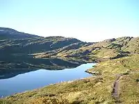 | ||
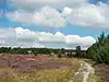
| grassland | Areas where the vegetation is dominated by grasses (Poaceae) and other herbaceous (non-woody) plants. For mown/managed grass see landuse=grass, for hay/pasture see landuse=meadow.
|
 |
 | ||
| heath | A dwarf-shrub habitat, characterised by open, low growing woody vegetation, often dominated by plants of the Ericaceae. Note. This is not for parks whose name contains the word "heath". |
 |
 | ||
| moor | Don't use, see wikipage. Upland areas, characterised by low-growing vegetation on acidic soils. | currently not rendered by OSM Carto | 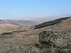 | ||
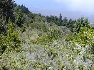
| scrub | Uncultivated land covered with shrubs, bushes or stunted trees. |  |
 | ||
| shrubbery | An area of shrubbery that is actively maintained or pruned by humans. A slightly wilder look is also possible | currently not rendered by OSM Carto | 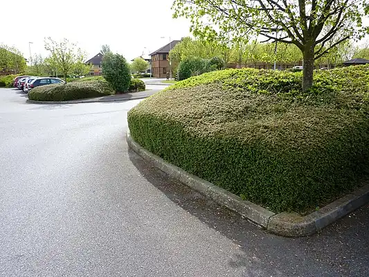 | ||
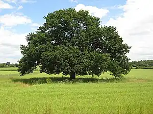
| tree | A single tree. |  |
 | ||
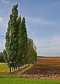
| tree_row | A line of trees. |  |
 | ||
| tree_stump | A tree stump, the remains of a cut down or broken tree. | 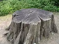 | |||
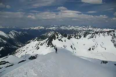
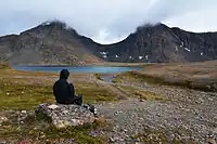
| tundra | Habitat above tree line in alpine and subpolar regions, principally covered with uncultivated grass, low growing shrubs and mosses and sometimes grazed. | 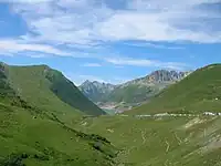 | |||
| wood | Tree-covered area (a 'forest' or 'wood'). Also see landuse=forest. For more detail, one can use leaf_type=* and leaf_cycle=*.
|
 |
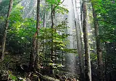 | ||
|
| |||||
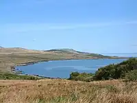
| bay | An area of water mostly surrounded by land but with a level connection to the ocean or a lake. |  |
 | ||
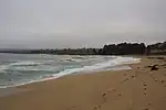
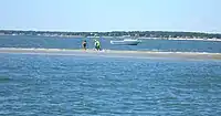
| beach | landform along a body of water which consists of sand, shingle or other loose material |  |
 | ||
| blowhole | An opening to a sea cave which has grown landwards resulting in blasts of water from the opening due to the wave action | 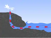 | |||
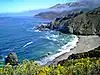
| cape | A piece of elevated land sticking out into the sea or large lake. Includes capes, heads, headlands and (water) promontories. | 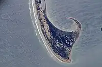 | |||
| coastline | The mean high water springs line between the sea and land (with the water on the right side of the way.) |  |
 | ||
| crevasse | A large crack in a glacier | 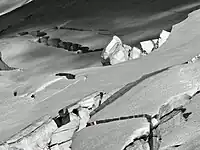 | |||
| geyser | A spring characterized by intermittent discharge of water ejected turbulently and accompanied by steam. | 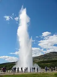 | |||
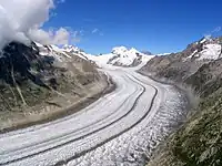
| glacier | A permanent body of ice formed naturally from snow that is moving under its own weight. |  |
 | ||
| hot_spring | A spring of geothermally heated groundwater | 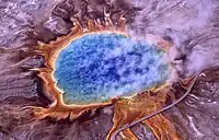 | |||
| isthmus | A narrow strip of land, bordered by water on both sides and connecting two larger land masses. | 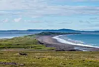 | |||
| mud | Area covered with mud: water saturated fine grained soil without significant plant growth. Also see =wetland + wetland=*.
|
 |
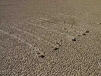 | ||
| peninsula | A piece of land projecting into water from a larger land mass, nearly surrounded by water | ||||
| reef | A feature (rock, sandbar, coral, etc) lying beneath the surface of the water | 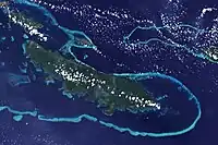 | |||
| shingle | An accumulation of rounded rock fragments on a beach or riverbed |  |
 | ||
| shoal | An area of the sea floor near the sea surface (literally, becomes shallow) and exposed at low tide. See =sand as well.
|
|
 | ||
| spring | A place where ground water flows naturally from the ground (Other languages). |  |
 | ||
| strait | A narrow area of water surrounded by land on two sides and by water on two other sides. | 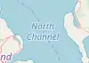 |
.jpg) | ||
| water | Any body of water, from natural such as a lake or pond to artificial like moat or canal. Also see water=river
|
 |
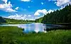 | ||
| wetland | A natural area subject to inundation or with waterlogged ground, further specified with wetland=*
|
 |
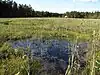 | ||
|
| |||||
| arch | A rock arch naturally formed by erosion, with an opening underneath. | currently not rendered by OSM Carto | 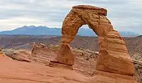 | ||
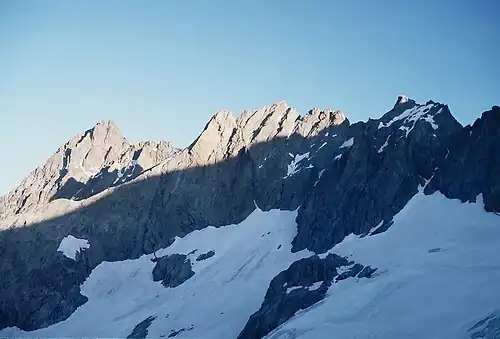
| arete | An arête, a thin, almost knife-like, ridge of rock which is typically formed when two glaciers erode parallel U-shaped valleys. |  |
 | ||
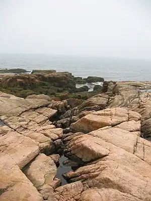
| bare_rock | An area with sparse/no soil or vegetation, so that the bedrock becomes visible. |  |
 | ||
| blockfield | A surface covered with boulders or block-sized rocks, usually the result of volcanic activity or associated with alpine and subpolar climates and ice ages. | Currently not rendered by OSM Carto | 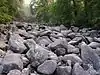 | ||
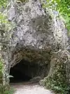
| cave_entrance | The entrance to a cave: a natural underground space large enough for a human to enter. |  |
 | ||
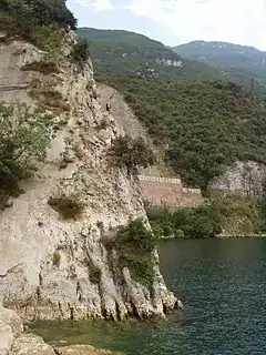
| cliff | A vertical or almost vertical natural drop in terrain, usually with a bare rock surface (leave the lower face to the right of the way). |  |
 | ||
| dune | A hill of sand formed by wind, covered with no or very little vegetation. See also =sand and =beach
|
currently not rendered by OSM Carto | 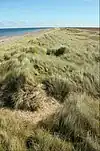 | ||
| earth_bank | Large erosion gully or steep earth bank | _1.jpg) | |||
| fumarole | A fumarole is an opening in a planet's crust, which emits steam and gases | .jpg) | |||
| gully | Small scale cut in relief created by water erosion | 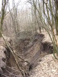 | |||
| hill | A hill. | currently not rendered by OSM Carto | 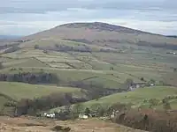 | ||
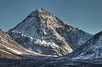
| peak | The top (summit) of a hill or mountain. |  |
 | ||
| ridge | A mountain or hill linear landform with a continuous elevated crest |  |
 | ||
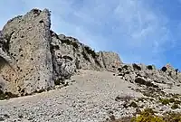
| rock | A notable rock or group of rocks attached to the underlying bedrock. | currently not rendered by OSM Carto | 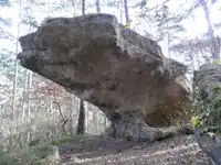 | ||
| saddle | The lowest point along a ridge or between two mountain tops |  |
 | ||
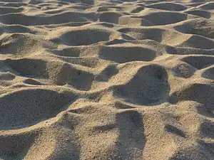
| sand | An area covered by sand with no or very little vegetation. See =beach and =dune as well.
|
 |
 | ||
| scree | Unconsolidated angular rocks formed by rockfall and weathering from adjacent rockfaces. | |
 | ||
| sinkhole | A natural depression or hole in the surface topography. | currently not rendered by OSM Carto | 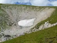 | ||
| stone | A single notable freestanding rock, which may differ from the composition of the terrain it lies in.; e.g., glacial erratic. | currently not rendered by OSM Carto |  | ||
| valley | A natural depression flanked by ridges or ranges of mountains or hills | currently not rendered by OSM Carto | 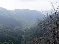 | ||
| volcano | An opening exposed on the earth's surface where volcanic material is emitted. |  |
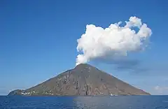 | ||
| user defined | All commonly used values according to Taginfo | ||||
This table is a wiki template with a default description in English. Editable here.
Deprecated values
Please avoid use of:
=land: Use an appropriate other tag to describe the use to which the land has been put. See also: multipolygon and=coastline.=marsh: Use=wetlandinstead withwetland=marsh.
Possible tagging mistakes
See also
- Landcover
- Land use and areas of natural land
- Conservation
- Geological
- Category:Key descriptions for group "natural"
- Category:Tag descriptions for group "natural"
- OpenLandcoverMap: render many landuse and natural tags.