MUTCD/Puerto Rico/W
Series W of the Manual de Rotulación para las Vías Públicas de Puerto Rico is for warning signs. The following tables display only the signs specific to the sign manual in Puerto Rico; consult MUTCD/W for warning signs in the national standard.
Temporary warning signs
This series includes warning signs for temporary traffic control zones, i.e., construction zones, as well as for incident management areas. Whereas a regulatory sign appears the same inside and outside a construction zone, a temporary warning sign has an orange background instead of the usual yellow, and an incident management warning sign has a fluorescent pink background. Incident management area signs are not to be confused with the emergency management signs of Series EM.
- W3-4
-
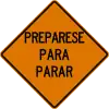 Construction zone
 -
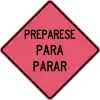 Incident management area
In general, OpenStreetMap only maps long-term closures and construction sites. For routing purposes, short-term construction is more reliably and efficiently tracked in incident management systems along with real-time traffic congestion data. However, if a temporary warning sign happens to be posted on a long-term basis for some reason, you can map it as you would map a permanent warning sign. If you map the temporary traffic sign as a node, use a W code but add colour=orange or pink to the node.
W1: Curves and Turns
| Sign or plaque | Designation | Name | Tags | Notes |
|---|---|---|---|---|
 
|
W1-1(I) | Turn | hazard=turn
| |
 
|
W1-1(D) | |||

|
W1-1a(I) | Combination Horizontal Alignment/Advisory Speed | hazard=turn maxspeed:advisory=25 mph
| |

|
W1-1a(D) | |||
|
W1-2(I) | Curve | hazard=curve
| |
 
|
W1-2(D) | |||

|
W1-2a(I) | Combination Horizontal Alignment/Advisory Speed | hazard=curve maxspeed:advisory=35 mph
| |

|
W1-2a(D) | |||
 
|
W1-3(I) | Reverse Turn | hazard=turns
| |
 
|
W1-3(D) | |||
 
|
W1-4(I) | Reverse Curve | hazard=curves curves=serpentine
| |
 
|
W1-4(D) | |||
| W1-4b(I) | W1-4b(I) | Reverse Curve (2 lanes) | hazard=curves curves=serpentine change=no lanes=2 |
Speculative |
| W1-4b(D) | W1-4b(D) | |||
| W1-4c(I) | W1-4c(I) | Reverse Curve (3 lanes) | hazard=curves curves=serpentine change=no lanes=3 |
Speculative |
| W1-4c(D) | W1-4c(D) | |||
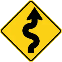
|
W1-5 | Winding Road | hazard=curves curves=extended
| |
| W1-6(I) | One-Direction Large Arrow | hazard=turn
| ||
| W1-6(D) | ||||
| W1-7 | Two-Direction Large Arrow | hazard=dangerous_junction
| ||
| W1-8(I) | Chevron Alignment | hazard=curve
| ||
| W1-8(D) | ||||

|
W1-10 | Combination Horizontal Alignment/Intersection | hazard=curve;dangerous_junction
| |

|
W1-11 | Hairpin Curve | hazard=curve curve=hairpin
| |

|
W1-13 | Truck Rollover | hazard:hgv=rollover |
Speculative |

|
W1-15 | 270-degree Loop | hazard=curve curve=loop
|
W2: Intersections
| Sign or plaque | Designation | Name | Tags | Notes |
|---|---|---|---|---|

|
W2-1 | Intersection Warning | hazard=dangerous_junction
| |

|
W2-2 | Intersection Warning | hazard=dangerous_junction
| |

|
W2-3 | Intersection Warning | hazard=dangerous_junction
| |

|
W2-4 | T-intersection | hazard=dangerous_junction
| |

|
W2-5 | Intersection Warning | hazard=dangerous_junction
| |

|
W2-6 | Circular Intersection | hazard=roundabout junction=roundabout
|
W3: Advance Traffic Control
| Sign or plaque | Designation | Name | Tags | Notes |
|---|---|---|---|---|
|
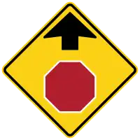
W3-1 | Stop Ahead | hazard=stophighway=stop ahead |
Speculative |
| W3-1a | Stop Ahead (plaque) | hazard=stophighway=stop ahead |
Speculative | |
 
|
W3-2 | Yield Ahead | hazard=give_wayhighway=give_way ahead |
Speculative |
| W3-2a | Yield Ahead (plaque) | hazard=give_wayhighway=give_way ahead |
Speculative | |
|
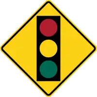
W3-3 | Traffic Signal Ahead | hazard=traffic_signalshighway=traffic_signals ahead
| |
 W3-3a W3-3a
|
W3-3a | Traffic Signal Ahead | hazard=traffic_signalshighway=traffic_signals ahead
| |
|
|
W3-4 | Prepare to Stop | highway=traffic_signals ahead
| |
 W3-5 W3-5
|
W3-5 | Reduced Speed Limit Ahead | hazard=maxspeedmaxspeed=45 mph ahead |
Speculative |
W4: Lanes and Merges
| Sign or plaque | Designation | Name | Tags | Notes |
|---|---|---|---|---|
 
|
W4-1(I) | Merge | hazard=merge |
Speculative |
 
|
W4-1(D) | |||
  W4-2(I) W4-2(I)
|
W4-2(I) | Lane Ends | hazard=mergeturn:lanes=merge_to_left change:lanes=yes |
Speculative |
  W4-2(D) W4-2(D)
|
W4-2(D) | hazard=mergeturn:lanes=merge_to_right change:lanes=yes
| ||
 
|
W4-3(I) | Added Lane | hazard=acceleration_lanelanes=* |
Speculative |
 
|
W4-3(D) | |||
|
|
W4-3 | Added Lane | hazard=acceleration_lanelanes=* |
Speculative |
 
|
W4-5 | Entering Roadway Merge | hazard=merge |
Speculative |
 
|
W4-6 | Entering Roadway Added Lane | hazard=acceleration_lanelanes=* |
Speculative |
W5: Road Width Restrictions
| Sign or plaque | Designation | Name | Tags | Notes |
|---|---|---|---|---|
 W5-1 W5-1
|
W5-1 | Road Narrows | hazard=road_narrowsnarrow=yes ahead
| |
 W5-2 W5-2
|
W5-2 | Narrow Bridge | narrow=yes on bridge
| |
 W5-3 W5-3
|
W5-3 | One Lane Bridge | lanes=1 on bridge
| |
 W5-4 W5-4
|
W5-4 | Ramp Narrows | hazard=road_narrowsnarrow=yes ahead
|
W6: Divided Highways
| Sign or plaque | Designation | Name | Tags | Notes |
|---|---|---|---|---|
 
|
W6-1 | Divided Highway | dual_carriageway=yes
| |
 
|
W6-2 | Divided Highway Ends | dual_carriageway=no
| |
 
|
W6-3 | Two-Way Traffic | oneway=no
|
W7: Hills and Grades
| Sign or plaque | Designation | Name | Tags | Notes |
|---|---|---|---|---|
 
|
W7-1 | Hill | incline=down
| |
 W7-3a W7-3a
|
W7-3a | Downhill Next XX Kilometers | incline=* for XX kilometers
| |
| W7-3b | Check Brakes | ?
| ||
| W7-3c | W7-3c | Check Brakes | ?
| |
| W7-4 | Runaway Truck Ramp XX Kilometers Ahead | highway=escape XX kilometers ahead
| ||
| W7-4b | Runaway Truck Ramp (with arrow) | highway=escape 1 kilometer (0.62 mi) ahead
|
W8: Pavement and Roadway Conditions
| Sign or plaque | Designation | Name | Tags | Notes |
|---|---|---|---|---|
 W8-1 W8-1
|
W8-1 | Bump | traffic_calming=bumphazard=bump
| |
 W8-2 W8-2
|
W8-2 | Dip | traffic_calming=diphazard=dip
| |
|
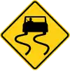
W8-5 | Slippery When Wet | hazard=slippery
| |
 W8-6 W8-6
|
W8-6 | Truck Crossing | hazard=hgv_crossinghgv=designated on cross street |
Speculative |
 W8-6a W8-6a
|
W8-6a | Trucks Entering and Exiting | hazard=hgv_crossinghgv=designated on cross street |
Speculative |
| W8-15p | Motorcycle (plaque) | hazard:motorcycle=*
| ||

|
W8-16 | Metal Bridge Deck | surface=metal hazard=metal_bridge_deck on the bridge |
Speculative |
 W8-17(I) W8-17(I)
|
W8-17(I) | Shoulder Drop Off (symbol) | ?
| |
 W8-17(D) W8-17(D)
|
W8-17(D) | |||
| W8-17p | Shoulder Drop-Off (plaque) | ?
| ||
 W8-18 W8-18
|
W8-18 | Road May Flood | hazard=flood
| |
| W8-19 | Flood Gauge | man_made=monitoring_station monitoring:water_level=yes display:analog=yes recording:manually=yes
| ||

|
W8-25 | Shoulder Ends | shoulder=no
|
W9: Lane Transitions
| Sign or plaque | Designation | Name | Tags | Notes |
|---|---|---|---|---|
 
|
W9-3 | Center Lane Closed Ahead | access:lanes=yes|no|yes
| |
.svg.png) .svg.png)
|
W9-3(I) | Left Lane Closed Ahead | access:lanes=no|yes
| |
.svg.png) .svg.png)
|
W9-3(D) | Right Lane Closed Ahead | access:lanes=yes|no
| |
| W9-3a W9-3a | W9-3a | Center Lane Closed Ahead | access:lanes=yes|no|yes
|
W11: Advance Warnings and Crossings
| Sign or plaque | Designation | Name | Tags | Notes |
|---|---|---|---|---|
|
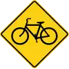
W11-1 | Bicycle | hazard=cyclistscrossing=* bicycle=designated
| |
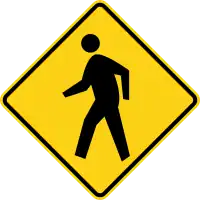
|
W11-2 | Pedestrian | hazard=pedestrianscrossing=* foot=designated
| |

|
W11-4 | Cow | hazard=animal_crossing hazard:animal=cow
| |
|
W11-8 | Emergency Vehicle | hazard=emergency_vehiclesemergency=designated on cross street
| |
| W11-8p | Fire Station (plaque) | amenity=fire_station
| ||

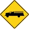
|
W11-10 | Truck | hazard=hgvhgv=designated on cross street
| |
| W11-10p | Truck Crossing (plaque) | hazard=hgvhgv=designated on cross street
| ||
| W11-11 | Watch for Livestock | hazard=livestock |
Speculative | |

|
W11-15 | Bicycle / Pedestrian | hazard=cyclists;pedestrianscrossing=* bicycle=designated foot=designated
|
W12: Low Clearance
| Sign or plaque | Designation | Name | Tags | Notes |
|---|---|---|---|---|
 
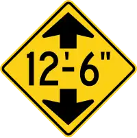
|
W12-1 | Double Arrow | N/A | Map each side as a separate way |
|
W12-2 | Low Clearance (with arrows) | maxheight=12'6" ahead
| |
 
|
maxheight=3.8 ahead
| |||
| W12-2p | Low Clearance | maxheight=14'4" on the roadway below
| ||
maxheight=4.3 on the roadway below
|
W13: Advisory Speeds
| Sign or plaque | Designation | Name | Tags | Notes |
|---|---|---|---|---|
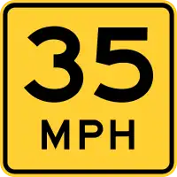
|
W13-1 | Advisory Speed (plaque) | maxspeed:advisory=35 mph
| |

|
W13-2 | Advisory Exit Speed | highway=*_link maxspeed:advisory=25 mph
|
W14: Dead End Streets and No Passing Zones
| Sign or plaque | Designation | Name | Tags | Notes |
|---|---|---|---|---|

|
W14-1 | No Outlet Street | N/A | |

|
W14-2 | No Outlet Road | N/A | |

|
W14-2a | Dead End | N/A | |
 
|
W14-3 | No Passing Zone (pennant) | overtaking=no
|
W15: Playground
| Sign or plaque | Designation | Name | Tags | Notes |
|---|---|---|---|---|

|
W15-1 | Playground | hazard=childrenleisure=playground nearby
|
W16: Supplemental
| Sign or plaque | Designation | Name | Tags | Notes |
|---|---|---|---|---|

|
W16-1 | Share the Road (plaque) | cycleway=shared_lane bicycle=designated
| |
| W16-2 | XXX Meters | distance=150 on the traffic sign
| ||
| W16-2a | XXX m | distance=150 on the traffic sign
| ||
| W16-5p(I) | Supplemental Arrow (plaque) | N/A | ||
| W16-5p(D) | ||||
| W16-6p(I) | Supplemental Arrow (plaque) | N/A | ||
| W16-6p(D) | ||||
| W16-7p(I) | Downward Diagonal Arrow (plaque) | N/A | ||
| W16-7p(D) | ||||
| W16-9p | Ahead (plaque) | N/A | ||
| W16-19 | Bicycle Crossing (plaque) | highway=crossinghighway=cycleway cycleway=crossing
|
W17: Speed Hump
| Sign or plaque | Designation | Name | Tags | Notes |
|---|---|---|---|---|

|
W17-1 | Speed Hump | traffic_calming=hump
| |

|
W17-2 | Landslide | traffic_calming=hump
| |
 
|
W17-3a,W17-3ap | Grooved Shoulder | shoulder:surface=grooved_asphalt shoulder:hazard=grooves |
Speculative |
 
|
W17-3b,W17-3b | Grooves in Center | shoulder:surface=grooved_asphalt shoulder:hazard=grooves |
Speculative |
W20: Work Zones
| Sign or plaque | Designation | Name | Tags | Notes |
|---|---|---|---|---|

|
W20-1 | Road Under Construction | construction=*
| |

|
W20-2 | Detour Advance | ?
| |

|
W20-3 | Road Closed Advance | access=no ahead
| |

|
W20-3a | Street Closed | access=no
| |

|
W20-4 | One Lane Road Advance | lanes=1 ahead
| |
.svg.png) .svg.png)
|
W20-5 | Lane(s) Closed | access:lanes=|no
| |
.svg.png) .svg.png)
|
W20-5a | Lane(s) Closed | access:lanes=|no|no
| |

|
W20-6 | One Lane Advance | lanes=1 ahead
| |

|
W20-7 | Flagger | supervised=yes
| |

|
W20-7a | Flagger (symbol) | supervised=yes
| |
.svg.png)
|
W20-8 | Bridge Under Construction | highway=construction construction=* bridge=* aheadconstruction:man_made=bridge ahead
| |

|
W20-8 | Slow | N/A | Two distinct signs with the same code |
W21: Road Work
| Sign or plaque | Designation | Name | Tags | Notes |
|---|---|---|---|---|

|
W21-1a | Workers | hazard=roadworks
| |

|
W21-3 | Road Machinery Ahead | N/A | |

|
W21-4 | Road Work | N/A | |

|
W21-5 | Shoulder Work | ?
| |
.svg.png)
|
W21-5b(I) | Shoulder Closed | shoulder:left:access=no
| |
.svg.png)
|
W21-5b(D) | shoulder:right:access=no
| ||

|
W21-5d | Bridge Work | N/A |
W24: Double Reverse Curves
| Sign or plaque | Designation | Name | Tags | Notes |
|---|---|---|---|---|

|
W24-1L | Double Reverse Curve (1 lane) | hazard=curves curves=double_reverse lanes=1 |
Speculative |

|
W24-1R | |||

|
W24-1bL | Double Reverse Curve (3 lanes) | hazard=curves curves=double_reverse lanes=2 change=no |
Speculative |

|
W24-1bR | |||

|
W24-1aL | Double Reverse Curve (2 lanes) | hazard=curves curves=double_reverse lanes=2 change=no |
Speculative |

|
W24-1aR |
External links
- Manual de Rotulación para las Vías Públicas de Puerto Rico: Rótulos de Precaución
- Manual de Rotulación para las Vías Públicas de Puerto Rico: Rótulos de Bicicletas
- Manual de Rotulación para las Vías Públicas de Puerto Rico: Rótulos de Construcción/Manejo de Incidentes
- Standard Drawings: Warning Signs
 Diagrams of warning road signs of Puerto Rico