Key:mooring
 |
| Description |
|---|
| The mooring tag is used to mark an area of bank where boats are explicitly permitted to moor. |
| Group: waterways |
| Used on these elements |
| Documented values: 11 |
| Useful combination |
| Status: de facto |
| Tools for this tag |
|
The mooring tag marks an area of bank where boats are explicitly permitted to moor to, e.g., stay for the night, load passengers or offload goods. A commercial mooring point can be tagged as =commercial. Mooring info is attached to the relevant stretch of towpath, or to a new dedicated way alongside the canal or river if there is no towpath.
Use =yes/private/no, applied to ways rather than nodes. Only explicitly marked mooring areas should be shown. Use the maxstay=* tag to show mooring restrictions.
Terminology
From International Hydrographic Organization, IHO Dictionary, S-32, 5th Edition:
- Mooring
- "A place where a vessel may be secured.
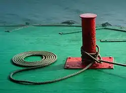
- (Usually in pl.) The equipment used to secure a vessel.
- The process of securing a vessel or oceanographic instruments other than anchoring with a single anchor."
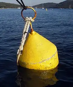
- Buoy, mooring
- "A buoy secured to the bottom by permanent moorings with means for mooring a vessel by use of its anchor chain or mooring lines."
Values
The following values can be used:
| berthing allowed | =yes
|
| ferry | =ferry
|
| cruise | =cruise
|
| guest mooring | =guest
|
| check in pier | =declaration
|