Yemen
| V・T・E |
| latitude: 15.7, longitude: 47 |
| Browse map of Yemen 15°42′00.00″ N, 47°00′00.00″ E |
| Edit map |
|
External links:
|
| Use this template for your locality |
Yemen is a country in Western Asia at latitude 15°42′00.00″ North, longitude 47°00′00.00″ East.
The official language in Yemen is Arabic.
Road tagging
Road classification
| Key | Value | Comment | Rendering | Photo! |
|---|---|---|---|---|
| highway | motorway | Do NOT use in Yemen, there isn't any Yemeni equivalent. |  |
 |
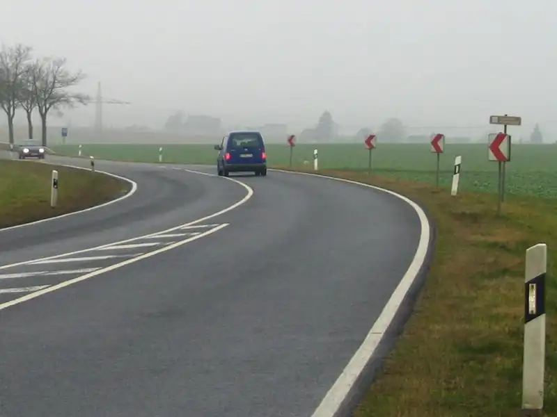
| highway | trunk | The most important roads in the country's system. Includes all M100s, M45s and M55s international roads (described in Mashreq international road) and roads linking cities. Does not need to be a divided highway, or needs to be paved. |  |
 |
| highway | primary | The next most important roads in the country's system. (Often link larger towns like governorate admin centres.) |  |
 |
| highway | secondary | The next most important roads in the country's system. (Often link towns and district admin centres.) |  |
 |
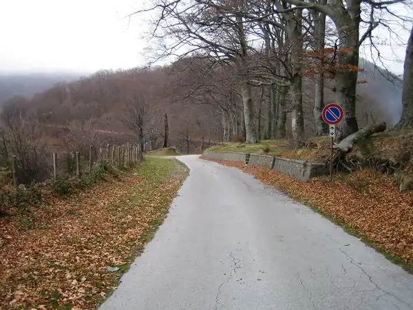
| highway | tertiary | The next most important roads in the country's system. (Often link smaller towns and villages) |  |
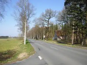 |
| highway | unclassified | The least important through roads in the country's system – i.e. minor roads of a lower classification than tertiary, but which serve a purpose other than access to properties. (Often link villages and hamlets.)
may be unpaved roads. |
 |
 |
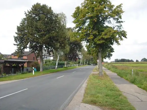
| highway | residential | Roads which serve as an access to housing, without function of connecting settlements. Often lined with housing. |  |
 |
| highway | service | For access roads to, or within an industrial estate, camp site, business park, car park etc. Can be used in conjunction with service=* to indicate the type of usage and with access=* to indicate who can use it and in what circumstances.
|
 |
 |
Names
Arabic is the default tag language, so use name=صنعاء for name=*.
For the English name, use name:en=Sanaa, and for the Arabic name use name:ar=صنعاء.
Place tagging
Administratively declared places
| Settlement | admin_level= | Element | Description | Comments |
|---|---|---|---|---|
place=state |
4 | Used for governorates | Relations are preferred. | |
place=district |
6 | Used for districts. |
place=province, place=county and place=municipality should not be used in Yemen.
place=region should be used only for geographic or historical areas with no clear boundary.
Populated settlements
| Settlement | Local Name | Element | Description | Comments |
|---|---|---|---|---|
place=city |
مدينة كبيرة |
|
Like Sana'a, Aden, Taiz... | |
place=town |
مدينة |
|
||
place=village |
قرية | A municipality having a population less then 5,000 people, larger than an hamlet, and with a significant infrastructure. | ||
place=hamlet |
محلة | A rural community less than 100-200 inhabitants, few infrastructure except a public access road or path. | ||
place=isolated_dwelling |
محلة | A rural named place with a single inhabited building or farm, almost no infrastructure except a nearby road or a private access path. |
Population
The population is taken from the data of the last census conducted on 17-12-2004 and its data is published on the website of the Central Statistical Organisation ([cso-yemen.com]), and the reference is added to the population unit number as follows:
source:population=YCSO2004:Population Unit Number
Where the population unit number consists of: Governorate No. - District No. - Sub-district No. - Village/Town No.
Import from GEOnet Names Server (GNS) database status
Everything in the GNS database except duplicates or incorrect items were imported until 16-01-2019, and the following data were tagged in the import:
GNS:id=UFI numberGNS:dsg_code=DSG fieldGNS:dsg_name=The name of the DSG field (feature name)
| ||||||