Fi:Key:natural
 |
| Kuvaus |
|---|
| Luonnon kohteet ja ominaisuudet. |
| Ryhmä: Natural |
| Käytetään karttakohteille |
| Dokumentoidut arvot: 92 |
| Tila: de facto |
| Työkalut tälle tagille |
Yhteenveto
Luonnon kohteita ja ominaisuuksia kuvaavat merkinnät.
Keskeisimmät käytettävät arvot
Luonto
Luonnon kohteita ja ominaisuuksia kuvaavat merkinnät.
| Key | Value | Element | Comment | Carto rendering |
Photo |
|---|---|---|---|---|---|
Vegetation | |||||
| fell | Paljakka, puuton ja matalakasvustoinen alue korkeilla paikoilla. | No, see #545. | 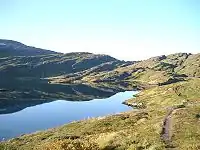 | ||
| grassland | Ruohoa. |  |
 | ||
| heath | Nummi, puuton varpukangas. Matalakasvuista pusikkoa, enintään satunnaisia puita. |  |
 | ||
| moor | Don't use, see wikipage. Upland areas, characterised by low-growing vegetation on acidic soils. | currently not rendered by OSM Carto | 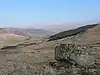 | ||
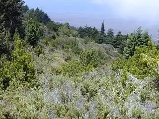
| scrub | Vapaasti rehottava metsätön alue, ei niitty; pääasiallisesti avoin, pusikkoa ja satunnaisia puita. |  |
 | ||
| shrubbery | An area of shrubbery that is actively maintained or pruned by humans. A slightly wilder look is also possible | currently not rendered by OSM Carto | 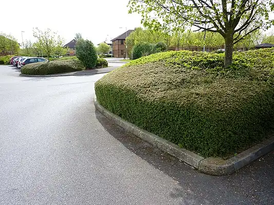 | ||
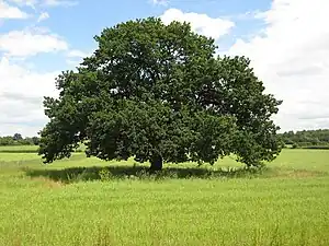
| tree | Puu. |  |
 | ||
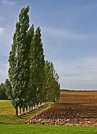
| tree_row | A line of trees. |  |
 | ||
| tree_stump | A tree stump, the remains of a cut down or broken tree. | 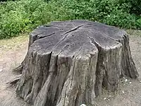 | |||
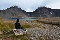
| tundra | Habitat above tree line in alpine and subpolar regions, principally covered with uncultivated grass, low growing shrubs and mosses and sometimes grazed. | 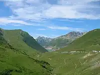 | |||
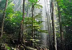
| wood | Metsä. Yhdistä landuse=forest jos alue on selvästi hoidettua talousmetsää.
|
 |
 | ||
|
| |||||
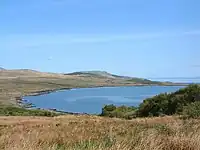
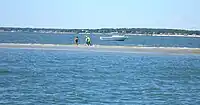
| bay | Lahti. |  |
 | ||
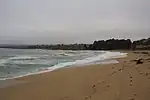
| beach | Hiekkaranta, mutta myös sorapintaiset. |  |
 | ||
| blowhole | An opening to a sea cave which has grown landwards resulting in blasts of water from the opening due to the wave action | 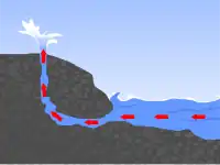 | |||
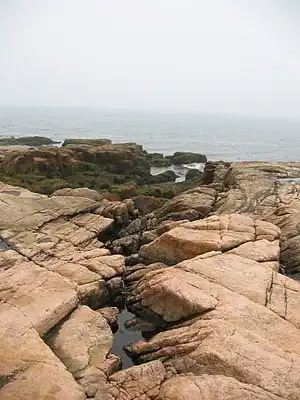
| cape | A piece of elevated land sticking out into the sea or large lake. Includes capes, heads, headlands and (water) promontories. | 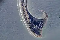 | |||
| coastline | Rantaviiva, käytetty meren rantoihin ja suurimpiin järviimme. Tässäkin vesi kuuluu way:n kulkusuunnassa oikealle puolelle ja maa vasemmalle. | 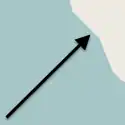 |
 | ||
| crevasse | A large crack in a glacier | 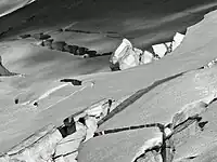 | |||
| geyser | A spring characterized by intermittent discharge of water ejected turbulently and accompanied by steam. | 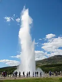 | |||
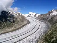
| glacier | Ympärivuotinen jäätikkö |  |
 | ||
| hot_spring | A spring of geothermally heated groundwater | 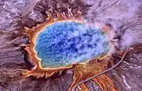 | |||
| isthmus | A narrow strip of land, bordered by water on both sides and connecting two larger land masses. | 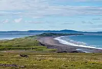 | |||
| mud | Mutaa, savea. |  |
 | ||
| peninsula | A piece of land projecting into water from a larger land mass, nearly surrounded by water | ||||
| reef | A feature (rock, sandbar, coral, etc) lying beneath the surface of the water | 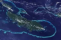 | |||
| shingle | An accumulation of rounded rock fragments on a beach or riverbed |  |
 | ||
| shoal | An area of the sea floor near the sea surface (literally, becomes shallow) and exposed at low tide. See =sand as well.
|
|
 | ||
| spring | Lähde |  |
 | ||
| strait | A narrow area of water surrounded by land on two sides and by water on two other sides. | 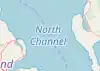 |
.jpg) | ||
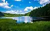
| water | Vesistö, muu kuin meri. Vesi kuuluu way:n kulkusuunnassa oikealle puolelle ja maa vasemmalle eli kierrä järvet myötäpäivään. Jos rantaviivan pituus ylittää n. 500 solmua, tehdään rantaviivan osista myös multipolygon-relaatio. Aikoinaan sellaisille käytettiin tagia =coastline.
|
 |
 | ||
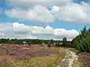
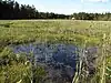
| wetland | Kosteikko. Käytä myös tagia wetland=* kertomaan kosteikon tyyppi tarkemmin.
|
 |
 | ||
|
| |||||
| arch | A rock arch naturally formed by erosion, with an opening underneath. | currently not rendered by OSM Carto | 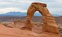 | ||
| arete | An arête, a thin, almost knife-like, ridge of rock which is typically formed when two glaciers erode parallel U-shaped valleys. |  |
 | ||
| bare_rock | An area with sparse/no soil or vegetation, so that the bedrock becomes visible. |  |
 | ||
| blockfield | A surface covered with boulders or block-sized rocks, usually the result of volcanic activity or associated with alpine and subpolar climates and ice ages. | Currently not rendered by OSM Carto | 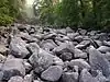 | ||
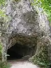
| cave_entrance | Luolan suuaukko. |  |
 | ||
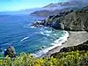
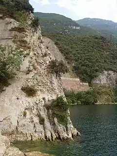
| cliff | (Kallio)jyrkänne | 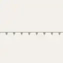 |
 | ||
| dune | A hill of sand formed by wind, covered with no or very little vegetation. See also =sand and =beach
|
currently not rendered by OSM Carto | 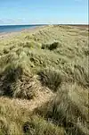 | ||
| earth_bank | Large erosion gully or steep earth bank | _1.jpg) | |||
| fumarole | A fumarole is an opening in a planet's crust, which emits steam and gases | .jpg) | |||
| gully | Small scale cut in relief created by water erosion | 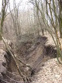 | |||
| hill | A hill. | currently not rendered by OSM Carto | 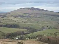 | ||
| peak | Huippu (mäen tai tunturin). Jos tiedossa, kerro korkeus tagilla ele=*.
|
 |
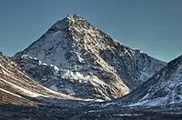 | ||
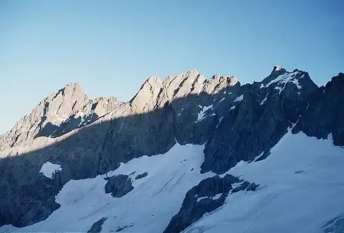
| ridge | A mountain or hill linear landform with a continuous elevated crest |  |
 | ||
| rock | A notable rock or group of rocks attached to the underlying bedrock. | currently not rendered by OSM Carto | 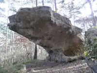 | ||
| saddle | The lowest point along a ridge or between two mountain tops |  |
 | ||
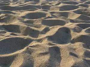
| sand | Hiekkaa. Ei yhtään tai vain vähäpätöistä kasvillisuutta. |  |
 | ||
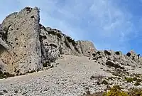
| scree | Kivikko, rakka | |
 | ||
| sinkhole | A natural depression or hole in the surface topography. | currently not rendered by OSM Carto | 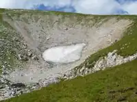 | ||
| stone | Siirtolohkare tai muu suuri kivi. | currently not rendered by OSM Carto |  | ||
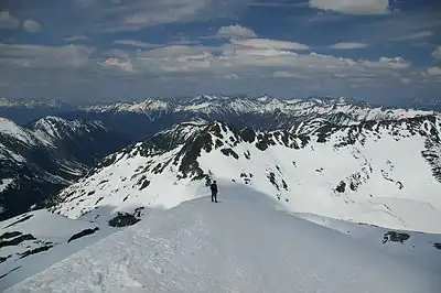
| valley | A natural depression flanked by ridges or ranges of mountains or hills | currently not rendered by OSM Carto | 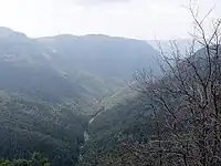 | ||
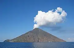
| volcano | Tulivuori. Lisätageilla mahdollisesti merkattu sammuneeksi, lepääväksi tai aktiiviseksi. |  |
 | ||
| user defined | All commonly used values according to Taginfo | ||||
This table is a wiki template with a default description in English. Editable here.