OSM Garrigues:Glossaire Garrigues Histoire
GLOSSAIRE des GARRIGUES
MODELE
| POI | Catégorie=Valeur | Détail=Valeur | Type | RenduOSM | Rendu CartoGarrigue | Commentaire | Photo |
|---|---|---|---|---|---|---|---|
| abreuvoir | amenity=watering_place
|
si avec fontainenatural=spring
|
P-S-R | x | pour animaux d'élevage ou sauvages | 
| |
| nom | amenity=watering_place
|
avec fontainenatural=spring
|
P-S-R | x | x | comment | |
| nom | amenity=watering_place
|
avec fontainenatural=spring
|
P-S-R | x | x | comment |
AGRICULTURE
| POI | Catégorie=Valeur | Détail=Valeur | Type | RenduOSM | Rendu CartoGarrigue | Commentaire | Photo |
|---|---|---|---|---|---|---|---|
| cultures | landuse=farmland
|
crop=cultures à préciser
|

|
x | culture à préciser
http://wiki.openstreetmap.org/wiki/WikiProject_France/Corine_Land_Cover/Nomenclature |

| |
| domaine agricole, mas | landuse=farm
|
P-S-R | 
|
x | 
| ||
| forêt | landuse=forest
|
natural=wood
|

|
x | 
| ||
| prairie,paturages permanents | landuse=meadow
|

|
x | 
| |||
| verger | landuse=orchard
|
trees=arbre fruitier
|

|
x | arbre fruitier à préciser : | 
| |
| vigne | landuse=vineyard
|
|
x | 
|
BÂTI
| POI | Catégorie=Valeur | Détail=Valeur | Type | RenduOSM | Rendu CartoGarrigue | Commentaire | Photo |
|---|---|---|---|---|---|---|---|
| abri animaux | générique : building=farm_auxiliary
bergerie : |
x | x | nom local du bâtiment à préciser:
|

| ||
| appentis | shelter_type=lean_to
|
P-S-R | x | x | 
| ||
| cabanon, mazet modernes | building=cottage
|
loc_name=mazet
|
x | x | 
| ||
| cabanon, mazet anciens | historic=cottage
|
building:material=dry_stone
nom local : |
x | x |
| ||
| Capitelle,abri ancien | historic=shelter
|
shelter_type=basic_hut
nom local : |

|
x | nom de l'organisme qui a fait l'inventaire
|

| |
| Garenne, affût ancien | historic=shelter
|
shelter_type=basic_hut
nom local : |
|
x | nom de l'organisme qui a fait l'inventaire
|
||
| carrière à ciel ouvert | landuse=quarry
|
propriétaire : owner=*
exploitant : matériau extrait : |
S-R | 
|
|
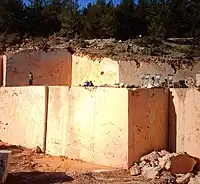
| |
| clapas(tas d'épierrement) | ne pas utiliser "décharge" | building:material=dry_stone
|

|
x | nom local : loc_name=clapas
ne pas confondre avec éboulis qui est naturel |

| |
| four ancien, historique | historic=kiln
|
à chaux : product=stone
charbonnière : de verrier : de potier : alambic à plantes alambic à fruits : |
x | nom de l'organisme qui a fait l'inventaire
|
.jpg)
| ||
| grange | building=barn
|
x | x | espace clos pour les récoltes | 
| ||
| hangar, remise | building=shep
|
x | x | espace de rangement de matériel | |||
| bâtiment historique | historic=building
|
préhistorique : historic:civilization=prehistoric
antique : Moyen-Age : Renaissance : XVII°-XIX° : |
x | x | si Monument historique : heritage:operator=mhs + ref:mhs=* (numéro base Mérimée)
sinon nom de l'organisme qui a fait l'inventaire et numéro dans l'inventaire
date de construction du monument |
||
| moulin à eau | man_made=watermill
|
x | x | si historique : historic=watermill
|
.jpg)
| ||
| moulin à vent | man_made=windmill
|
x | si historique : historic=windmill
|

| |||
| tour ancienne | historic=tower
|
si en pierre sèche
|
x | x | 
| ||
| Propriétés annexes | |||||||
| Altitude | ele=*
|
x | x | altitude en mètres à préciser en chiffres | |||
| date création du POI | start_date=*
|
x | x | au format aaaa-mm-jj | |||
| Hauteur | height=*
|
x | x | hauteur en mètres à préciser en chiffres | |||
| inscription | texte : inscription=*
|
x | x | maxi 255 caractères | |||
| Longueur | length=*
|
x | x | longueur en mètres à préciser en chiffres | |||
| Largeur | width=*
|
x | x | largeur en mètres à préciser en chiffres | |||
| matériau | en pierre sèche : building:material=dry_stone
en brique : en béton : à colombages : |
x | x | ||||
| nom du bâtiment | name=*
|
x | x | nom propre : ne pas confondre avec nom local | |||
| avec mur décoré | construction=painted
|
x | x |
EAU
| POI | Catégorie=Valeur | Détail=Valeur | Type | RenduOSM | Rendu CartoGarrigue | Commentaire | Photo |
|---|---|---|---|---|---|---|---|
| abreuvoir | amenity=watering_place
|
si avec source : natural=spring
|
x | pour animaux d'élevage ou sauvages |
| ||
| aiguier | man_made=storage_tank
|
material=dry_stone
|
x | x | si pas en pierre sèche voir citerne | 
| |
| Aqueduc historique
Aqueduc moderne |
historic=aqueduct
|
x | x | 
| |||
| barrage | waterway=dam
|
x | x | si l'eau passe dessus voir digue | 
| ||
| bassin de détention
bassin de rétention |
landuse=basin
|
basin=detention
|

|
x | pour stocker les eaux de ruissellement
pour contrôle des eaux de ruissellement |

| |
| Borne BRL irrigation | waterway=water_point
|
x | x | 
| |||
| canal de drainage
vallat, roubine |
waterway=drain
|
x | x | ||||
| canal irrigation | waterway=canal
|
x | x | _Canal_du_Bas-Rh%C3%B4ne_(Canal_Philippe_Lamour).JPG)
| |||
| canal ou aqueduc souterrain | waterway=canal
|
tunnel=yes
|
x | x | 
| ||
| captage | waterway=channeling
|
x | x | 
| |||
| château d'eau | man_made=water_tower
|
x | si enterré voir citerne | 
| |||
| cheminée d'équilibre de siphon | man_made=chimney
|
hauteur : height=*
|
x | x | préciser la hauteur | 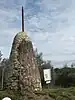
| |
| citerne, réservoir | man_made=storage_tank
|
si couvert : covered=yes
|

|
x | si couvert et en pierre sèche voir aiguier | 
| |
| danger de crue | waterway=cours d'eau
|
hazard=water_level
|
x | x | 
| ||
| digue | waterway=weir
|
x | x | si l'eau ne passe pas dessus voir barrage | 
| ||
| fossé | barrier=ditch
|
x | x | pour les eaux de ruissellement | |||
| gué | highway=ford
|
x | x | sur un chemin au croisement d'un cours d'eau | 
| ||
| lavogne | natural=water
|
pour chasseurs : operator=hunters
pour bergers : temporaire : |
x | x | Catégorie identique pour mare bâtie ou naturelle (voir http://wiki.openstreetmap.org/wiki/Proposed_features/Water_details a body of standing water, either natural or man-made | 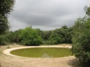
| |
| lavoir | amenity=lavoir
|
si plein : water=yes
|
x | x | 
| ||
| mare | natural=water
|
temporaire : intermittent=yes
|
x | x | Catégorie identique pour mare bâtie ou naturelle (voir http://wiki.openstreetmap.org/wiki/Proposed_features/Water_details a body of standing water, either natural or man-made | 
| |
| noria, meuse, roue à aubes
pouzarenque |
man_made=water_wheel
|
x | x | 
| |||
| plan d'eau | landuse=reservoir
|
x | x | 
| |||
| ponceau | waterway=culvert
|
x | x | 
| |||
| puits | man_made=water_well
|
x | x | -20150515.jpg)
| |||
| ruisseau,
agau, cadereau |
waterway=stream
|
permanent : seasonal=no
|

|
x | 
| ||
| source | natural=spring
|
x | 
|
EQUIPEMENTS
| POI | Catégorie=Valeur | Détail=Valeur | Type | RenduOSM | Rendu CartoGarrigue | Commentaire | Photo |
|---|---|---|---|---|---|---|---|
| banc | amenity=bench
|
x | 
| ||||
| borne incendie | emergency=fire_hydrant
|
x | x | 
| |||
| poids public | enforcement=maxweight
|
x | x | 
|
HISTOIRE-CULTURE
pour préciser les attributs d'objets historiques,
voir http://wiki.openstreetmap.org/wiki/FR:Historical_Objects/Attributs


.JPG)


LIEUX
| POI | Catégorie=Valeur | Détail=Valeur | Type | RenduOSM | Rendu CartoGarrigue | Commentaire | Photo |
|---|---|---|---|---|---|---|---|
| habitation isolée, mas | place=isolated_dwelling
|
name=nom du mas
|
x | x | |||
| hameau | place=hamlet
|
name=nom du hameau
|
x | x | 
| ||
| lieu-dit non habité | place=locality
|
name=nom du lieu-dit
|
x | x | 
| ||
| village | place=neighbourhood
|
name=nom du village
|
x | x | 
| ||
| ville | place=town
|
name=nom de la ville
|
x | x |
LIMITES
| POI | Catégorie=Valeur | Détail=Valeur | Type | RenduOSM | Rendu CartoGarrigue | Commentaire | Photo |
|---|---|---|---|---|---|---|---|
| barrière à vélo | barrier=cycle_barrier
|
x | x | 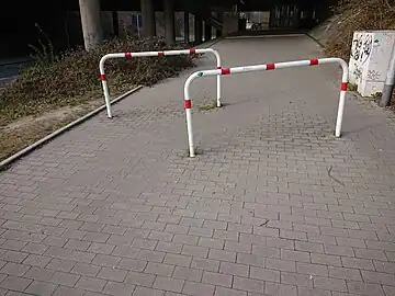
| |||
| barrière pivotante | barrier=swing_gate
|
x | x | ||||
| barrière relevable | barrier=lift_gate
|
x | x | 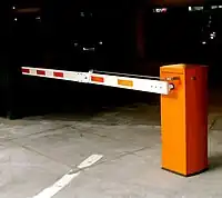
| |||
| barrière véhicule 4 roues | barrier=gate
|
x | x | 
| |||
| clôture | barrier=fence
|
grillage : fence_type=chain_link
fil de fer barbelé : parapet : électrique : rondins : bois : |

|
x | 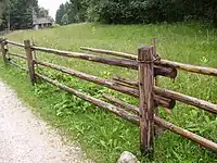
| ||
| haie | d'arbustes : barrier=hedge
|
x | x | 
| |||
| limite administrative | boundary=administrative
|
admin_level=*
|

|
x | compliqué :voir admin_level=* - France
|
||
| mur d'enclos en pierre sèche | barrier=wall
|
material=dry_stone
|
x | mur d'enclos | 
| ||
| mur de soutènement | barrier=retaining_wall
|
x | x | sens de tracé : côté bas du remblai du côté droit. | 
| ||
| remblai | de route : highway=*
de voie ferrée : de canal : |
embankment=yes
|
x | x | terrain surélevé artificiellement | 
| |
| route bordée d'arbres | natural=tree
|
denotation=avenue
|
x | x | 
|
LOISIRS
| POI | Catégorie=Valeur | Détail=Valeur | Type | RenduOSM | Rendu CartoGarrigue | Commentaire | Photo |
|---|---|---|---|---|---|---|---|
| parc | leisure=park
|
x | x | 
| |||
| piscine privée | leisure=swimming_pool
|
access=private
|
x | x |
NATURE
| POI | Catégorie=Valeur | Détail=Valeur | Type | RenduOSM | Rendu CartoGarrigue | Commentaire | Photo |
|---|---|---|---|---|---|---|---|
| arbre feuillage caduc | natural=tree
|
type=deciduous
|
x | 
| |||
| arbre feuillage persistant | natural=tree
|
type=evergreen
|
x | si palmier : type=palm
|

| ||
| arbre remarquable | natural=tree
|
par sa taille : denotation=landmark
historique : |
x | 
| |||
| bois, forêt | natural=wood
|
à feuillage caduc : wood=deciduous
|
x | x | genus: en français à préciser | ||
| éboulis | landcover=scree
|
x | x | ne pas confondre avec clapas qui est de main d'homme | -JW.jpg)
| ||
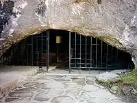
| entrée d'aven ou de grotte | natural=cave_entrance
|
si aven : loc_name=aven
accès possible accès spécialiste |
x |
si clé disponible choisir private |
| ||
| Falaise | natural=cliff
|
x | sens de tracé : côté bas de la falaise du côté droit | _chateau_falaise_sud.JPG)
| |||
| garrigue ouverte | landcover=heath
|
x | x | 
| |||
| garrigue fermée | landcover=scrub
|
x | x | 
| |||
| genre-espèce d'arbre | natural=tree
|
en français : genus:fr=nom français species:fr=nom français
|
x | x | nom local loc_name=à préciser
|
||
| lapiaz | natural=bare_rock
|
loc_name=lapiaz
|
x | x | 
| ||
| rocher naturel remarquable | natural=stone
|
x | x | 
|
SOURCE DOCUMENTAIRE
| POI | Catégorie=Valeur | Détail=Valeur | Type | RenduOSM | Rendu CartoGarrigue | Commentaire | Photo |
|---|---|---|---|---|---|---|---|
| cadastre | source="automatique"
|
P-S-R | x | x | |||
| attribution | attribution=références de l'inventeur
|
P-S-R | x | x | nom, nom de l'assoc, année, lieu |
TOURISME
| POI | Catégorie=Valeur | Détail=Valeur | Type | RenduOSM | Rendu CartoGarrigue | Commentaire | Photo |
|---|---|---|---|---|---|---|---|
| office de tourisme | information=office
|
x | 
| ||||
| panneau d'information | information=board
|
historique : board_type=historic
environnement : vie sauvage : plantes : cartes : |
x | x | 
| ||
| POI architectural | tourism=artwork
|
x | x | 
| |||
| point de vue remarquable | tourism=viewpoint
|
x | 
|
VOIE
| POI | Catégorie=Valeur | Détail=Valeur | Type | RenduOSM | Rendu CartoGarrigue | Commentaire | Photo |
|---|---|---|---|---|---|---|---|
| allée cavalière | highway=bridleway
|
|
x | 
| |||
| chemin piéton, voie verte | highway=footway
|

|
x | .jpg)
| |||
| chemin de terre, piste | highway=track
|
|
x | 
| |||
| escaliers | highway=steps
|

|
x | 
| |||
| piste cyclable | highway=cycleway
|
|
x | ||||
| route | autoroute : highway=motorway
grosse départementale : intervillages : locale : lotissement : |
numéro de la voie : nom de la voie : |
x | x | 
| ||
| rue piétonne | highway=pedestrian
|
|
x | .JPG)
| |||
| sentier | highway=path
|
|
x | 
| |||
| Propriétés annexes | |||||||
| accès public | public : access=yes
conseillé : seuls riverains : autorisé par propriétaire : |
x | x | ||||
| accessible aux handicapés | wheelchair=yes
|
x | x | x | |||
| avec couverture articielle | covered=yes
|
x | x | ||||
| voie accessible aux cycles | highway=* (sauf cycleway)
|
bicycle=Yes
|
x | x | autre que piste cyclable | ||
| bande cyclable en bord de voie | highway=* (sauf cycleway)
|
cycleway=lane
|
x | x | autre que piste cyclable
préciser suivant sens de la route des 2 côtés : lane=2 du côté droit : lane_right du côté gauche : lane=left | ||
| revêtement | enrobé : surface=paved
pavés : pavage : |
x | x | ||||
| sous arcade avec bâti | tunnel=building_passage
|
x | x | ||||
| type de chemin | stabilisé : tracktype=grade1
|
x | x | donne des chemins en pointillés
bruns variables selon le type | |||
| viabilité | roller : smoothness=excellent
vélo de course : fauteuil : voiture : SUV : 4x4 : VTT : Pied seul : |
x | x |